As of my last update in September 2021, there are 3,143 counties in the United States, and each county has a unique name. It’s important to note that the origins of county names can vary significantly. Some counties are named after individuals, historical figures, Native American tribes, geographical features, or even events.
The etymology map of the U.S. below created by Reddit user uvbseventysix below shows the origin of United States county names, placing all 3,000 + into seven broad categories.
U.S. County Etymology Map
Many counties are named after prominent individuals, such as founding fathers, notable people, politicians, military leaders, explorers, or local heroes. Especially many U.S. counties called after leaders such as Washington, Madison, Polk, Jefferson, etc.
Some counties derive their names from geographical features, like rivers, mountains, forests, or other landmarks in the area. A few counties are named to commemorate specific events or historical milestones. Some counties are named after Native American tribes that once inhabited the region or native American worlds.
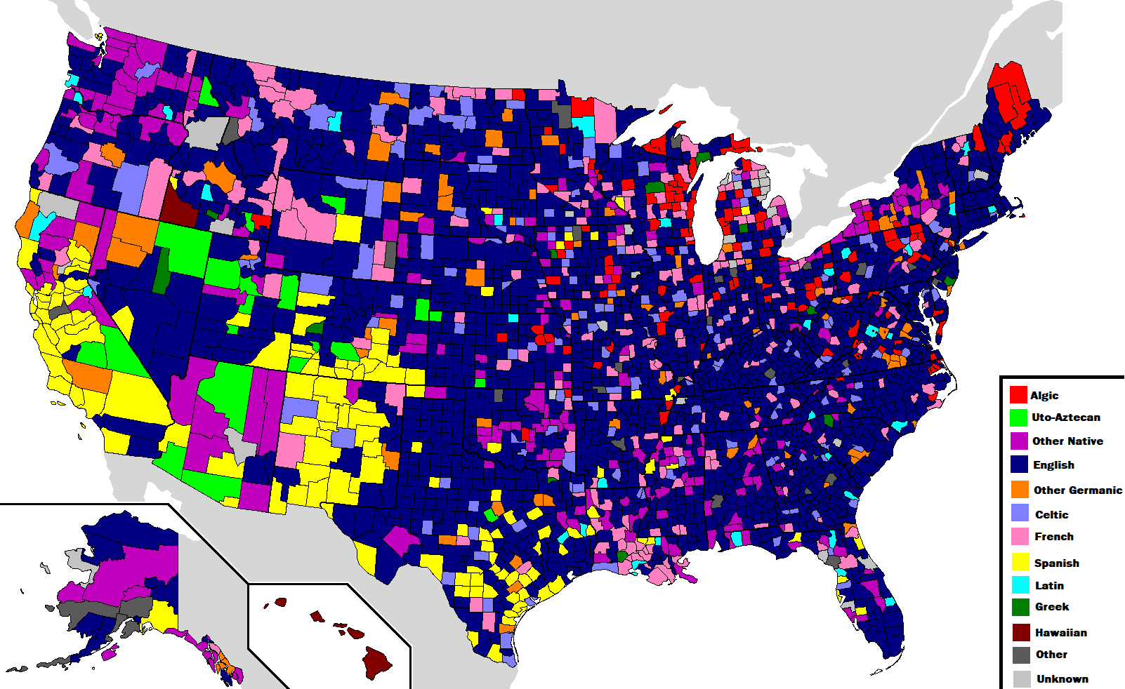
The maps below show U.S. counties categorized by the language of origin.
Language of Origin of the U.S. Counties
That being said, the names of many counties cannot be said to be unique. The maps below shows the U.S. counties that share a name with another county or state.
Uniqueness of the names of the U.S. counties
Some counties and parishes with the same names even border each other.
Greenwoodstreet
In Louisiana, Texas, Arkansas, Mississippi, Indiana, and Iowa, the ones that share names with states are former townships or current parishes instead of counties. This is why they have the same names across state lines. There is a group of towns divided across county lines in a similar manner, where the part in the other county is typically the unincorporated land with the same name. This situation commonly arises when a U.S. county or state border cuts through a zip code.
And here is one more map; this one shows U.S. counties that share their names with states.


New England, but just the towns whose names aren’t used by another New England state.