China Meets Russia
The Russian-China boundary consists of 2 non-contiguous segments. The eastern, more extended border part is about 4,194 kilometers (2,607 mi) in length. The western border part is much shorter (less than 100 kilometers or 62 miles). It runs in the principally snow-covered high elevation range of the Altai Mountains.
The map below shows the Amur River dividing barren Russia from densely populated China.

Such differences, visible from space, are due to the different population sizes of Russia and China. The deforested territory of China bordering Russia shows a large number of settlements. In contrast, the opposite Russian side of the Amur River is covered by forests.
China covering approximately 9,600,000 square kilometers (3,700,000 sq mi) and has population of around 1.404 billion. Population density: 145/km2 (375.5/sq mi).
Russia is the largest country in the world is with a land area of 17,125,200 square kilometers (6,612,100 sq mi). The estimated 2019 population of Russia, which was 146.77 million people. Population density:8.4/km2 (21.8/sq mi).
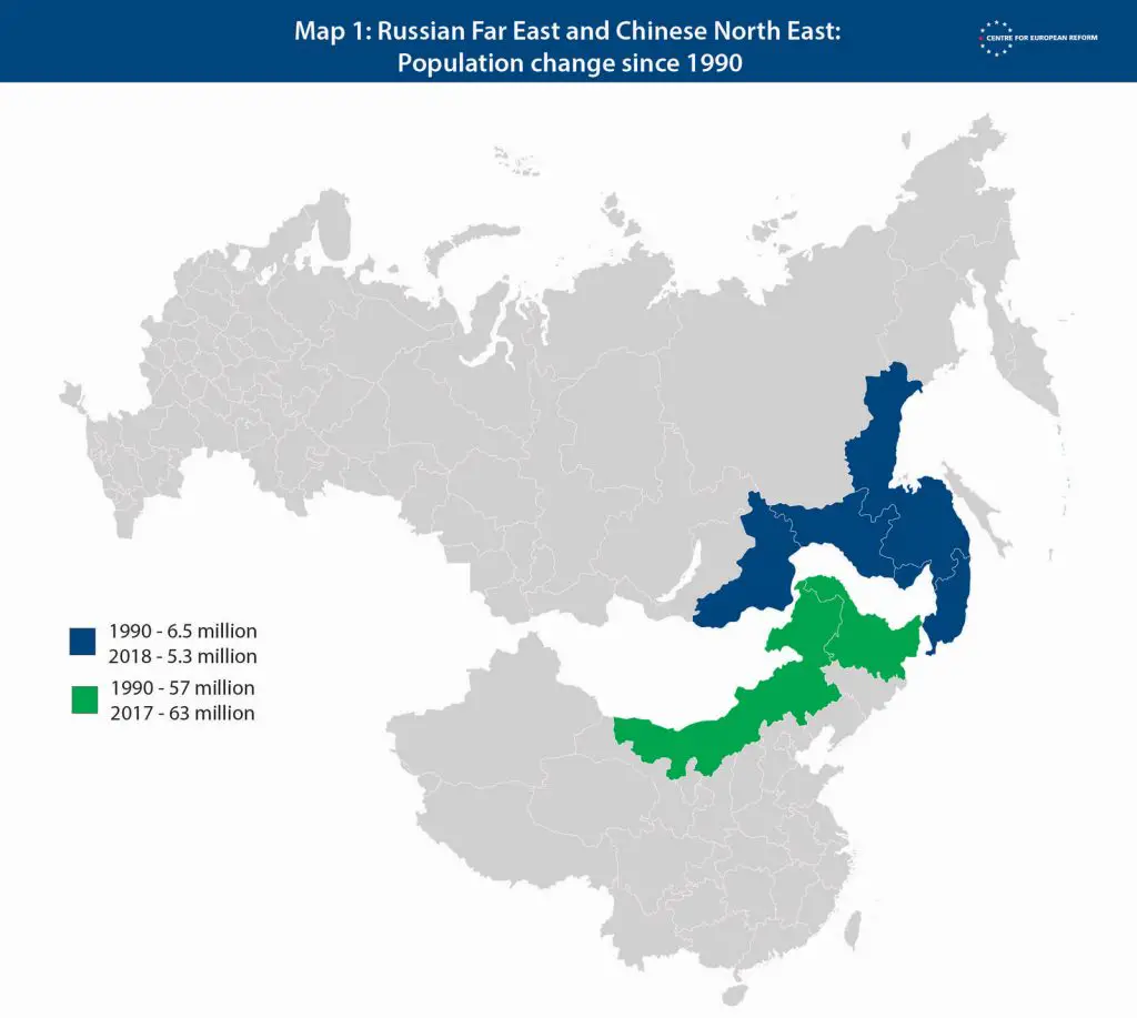
Recently, the population density in the eastern part of Russia is rapidly declining. The map below shows how much the Russian Far East and Chinese North-East populations have changed since 1990.


