The United States is home to a diverse and expansive network of metropolitan areas. These regions, often referred to as “metro areas,” are hubs of economic activity, cultural diversity, and population growth. A metropolitan area in the United States consists of a densely populated urban core and its less-populated surrounding territories, sharing industries, infrastructure, and housing. There are currently 384 metropolitan areas in the U.S., housing approximately 83% of the nation’s population. This significant percentage underscores the importance of metro areas as central to American life, influencing everything from economic policies to cultural trends.
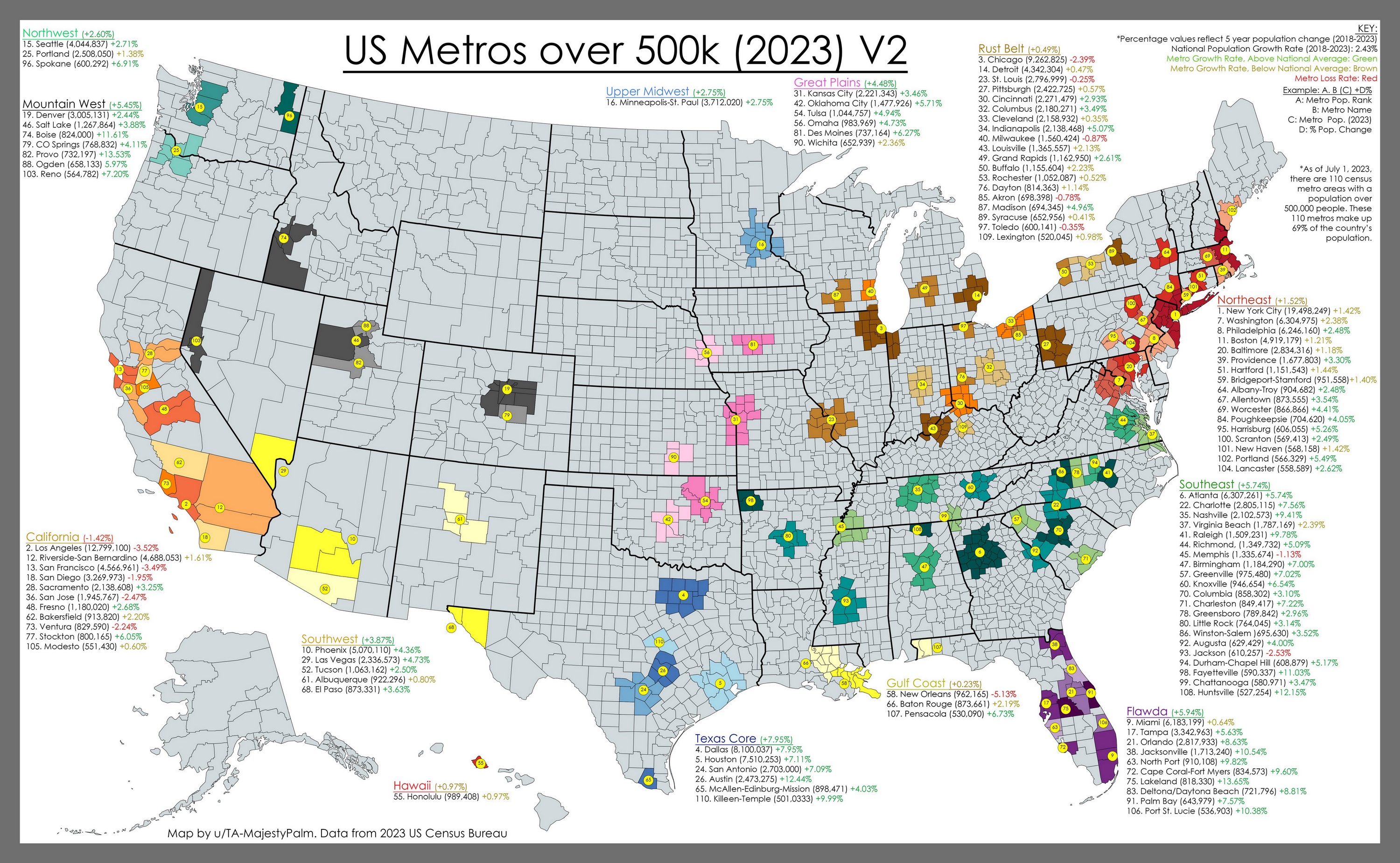
The detailed map of the United States below, created by Reddit user TA-MajestyPalm, showcases metropolitan areas with populations over 500,000.
The development of metropolitan areas has been shaped by several key processes over time:
Urbanization: Migration from rural to urban areas in search of better employment, education, and healthcare opportunities.
Industrialization: Development of industries in urban areas attracting workers and leading to urban growth.
Transportation Development: Establishment of transportation networks such as railroads, highways, and ports facilitating the movement of goods and people.
Economic Opportunities: Concentration of economic activities and businesses in urban areas creating job opportunities and attracting populations.
These processes began to shape the first metropolitan areas in the U.S. during the late 18th and early 19th centuries.
The First Metropolitan Areas in the United States
Historically, the first metropolitan areas formed around major ports and industrial hubs.
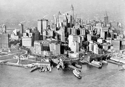
New York City (Formed around 1624)
Established as a major port and trading hub, New York City quickly became a center of commerce and immigration. The construction of the Erie Canal in 1825 further boosted its growth. The city’s strategic location and natural harbor made it a prime spot for trade and industry, eventually growing into the largest city in the U.S.
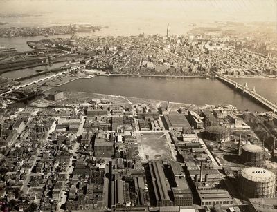
Boston (Formed around 1630)
Known for its historical significance and early industrialization, Boston was a key player in the American Revolution and a major center for shipping and trade. Its development was significantly influenced by its education and research institutions, fostering an environment of innovation and growth.
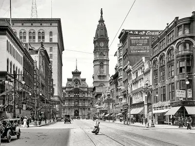
Philadelphia (Formed around 1682)
A center of American independence and early manufacturing, Philadelphia grew rapidly due to its strategic location and robust industrial base. It was a leading city in the Industrial Revolution, with many factories and businesses setting up shop, making it one of the most important economic centers in the early U.S.
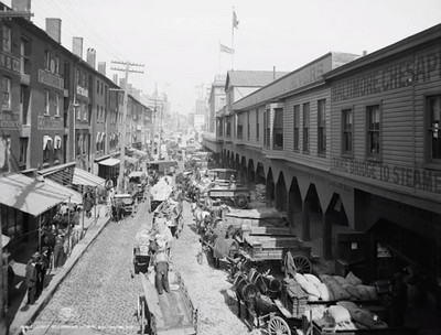
Baltimore (Formed around 1729)
Initially a port town, Baltimore’s growth was propelled by the tobacco trade and later by its role as a transportation hub with the establishment of the Baltimore and Ohio Railroad, the first commercial railroad in the U.S.
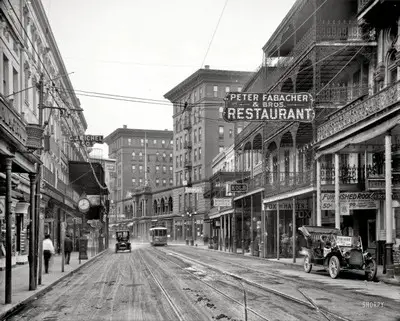
New Orleans (Formed around 1718)
As a vital port city due to its strategic location along the Mississippi River, New Orleans became a key area for trade, particularly in the cotton and sugar industries. Its cultural diversity and rich history have also made it a significant metropolitan area.
Played a significant role in the civil rights movement and home to the busiest airport in the world.
10
Boston-Cambridge-Newton, MA-NH
4,875,390
A world leader in higher education and medical research.
Metropolitan areas exhibit unique dynamics; some are experiencing rapid growth, while others are seeing a slowdown in their expansion.
The 10 Metropolitan Areas with the Highest Population Growth Rates
The table below highlights the ten metropolitan areas in the United States with the highest population growth rates from 2010 to 2020, based on data from the U.S. Census Bureau.
Rank
Metropolitan Area
Population Growth
Growth Rate (%)
1
Austin-Round Rock, TX
+579,014
+29.8
2
Orlando-Kissimmee-Sanford, FL
+553,215
+23.9
3
Raleigh, NC
+380,702
+25.7
4
Phoenix-Mesa-Scottsdale, AZ
+744,515
+16.2
5
Las Vegas-Henderson-Paradise, NV
+475,232
+18.5
6
Charlotte-Concord-Gastonia, NC-SC
+529,336
+20.0
7
Dallas-Fort Worth-Arlington, TX
+1,036,254
+15.7
8
Houston-The Woodlands-Sugar Land, TX
+958,840
+15.6
9
Nashville-Davidson–Murfreesboro–Franklin, TN
+342,306
+20.1
10
Tampa-St. Petersburg-Clearwater, FL
+407,858
+14.1
The 10 Metropolitan Areas with the Fastest Population Decline
Conversely, the table below lists the ten metropolitan areas with the fastest population decline rates from 2010 to 2020, according to the U.S. Census Bureau.
Rank
Metropolitan Area
Population Decline
Decline Rate (%)
1
Youngstown-Warren-Boardman, OH-PA
-22,462
-5.7
2
Pittsburgh, PA
-40,041
-3.1
3
Cleveland-Elyria, OH
-33,725
-2.2
4
Buffalo-Cheektowaga-Niagara Falls, NY
-15,950
-1.7
5
Scranton–Wilkes-Barre–Hazleton, PA
-10,955
-2.0
6
Detroit-Warren-Dearborn, MI
-36,426
-1.5
7
Rochester, NY
-9,985
-1.2
8
Springfield, MA
-5,772
-1.0
9
Syracuse, NY
-5,625
-1.0
10
Charleston, WV
-5,379
-1.6
The Future Evolution of Metropolitan Areas
These trends in population growth and decline are influenced by various factors, including economic opportunities, climate, and quality of life.
The future of metropolitan areas is a topic of significant interest and study among urban planners and demographers. According to recent studies:
Increase in Number and Population: The number of metropolitan areas and their populations are expected to increase. Urbanization will continue as people migrate to cities for better economic opportunities and living conditions.
Technological Advancements: Innovations in technology, such as smart city initiatives, will enhance the efficiency and livability of metropolitan areas. This will attract more people to urban centers.
Sustainability Efforts: There will be a greater focus on sustainable development. Cities will implement green infrastructure, improve public transportation, and reduce their carbon footprints to create more sustainable living environments.
Population Shifts: Demographic changes, including aging populations and migration patterns, will influence the growth and distribution of urban populations. Cities will need to adapt to these shifts to maintain their growth.
Economic Diversification: Economic diversification will promote resilience in metropolitan areas. Cities that can attract and sustain diverse industries will continue to grow and thrive.
Discover More Maps of the United States
For those fascinated by the geographic and demographic diversity of the United States, numerous maps are available that provide detailed insights into different aspects of American life. Check out these highly recommended maps available on Amazon:


")

