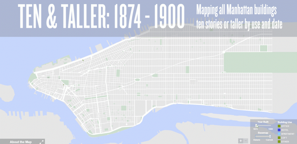
Mapping the skyscrapers of Manhattan by use & date (1874 – 1900)
From the NYC Department of City Planning. A slider allows viewers to transition the base map from the present to the past and vice versa. Over these maps, we added the footprints of the 249 buildings in the TEN & TALLER STUDY, color-coded by use.
The simple zoomed-out modern map emphasizes the spatial geography and different use types of our buildings. Using the “Year Built” slider will add or remove buildings by date to dramatize the pace of development. For example, sliding the button between 1897 and 1900 will reveal a burst of construction that outline the path of Broadway.
The historic map adds color and details. Zooming in shows street names, lots, and buildings. Clicking on a colored footprint opens a pop-up window with images and data.
The 249 buildings outlined on this map represent a span of years from 1874 through 1900. To accurately place the building footprints, including the 115 that have been demolished, we needed a historic map from 1900 or after. The best version available to us was the 1909 edition of the G. W. Bromley and Co. Atlas of The City of New York; the version we purchased was updated in 1913, 1914, and May 1915.
The 1909 Bromley is a Manhattan “land book” published in five folio-sized volumes of individual plates measuring 30 x 20 inches. These highly detailed plates identify streets, addresses, and, often, building names; block and lot numbers; precise building dimensions and lot coverage; height in stories; street and sidewalk widths; and other geographic information. The Museum used 101 plates of the Bromley Atlas, which we stitched together into one continuous map. This process allowed us to create a map that is both draggable and zoomable – a format and function that to our knowledge exists nowhere else in a map of this period with this level of detail.


")