New Amsterdam was a 17th-century Dutch settlement founded at the southern point of Manhattan Island that functioned as the colonial administration place in New Netherland. The first trading company gave a start to the settlement around Fort Amsterdam. The fort was located on the island of Manhattan’s strategic southern point and was meant to protect the Dutch West India Company’s fur trade activity in the Hudson River.
In 1624, it became a local extension of the Dutch Republic and was chosen as the province’s capital in 1625.
By 1655, New Netherland’s population had increased to two thousand people, with 1.5 thousand living in New Amsterdam. By 1664, the New Netherland population had grown to about nine thousand people, 2.5 thousand of whom lived in New Amsterdam, one thousand lived near Fort Orange, and the remains in other settlements.
In 1664 the English took over New Amsterdam and renamed it New York City after the Duke of York. After the Second Anglo-Dutch War of 1665–1667, England and the Netherlands admitted to the Treaty of Breda’s status quo. The English had the island of Manhattan, the Dutch giving up their interest to the city and the rest of New Netherland’s colony. Simultaneously, the English formally ceded Surinam in South America and the island of Run in the East Indies to the Dutch, proving their control of the worthy Spice Islands.
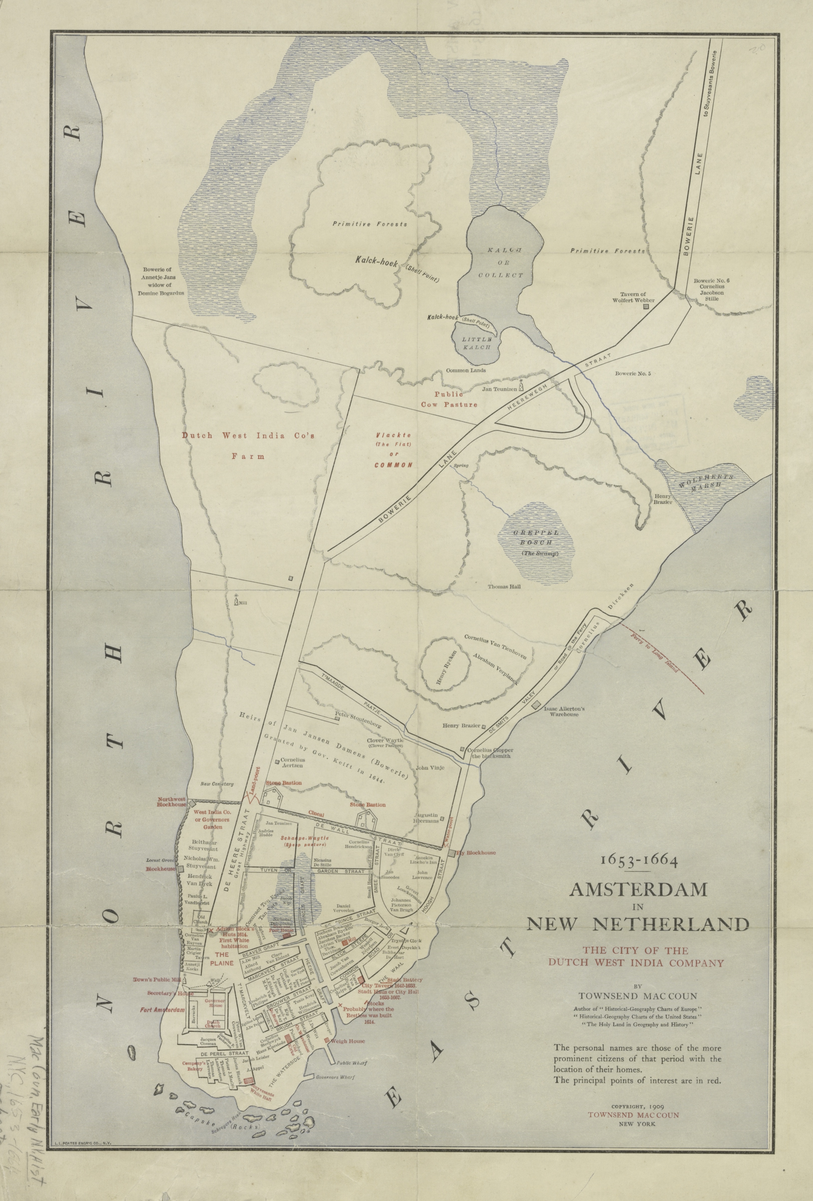
Below are the historical maps of New Amsterdam and New Netherlands.
I would like to include the image Map of Amsterdam in New Netherland in a story I am writing for my family about one line of our ancestors who migrated from Haarlem, Netherlands to New Amsterdam in the 1600s. It is not for commercial publication. Is it possible to get permission to use it? I would, of course, cite the source.


I would like to include the image Map of Amsterdam in New Netherland in a story I am writing for my family about one line of our ancestors who migrated from Haarlem, Netherlands to New Amsterdam in the 1600s. It is not for commercial publication. Is it possible to get permission to use it? I would, of course, cite the source.
Of course!