New York City’s transportation network is a complex web of subways, buses, taxis, and pedestrian pathways. This intricate system shapes the daily lives of millions, defining the rhythm of the city and the accessibility of its diverse neighborhoods. Let’s explore how different modes of transit affect mobility across the Big Apple, using data and real-world examples to guide our journey.
The Subway: NYC’s Circulatory System
The New York City subway is often called the city’s lifeblood, and for good reason. With over 850 miles of track and 472 stations, it’s one of the most extensive public transportation systems in the world.
The subway map reveals the extensive reach of this underground network. Lines like the 1, 2, 3 stretch from the tip of Manhattan down to Brooklyn, while the A, C, E connect diverse neighborhoods from Washington Heights to the Far Rockaways.
Subway Efficiency: A Tale of Two Boroughs
Let’s consider two common commutes to illustrate the subway’s efficiency:
Commute from Jackson Heights, Queens to Midtown Manhattan:
Average time: 35 minutes
Primary routes: E, F, M, R trains
Commute from Bay Ridge, Brooklyn to Lower Manhattan:
Average time: 45 minutes
Primary route: R train
These examples show how the subway can quickly connect outer boroughs to Manhattan’s job centers, albeit with varying degrees of efficiency depending on the starting point.
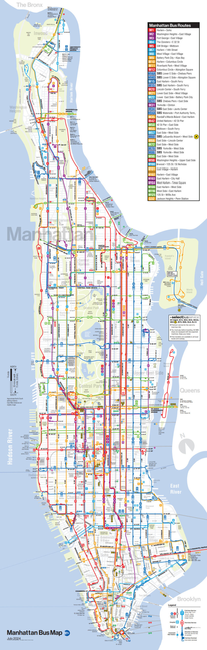
Buses: Filling the Gaps
While the subway forms the backbone of NYC transit, buses play a crucial role in filling transportation gaps and connecting areas underserved by the subway. Here is the Manhattan Bus Map.
New York’s bus system includes:
Local buses: Serving neighborhoods with frequent stops
Select Bus Service (SBS): Faster, limited-stop routes on high-demand corridors
Express buses: Primarily connecting outer boroughs to Manhattan
For example, the Bx12 SBS along Fordham Road in the Bronx showcases how bus rapid transit can improve cross-borough travel, cutting journey times by up to 20% compared to local bus service.
The Interplay of Modes: Maximizing Accessibility
The true power of New York’s transportation system lies in the interplay between different modes. Let’s look at a typical journey that combines multiple transit options:
Scenario: Commute from Forest Hills, Queens to Brooklyn Navy Yard
Local bus Q23 to 71st Ave subway station (10 minutes)
E train to Court Square station (20 minutes)
G train to Clinton-Washington Aves station (15 minutes)
Walk or bus B57 to final destination (10 minutes)
Total journey time: Approximately 55 minutes
This multi-modal trip demonstrates how combining buses and subways can connect seemingly distant parts of the city, making jobs and amenities accessible across borough lines.
Commuting Patterns: A Borough-by-Borough Breakdown
While transit options are plentiful, actual commuting habits vary widely across New York City’s boroughs. The following map, created by @MetricMaps, provides a fascinating visual comparison of how residents in different boroughs travel to work:
This map clearly illustrates the stark differences in commuting habits across the city. We can see that Manhattan, Brooklyn, and the Bronx heavily favor public transportation and walking, while Staten Island shows a higher proportion of residents driving to work.
These statistics align with what we see in the map. Manhattan, Brooklyn, and the Bronx show a clear preference for public transit and walking, while Queens has a more balanced split. Staten Island stands out with its higher reliance on private vehicles, likely due to its more suburban layout and limited subway access.
Challenges and Innovations in NYC Transit
Despite its extensive network, New York’s transportation system faces ongoing challenges:
Overcrowding: Peak hours often see subway cars and stations packed to capacity.
Aging infrastructure: Many subway lines and stations require significant upgrades.
Accessibility: Only about 25% of subway stations are fully accessible to people with disabilities.
To address these issues, the MTA (Metropolitan Transportation Authority) has been implementing various initiatives:
OMNY contactless payment system: Speeding up bus boarding and subway entry.
Signal system upgrades: Improving train frequency and reliability.
Expanded Select Bus Service: Enhancing surface transit options.
Navigating the Concrete Jungle
Whether you’re a long-time New Yorker looking to optimize your commute or a visitor planning to explore the city, having a reliable New York City map is essential. Here are some options available on Amazon to help you navigate the Big Apple:
These maps can be valuable companions as you explore the diverse transportation options and neighborhoods of New York City.
In conclusion, New York’s transportation system is a complex, ever-evolving network that shapes urban life in countless ways. From subway lines to bus routes, each mode of transport plays a crucial role in connecting the city’s diverse neighborhoods. Understanding this system is key to unlocking the full potential of life in the Big Apple, where the journey is often as fascinating as the destination itself.


 Expensive To Be an Apple Superfan?")


