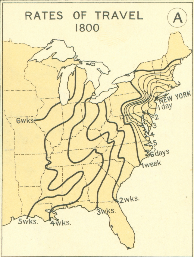
The Atlas of the Historical Geography of the United States, published in 1932, estimates travel time from New York City to other parts of the country. In 1800 horse-drawn carriage accessibility from New York City couldn’t get you out of the Northeast, and a journey to Charleston (South Carolina) would take ten days of cruising.
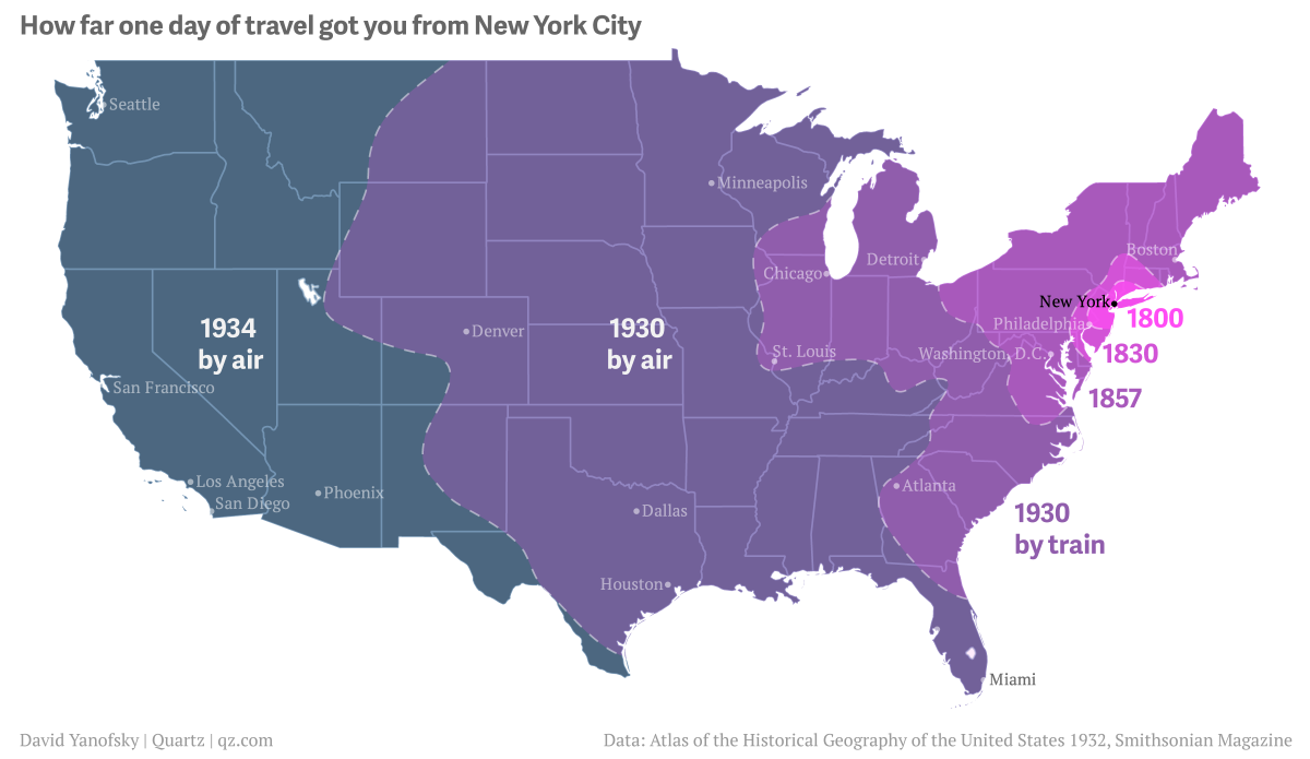
California became a one-day trip for New Yorkers only by 1934.
Rates of travel 1800
Atlas of the Historical Geography of the U.S. (1932).
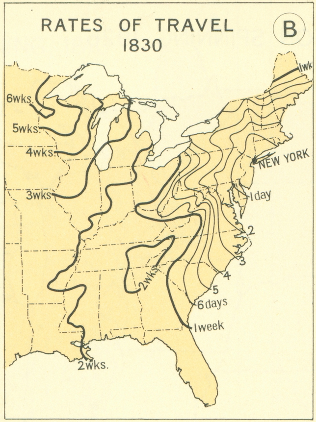
Rates of travel 1830
Atlas of the Historical Geography of the U.S. (1932).
Rates of travel 1857
Atlas of the Historical Geography of the U.S. (1932).