How long each nation has been a republic
San Marino is the world’s oldest republic, established in 301.
Read More
San Marino is the world’s oldest republic, established in 301.
Read MoreRed: Corporate Tax, Blue: Maximum Income Tax, Green: VAT
Read MoreAfrican countries have the lowest literacy rate.
Read MoreAustralia has the largest reserves of uranium.
Read MoreIn the Middle Ages, the two most important defining elements of Europe were Christians and Latinitas Currently, the most languages
Read MoreUS citizens have the most weapons.
Read MoreThe orgasm gap is a social phenomenon relating to the general difference between heterosexual women and men and women in sexual satisfaction.
Read More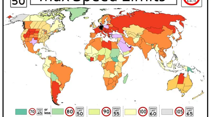
Speed limits vary around the world and are typically set by individual countries or regions within a country. These limits are established to promote road safety and reduce the risk of accidents.
Read MoreAreas not under government control on 3/27/15.
Read MoreFemale bosses are most in Jamaica, Colombia, Saint Lucia, USA, Mongolia, Poland, Moldova and Estonia.
Read More