Bridging Dreams: The 1913 Vision of Connecting Scotland and Ireland
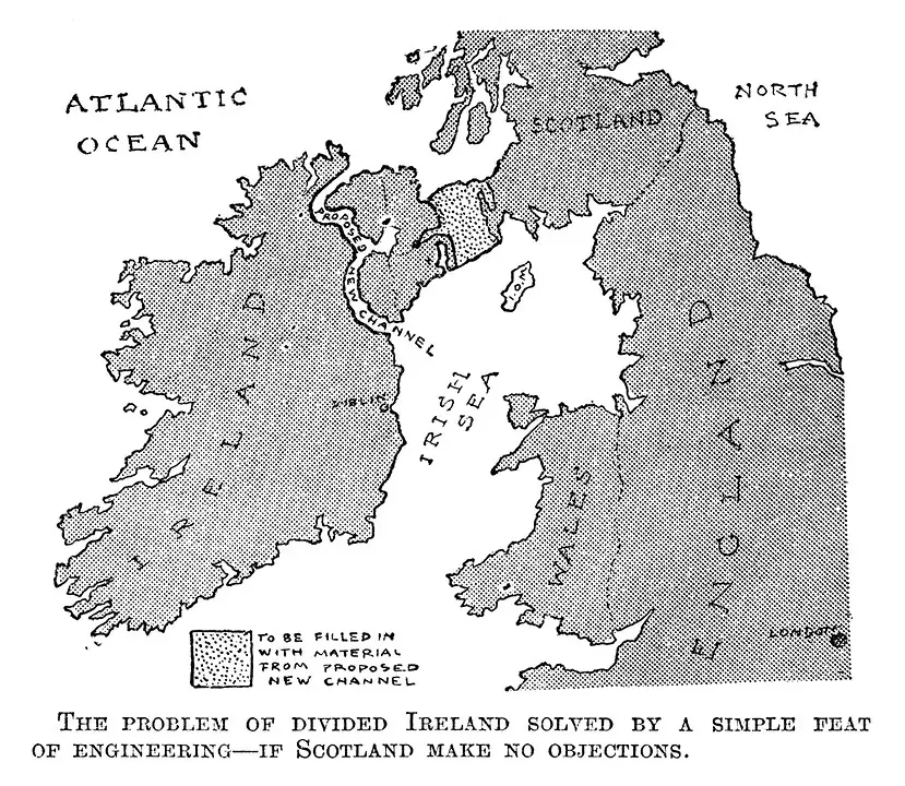
In 1913, the satirical magazine Punch published a whimsical map proposing a land bridge and canal connecting Scotland and Ireland. The map bore the caption: “The problem of divided Ireland solved by a simple feat of engineering – if Scotland makes no objections.” This tongue-in-cheek suggestion aimed to address the political tensions in Ireland by physically linking it to Scotland.
The map humorously envisions a massive engineering project, featuring a land bridge complemented by a canal. While clearly satirical, it reflects the period’s fascination with grand infrastructural endeavors. Interestingly, the idea of a physical connection between Ireland and Scotland has resurfaced multiple times over the years. In recent discussions, proposals for an “Irish Sea Bridge” or “Celtic Crossing” have been considered, aiming to link Portpatrick in Scotland to Larne in Northern Ireland—a distance of approximately 45 kilometers. However, feasibility studies have highlighted significant challenges, including deep waters and the presence of an underwater munitions dump at Beaufort’s Dyke. A 2021 study estimated the cost of such a bridge at £335 billion, leading to debates about its practicality.


