The global ocean generates more than 60 percent of the ecosystem services that allow us to live, starting with the production of most of the oxygen we breathe. Highlighting the importance of the World Ocean, the Spilhaus projection offers a unique perspective on our planet.
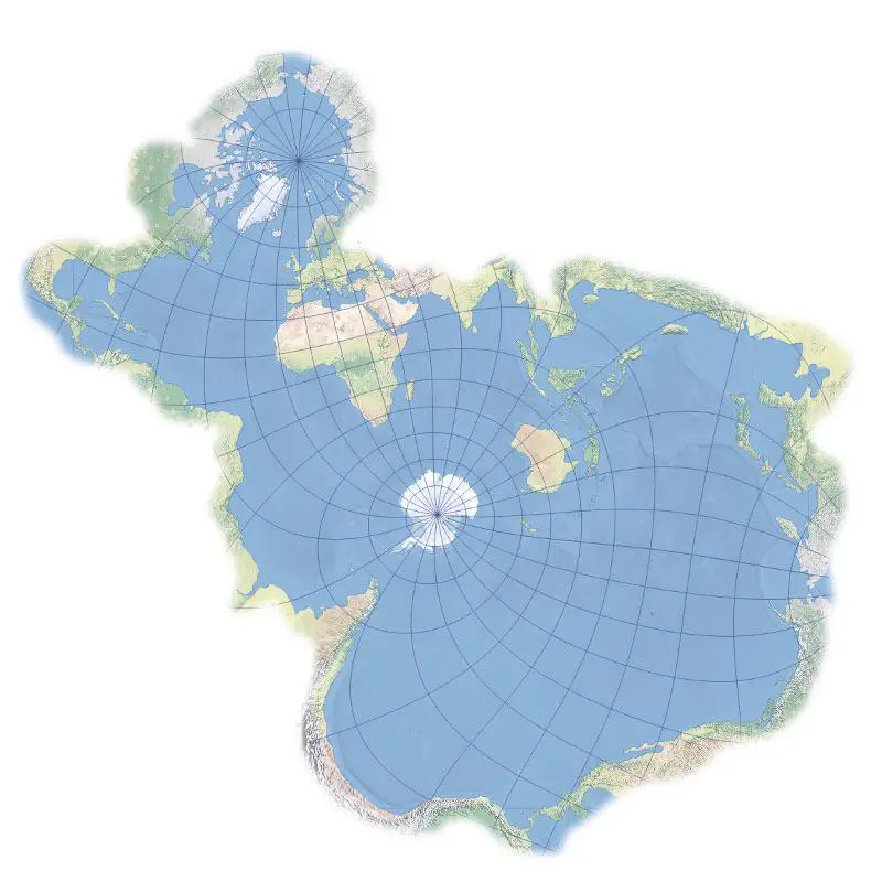
In 1942, the oceanographer and geophysicist Athelstan Frederick Spilhaus developed a fascinating world map. Unlike traditional maps that prioritize landmasses, the Spilhaus projection centers the world’s oceans. This approach shifts our focus to the interconnectedness of marine regions, emphasizing their central role in Earth’s ecosystem.
Here is another map in the Spilhaus projection created by le-cartographe.net.
By centering Antarctica and the surrounding oceans, the Spilhaus projection allows us to visualize the vast expanses of the World Ocean as a cohesive whole. This perspective is particularly useful for understanding global ocean currents and surface water temperatures.
For instance, the Spilhaus projection can vividly illustrate ocean currents. These currents are the lifeblood of our planet’s climate system, transporting heat and nutrients across the globe. By presenting the oceans as a continuous entity, the Spilhaus map makes it easier to track the dynamic movement of these currents and understand their global impact.
Reddit user: Petrarch1603
Similarly, the Spilhaus projection is ideal for displaying the temperature of the surface water layer throughout the year. This visualization helps us grasp the seasonal variations in ocean temperatures, which influence weather patterns, marine ecosystems, and the global climate.
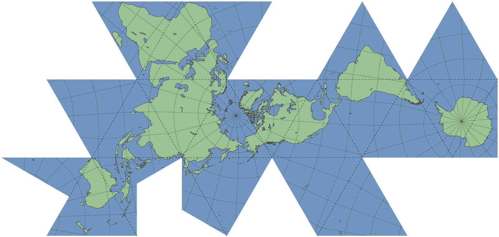
In contrast to the Spilhaus projection, R. Buckminster Fuller’s Dymaxion map projection shows all the landmasses nearly continuously. This map minimizes distortion of the continents, providing a contiguous view of Earth’s land areas. The Dymaxion map is particularly useful for understanding human geography and geopolitical relationships, presenting an alternative perspective on our world.
Both the Spilhaus and Dymaxion projections offer unique insights into our planet’s geography. The Spilhaus projection emphasizes the interconnectedness of the world’s oceans and their central role in Earth’s systems, while the Dymaxion map provides a comprehensive view of the continents. Together, these maps encourage us to appreciate the complexity and interconnectedness of our world.
Popular World Maps on Amazon
For those interested in exploring different map projections, here are some popular world maps available on Amazon:


The Spilhaus Projection (1942)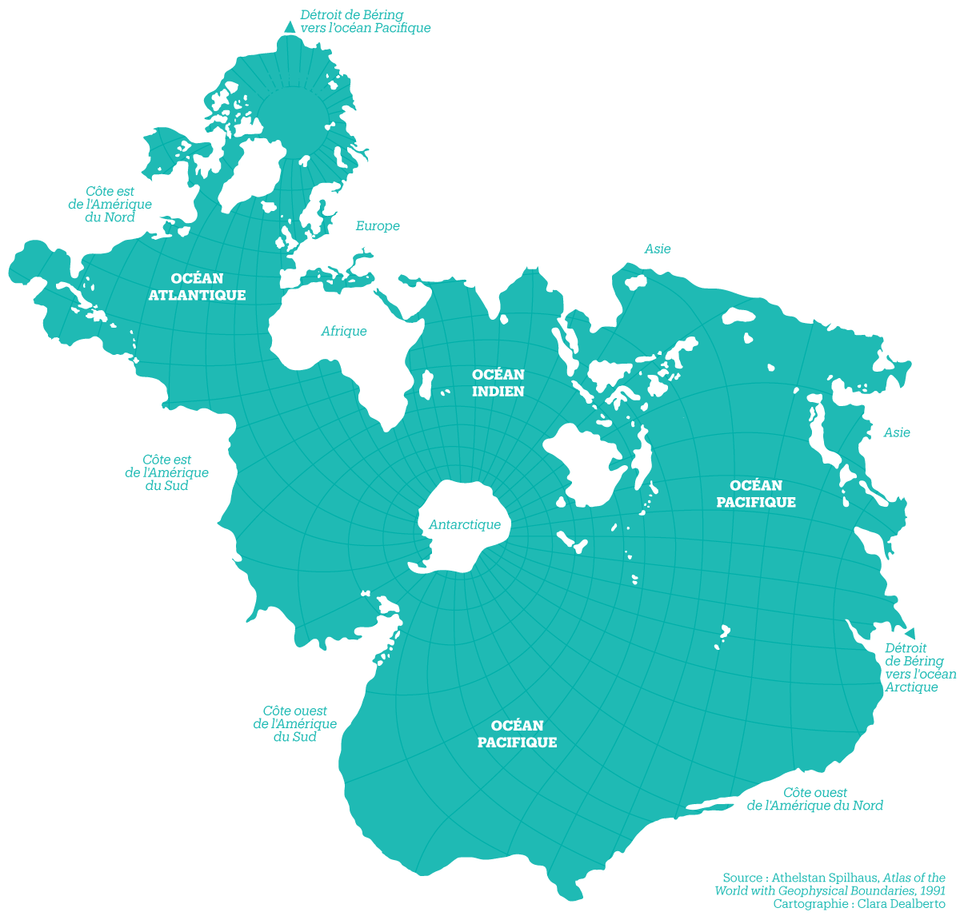
A nice example from the Seattle Aquarium