Brazil is the largest country in both South America and Latin America. At 8.5 million sq km (3.2 million sq mi)and with over 212 million people, Brazil is the world’s 5th-largest nation by area and the 6th-most populous. The Federative Republic of Brazil is comprised of the union of the 26 states and the Federal District.
The first Portuguese settlement was founded after the signing of the “Tordesilhas Treat” in 1532. Colonization began in 1534 when King John III of Portugal split the territory into Brazil’s fifteen private and autonomous Captaincy Colonies.
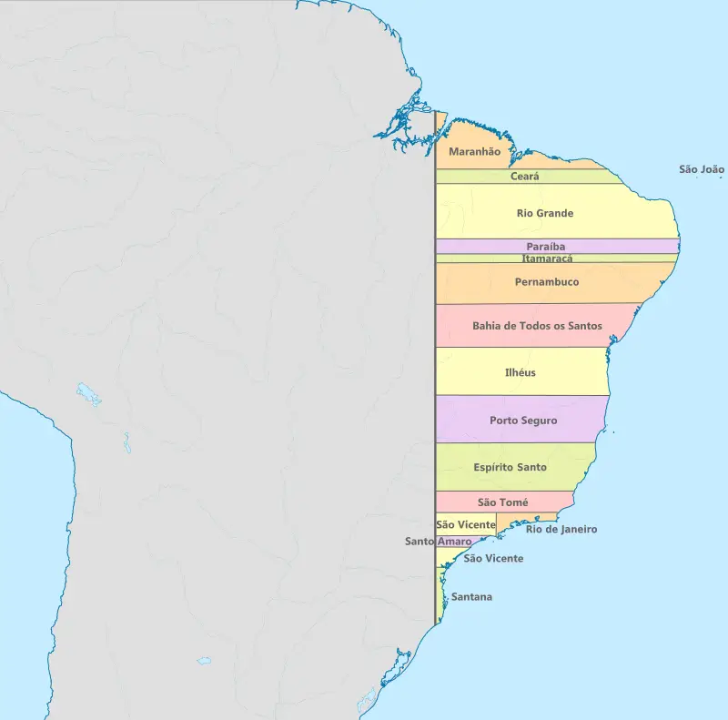
It was the first territorial division the Portuguese initiated before they even got actually to know the land. They haven’t much knowledge about the relief of Brazil. That is why the first borders between the provinces were straight lines. They were named “Hereditary captaincies” and given out by the King to nobles, whose descendants would inherit them.
Such an administrative division most didn’t work out because many of those who received the land dropped it due to indigenous attacks or the absence of resources. After this failure, Brazilian colonization became more centralized by the government.
Brazil’s straight borders in 1534
Brazil continued a Portuguese colony until 1808, when the capital of the empire was shifted from Lisbon to Rio de Janeiro. In 1815, the settlement was raised to the rank of kingdom upon the creation of the United Kingdom of Portugal, Brazil, and the Algarves. Independence was signed in 1822 with the Empire of Brazil’s appearance, a unitary nation ruled under a constitutional monarchy and a parliamentary system.
The interactive map below shows the territorial evolution of Brazilian borders.


")