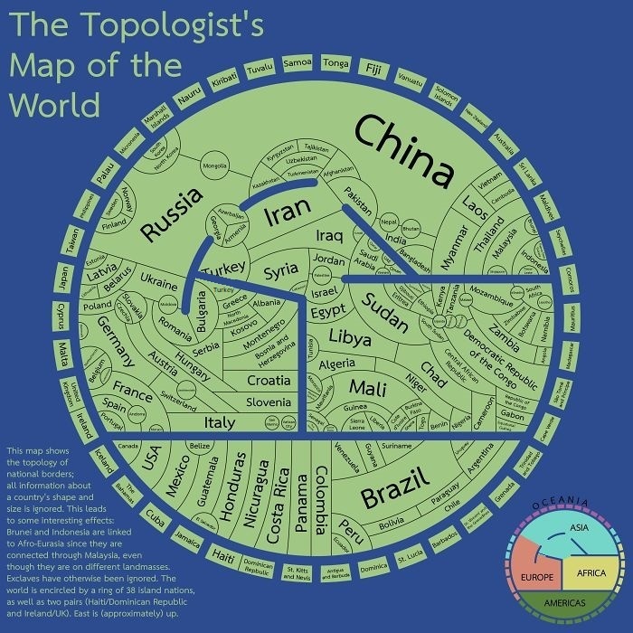
This map, at first glance, similar to a medieval map of the world ‘mappa mundi’, is the topologist’s map of the world, showing international borders, and nothing else.
Topology in math is the study of properties that are preserved when a shape is curved or elongated. So a circle and a square are topologically equal because they are both a simple loops. A figure eight isn’t comparable to them since it has the intersection point and two loops.
This map is showing the basic adjacency within regions, without consideration for the complicated shapes the areas take. In topology, the borders can be smoothed out, but the adjacency is a fixed property that remains no matter how much the edge is reshaped.
The map shows the topology of national borders; all information about a country’s shape and size are ignored. This leads to some interesting effects: Brunei and Indonesia are linked to Afro-Eurasia since they connected through Malaysia, even though they are on different landmasses. Exclaves have otherwise been ignored. The world is encircled by a ring of 38 island nations, as well as two pairs (Haiti/Dominican Republic and Ireland UK). East is (approximately) up.
A link is missing between Black sea and Mediterranean, because the Black sea is not an inland lake. Here is an edited version:
Be the better person
4 years ago
Funny that on your map Brazil is not connected to water.
I sincerely do not know then what the fuss is all about Copacabana beach?
Chaplin
4 years ago
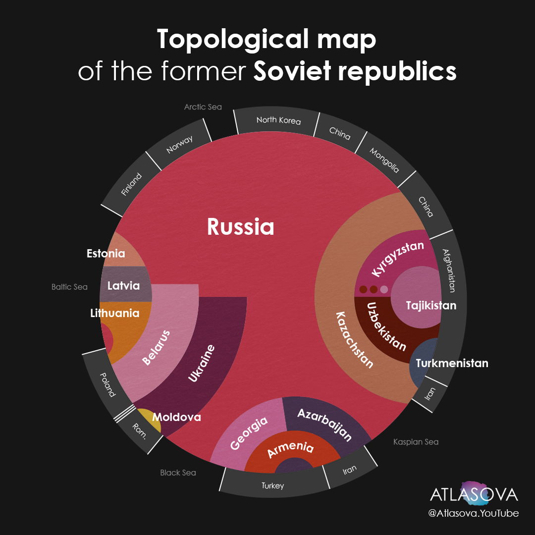
Topological map of the former USSR.
Chaplin
4 years ago
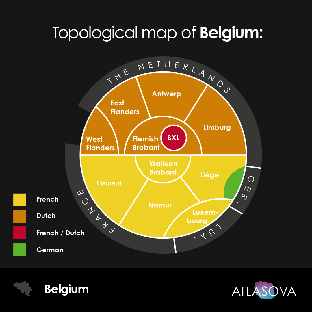
Topological map of Belgium
Chris M
4 years ago
This map is nonsense. According to this map, Papua New Guinea is not an island, because it joins Indonesia, and Indonesia (on a different land mass) joins Malaysia. OK fine, but Gibraltar is joined to Spain, so by that logic the Ireland should be part of Europe’s main land mass because it joins the UK which joins Europe. And Guantanamo Bay joins Cuba, therefore Cuba should be part of the American land mass. And guess what… Australian Antartic Territory joins Russian Antarctic Territory, so why is Australia off on its own? This map is complete nonsense, the entire basis of it needs rethinking.
Brett Stiefel
5 years ago
Can this be purchased. I am perfectly happy to pay the creator. If not is it public domain or licensed for public printing?
Alexander Gorbunov
5 years ago
@disqus_naTGRsVJf2:disqus Hi ! Did you use any software to generate the topological maps of the countries ? I would like to try something similar on city maps.
Chaplin
5 years ago
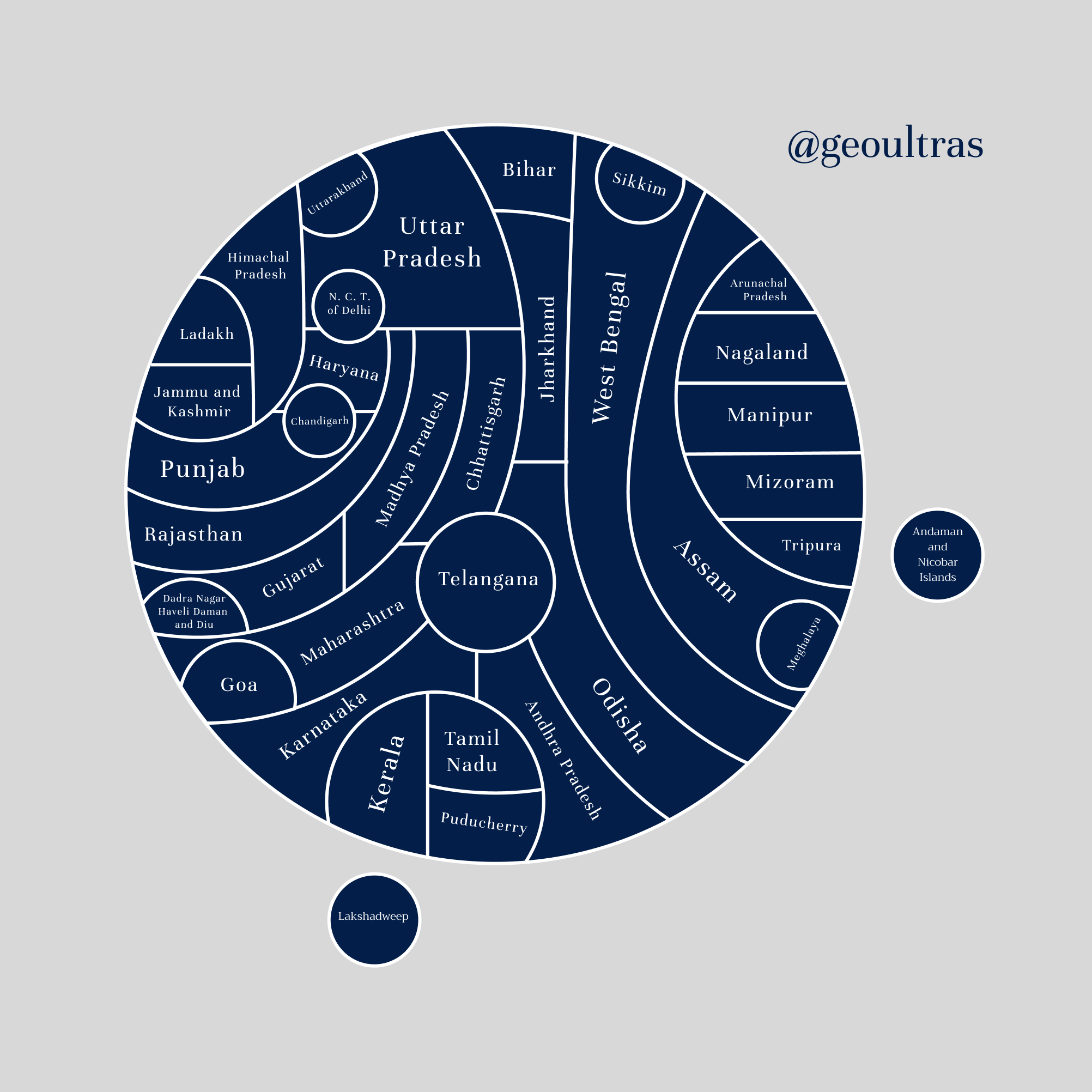
Topological map of India
Slimpie
5 years ago
Saint-Martin? I miss a link between France and the Netherlands.
– The province is called Tierra del Fuego (Ushuaia is the capital city).
– Buenos Aires and Córdoba have a common border.
– There’s a quadripoint between Mendoza, La Pampa, Neuquén and Río Negro. If you show La Pampa and Neuquén as having a common border, then there should be one between Rio Negro and Mendoza too.
– Chaco has a (short) border with Paraguay.


A link is missing between Black sea and Mediterranean, because the Black sea is not an inland lake. Here is an edited version:
Funny that on your map Brazil is not connected to water.
I sincerely do not know then what the fuss is all about Copacabana beach?
Topological map of the former USSR.
Topological map of Belgium
This map is nonsense. According to this map, Papua New Guinea is not an island, because it joins Indonesia, and Indonesia (on a different land mass) joins Malaysia. OK fine, but Gibraltar is joined to Spain, so by that logic the Ireland should be part of Europe’s main land mass because it joins the UK which joins Europe. And Guantanamo Bay joins Cuba, therefore Cuba should be part of the American land mass. And guess what… Australian Antartic Territory joins Russian Antarctic Territory, so why is Australia off on its own? This map is complete nonsense, the entire basis of it needs rethinking.
Can this be purchased. I am perfectly happy to pay the creator. If not is it public domain or licensed for public printing?
@disqus_naTGRsVJf2:disqus Hi ! Did you use any software to generate the topological maps of the countries ? I would like to try something similar on city maps.
Topological map of India
Saint-Martin? I miss a link between France and the Netherlands.
Soviet Union Topological Map
Topological map of India
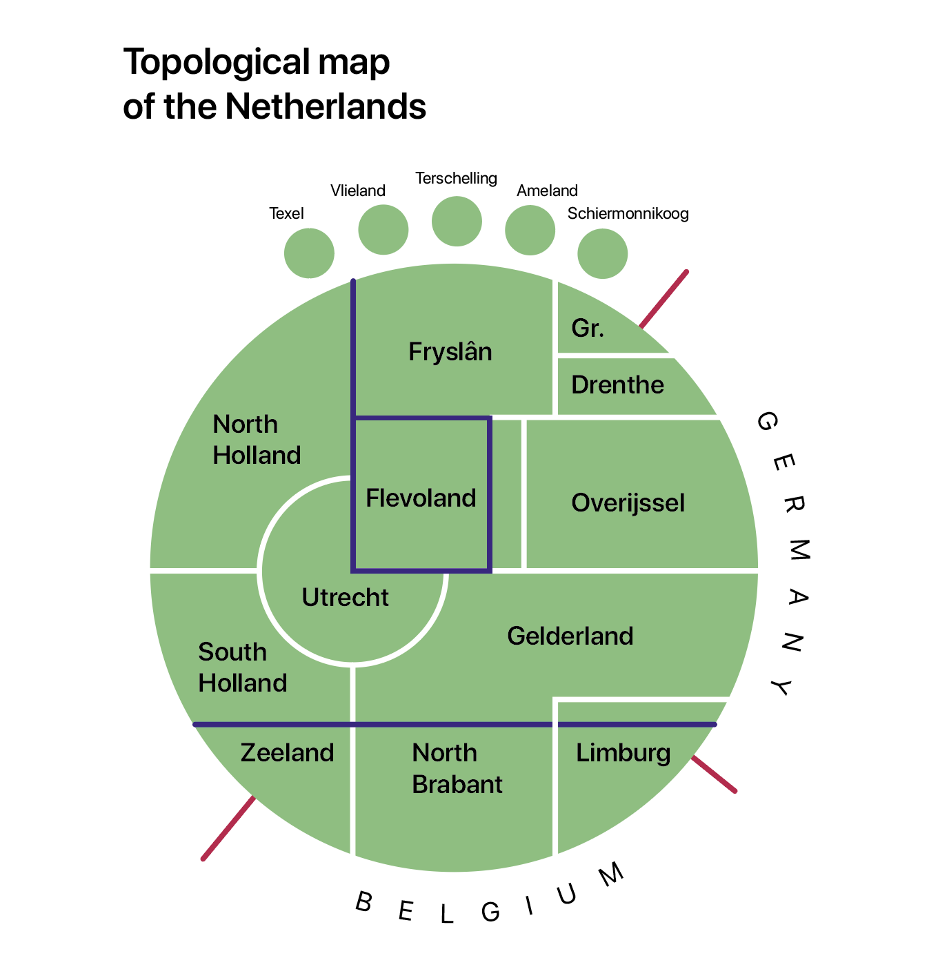
Topological map of the Netherlands
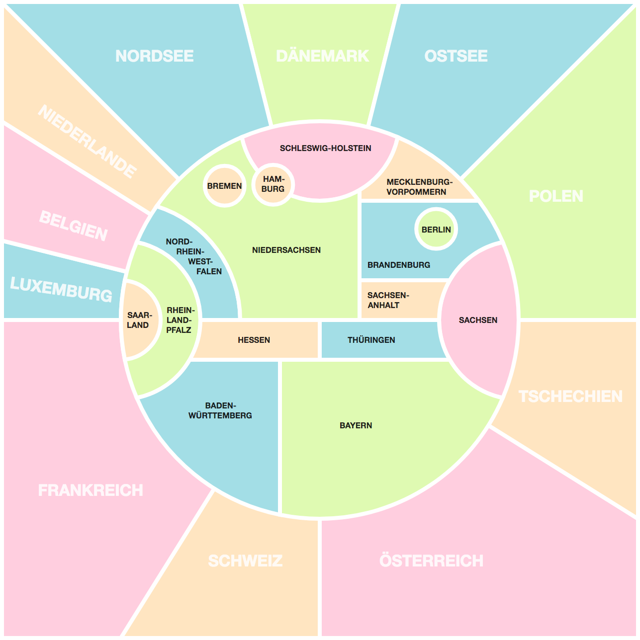
Topologycal Map of Germany
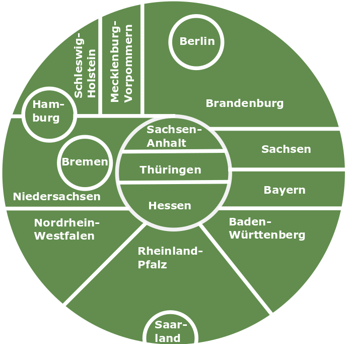
Topological Map of Germany
Brazilian States Topological Map
Topologcial maps of France
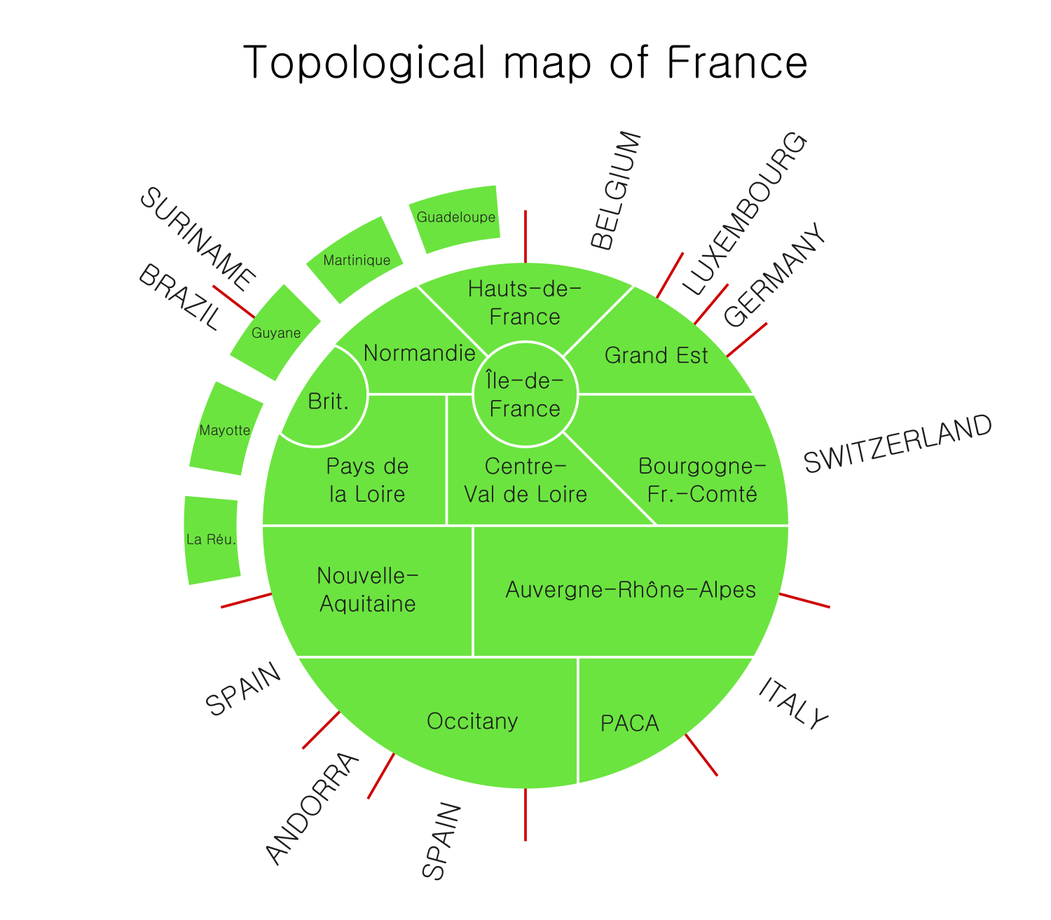
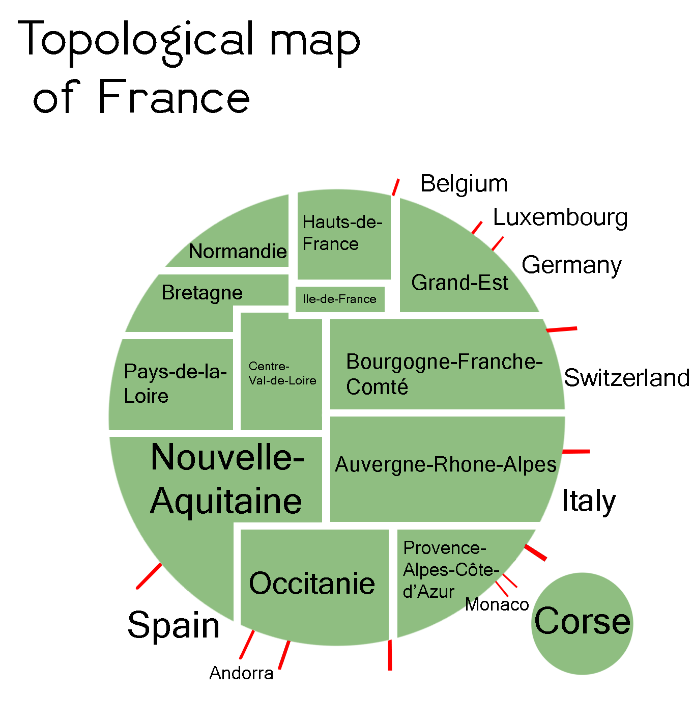
Borders of France
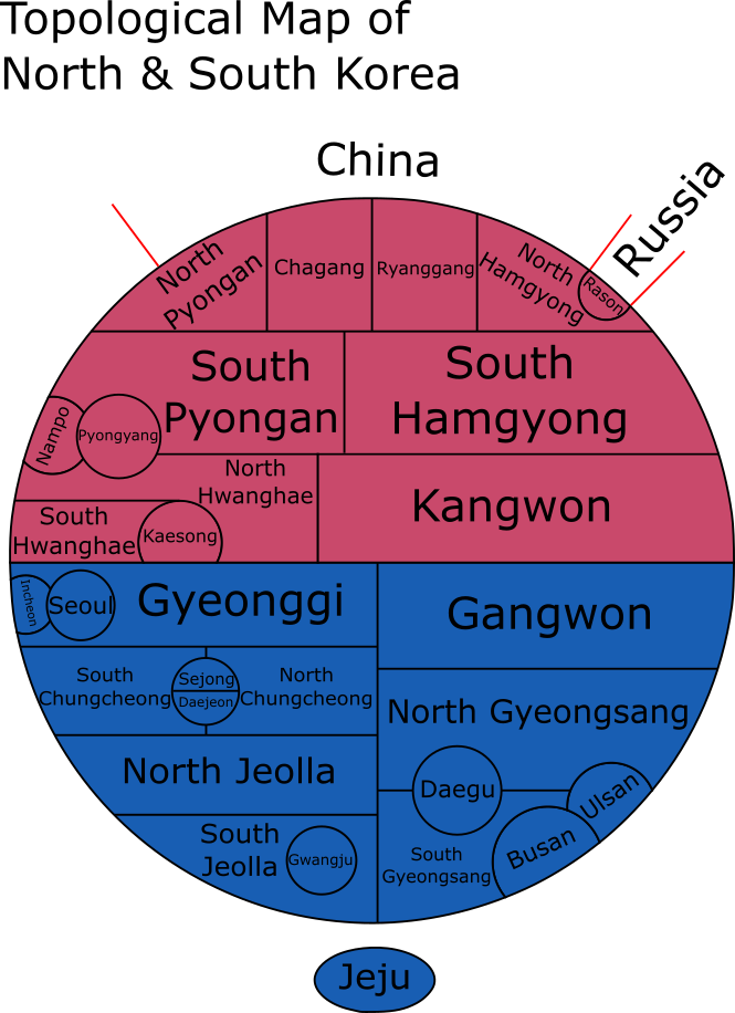
Topological Map of North and South Korea
Topological map of Spain
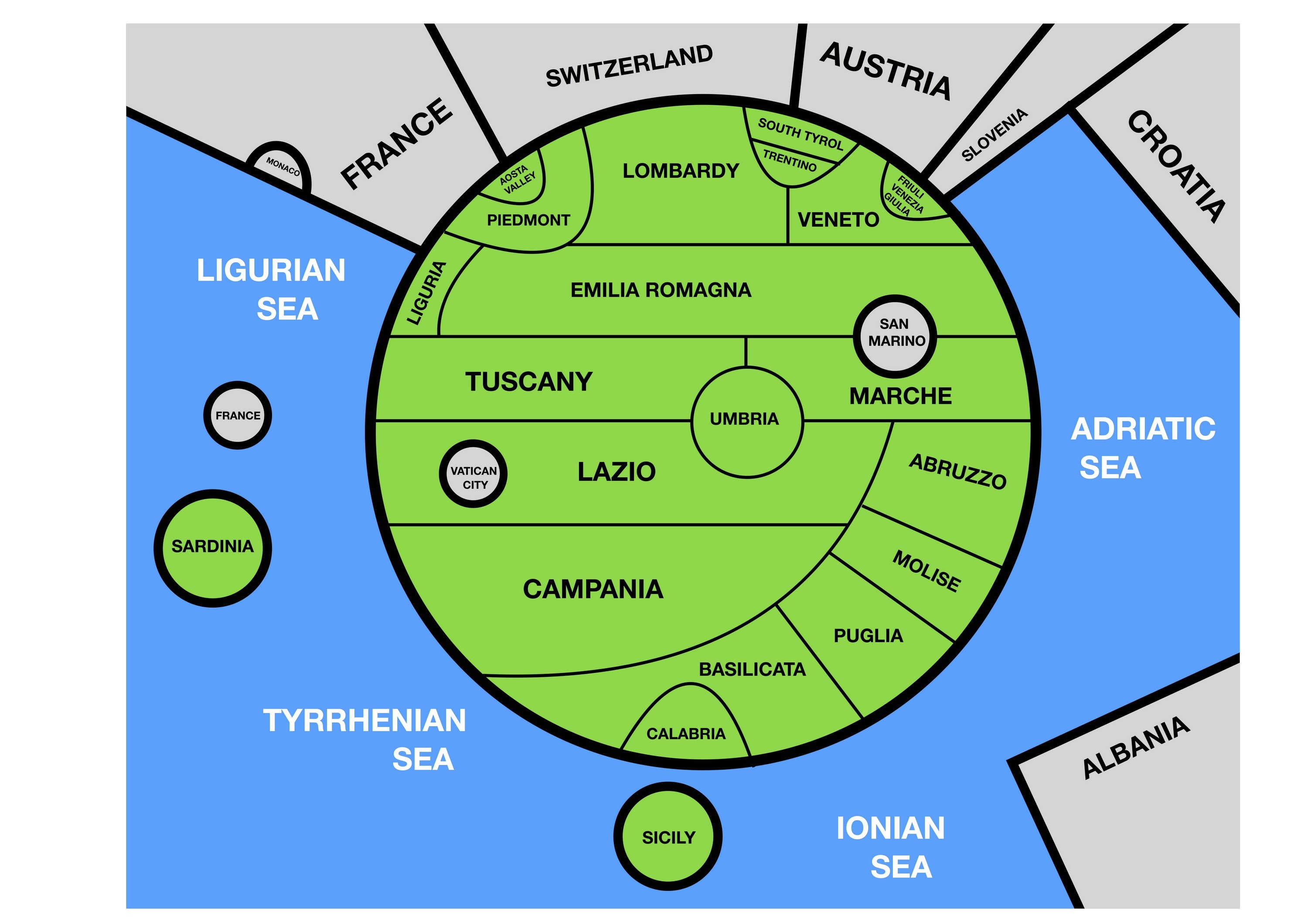
Topological map of Italy
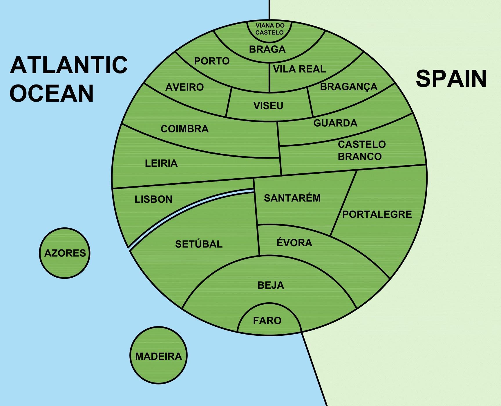
Topological map of Portugal
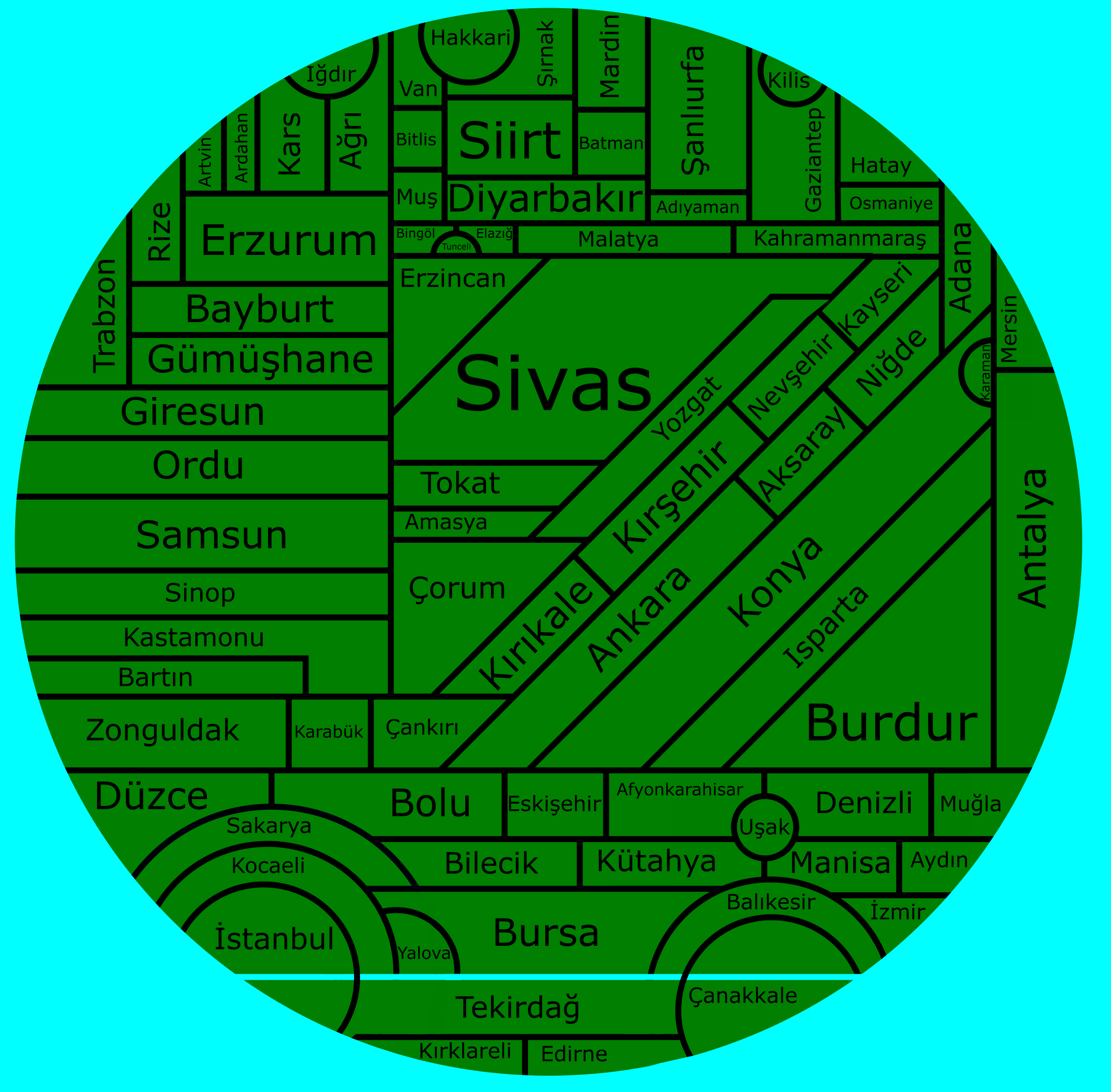
Topological map of Turkey
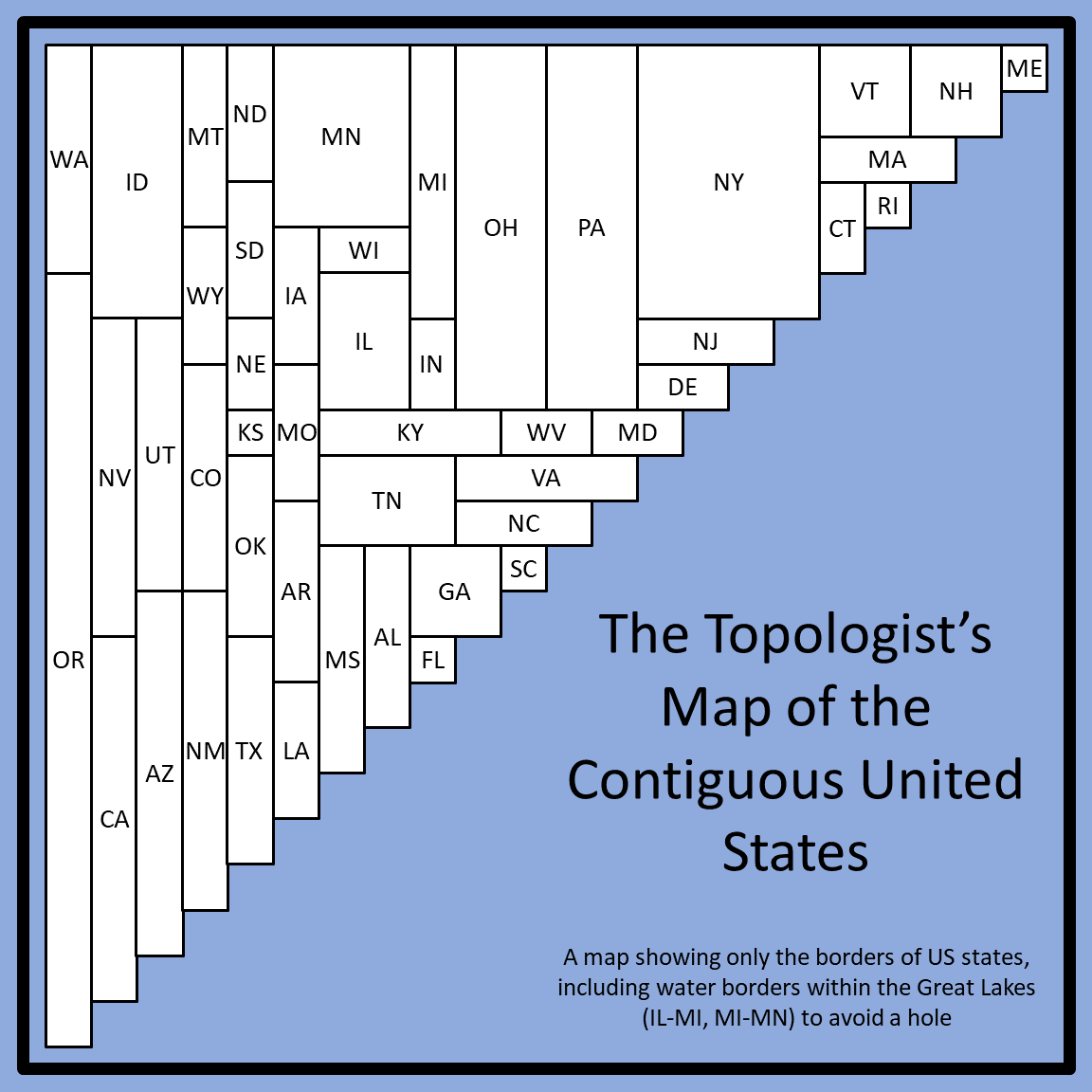
Topological Map of United States
The Topologist’s Map of the Contiguous U.S.
Topological map of Florida and its counties
Topological map of Argentina.
Some mistakes there:
– The province is called Tierra del Fuego (Ushuaia is the capital city).
– Buenos Aires and Córdoba have a common border.
– There’s a quadripoint between Mendoza, La Pampa, Neuquén and Río Negro. If you show La Pampa and Neuquén as having a common border, then there should be one between Rio Negro and Mendoza too.
– Chaco has a (short) border with Paraguay.
Topological (language) map of Belgium
Topological Map of Germany
Yoguslavia’s Topology Map
Topological maps of the autonomous communities and provinces of Spain
https://www.reddit.com/r/MapPorn/comments/x10ua9/topological_maps_of_the_autonomous_communities/