Travel time from Paris
According to James Maxwell Anderson, by the late eighteenth century, the region of the Ile de France had the best-constructed roads in Europe, much admired by foreigners. But, when traveling by horse-drawn vehicles over vast distances, travelers found that the roads sometimes became just bumpy tracks and that the trip was slow and tiresome. Going to Bordeaux or Strasbourg from Paris took six days; traveling to Toulouse took seven or eight-day and to Marseille, nine days.
The trip from Paris to Calais by fourgon also took six days; by diligence, the travel time was two and a half days.
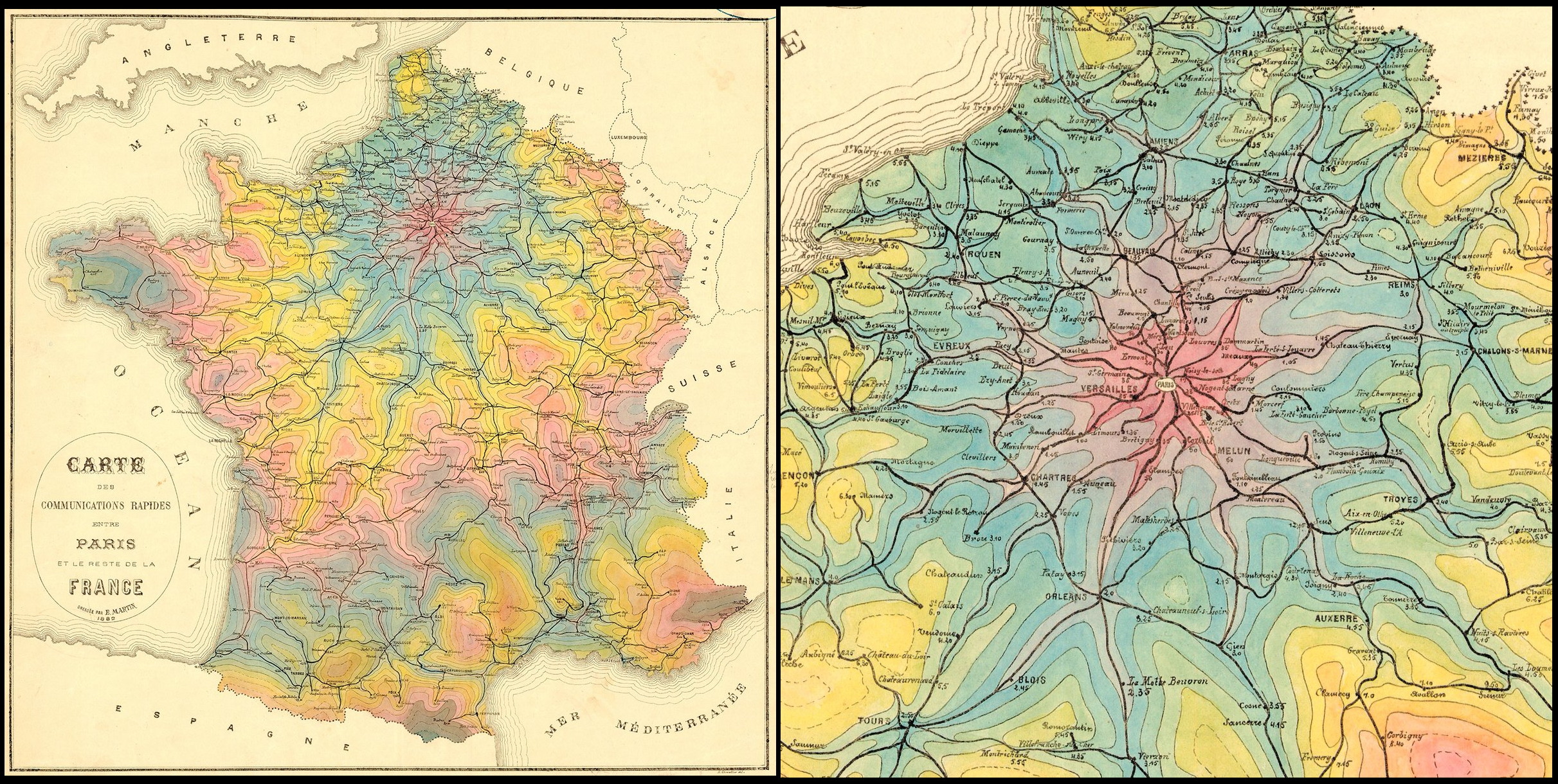
Isochrone Map from Paris (1882)
Here is another map from 1898 showing the decrease of travel times for five dates than the 17th century. For each of these dates, the 17 cities are depicted at a distance reduced proportionally to reducing travel time. So the outlines aren’t isochronic lines but explain how close the outline of France would appear to 17th century Parisians if they could travel at speeds of those future dates.

Nowadays, everything has changed. Now you can drive through all of France in one day.
Travel time from Paris by car (2020)

Below is another version map of travel time from Paris by car.


