Models 
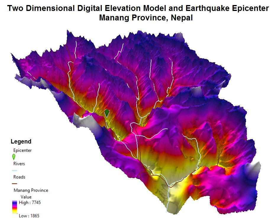
Two Dimensional Digital Elevation Model and Earthquake Epicenter in Nepal June 19, 2015 Alex This post may contain affiliate links. As an Amazon Associate, we earn from qualifying purchases. Related Posts:Earthquake hazard map for the U.S.Earthquakes from 1956‒2022, MappedUnited States ElevationInteractive World Map of EarthquakesThe Countries That Pay The Most And Least For A…Global Digital Elevation MapThe atlas of the United States in the style of Joy DivisionHow Healthy (or Unhealthy) Your Neighborhood Is ?