Voronoi maps are built from a series of polygons created around the location of a sample point.
We frequently need to find the nearest airport, shop, or hospital. A map split into cells, each cell embracing the region closest to a particular center, can help us in our search. Such maps are called a Voronoi diagram, named after Georgy Voronoi, a mathematician born in Russian Empire in 1868. He was a student of the famous mathematician Andrey Markov from the Department of Physics and Mathematics at the University of St. Petersburg. In 1909, another Russian scientist Boldyrev used the term “area of influence polygons” for similar diagrams in Geology’s scientific work. It is believed that Rent Descartes first used such diagrams in his works in 1644.
In mathematics, a Voronoi diagram is a partition of a plane into regions close to each of a given set of objects. These regions are called Voronoi cells. The Voronoi cells have borders made up of straight-line segments, and all corners have interior angles less than 180°.
One of the first uses of a Voronoi map was Dr. John Snow, a famous London physician. During a severe cholera outbreak that killed tens of millions in 1854, John Snow used data on the number of victims and locations of disease cases. He divided London into sections, each having a separate water source. He plotted his data on a map, finally creating a Voronoi diagram, and found that most deaths were in houses provided by a particular pump in Broad Street, Soho. Before, no one knew what the source of the disease was.
Below are some colorful examples of the use of Voronoi maps, which help us understand our world.
World Map if borders were decided by nearest capital
On this map, the world’s territories have been redrawn so that the closest capital city determines a region.
Reddit user: jossy010
The U.S. map with state borders redrawn based on the locations of the state capitals you can find here.
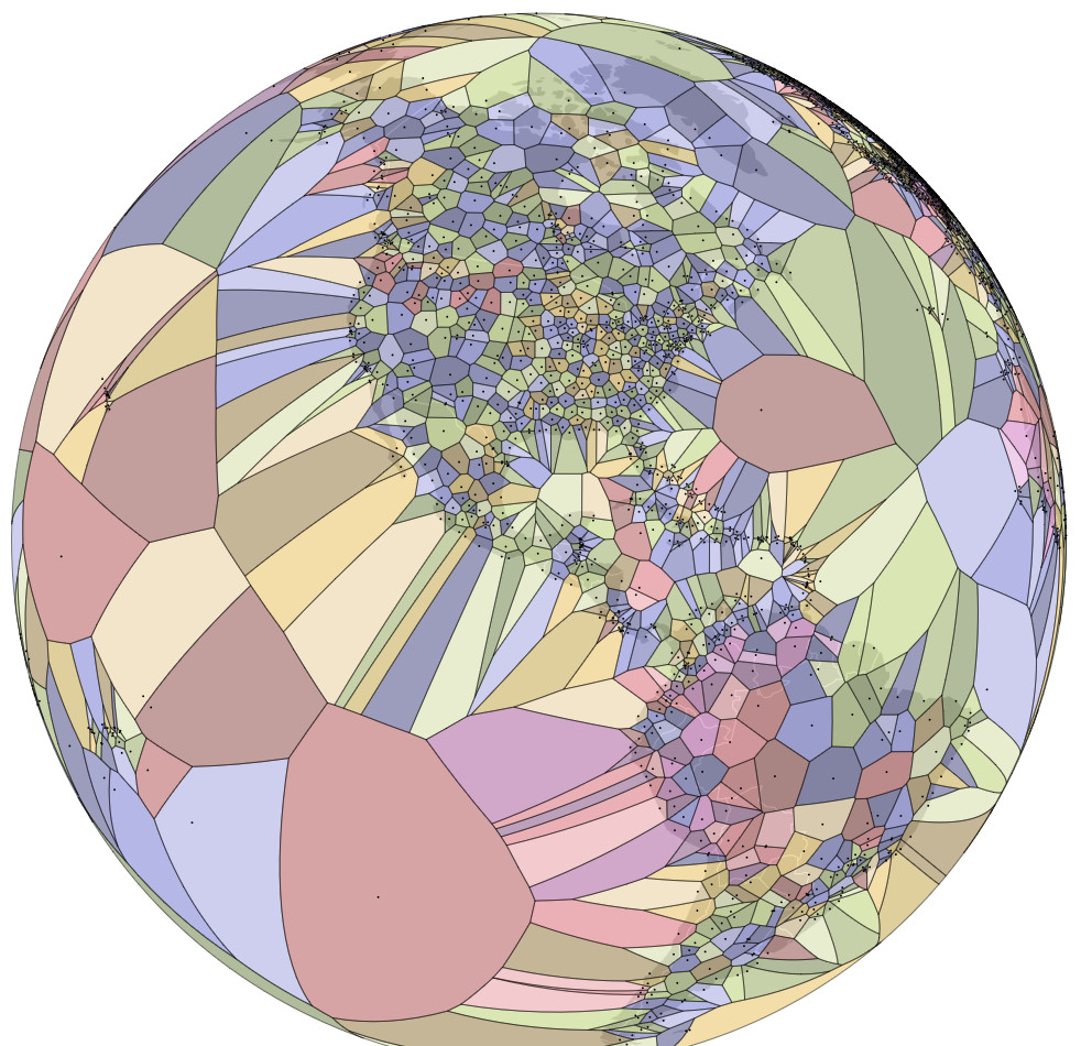
The closest airport for each region of the Earth
This map created by Jason Davies provides a Voronoi diagram to highlight airports worldwide, with the areas closest to every airport.
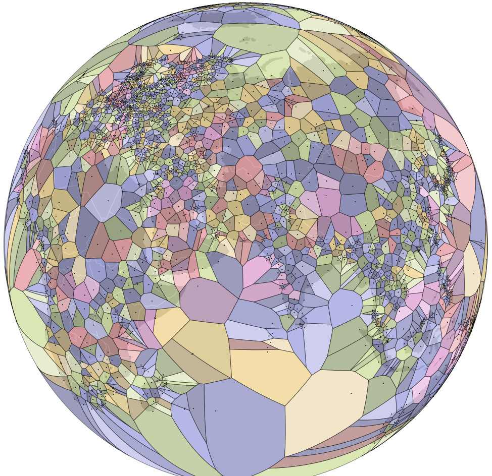
The closest seaport for each region of the planet
The map below plots the closest seaport for each region.