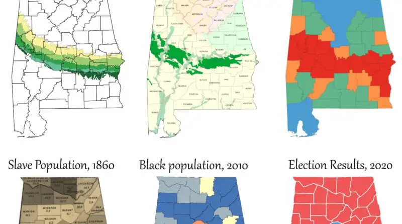
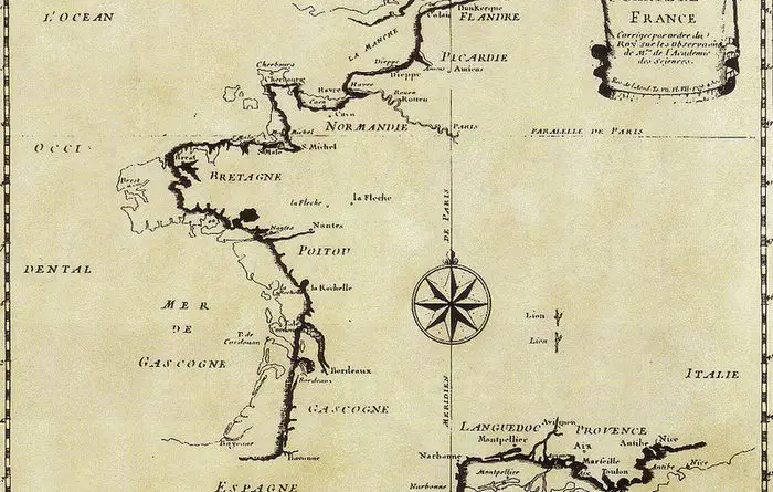
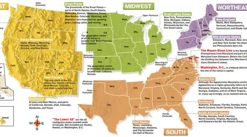
Corrected map of France: showing the coastline of France after scientifically mapping it in the late 17th century
“Corrected on the order of the King, according to the observations of the Master of the Academy of Sciences”
Read more“Corrected on the order of the King, according to the observations of the Master of the Academy of Sciences”
Read moreThe US Census Bureau defines four statistical regions, with nine divisions.
Read moreIdentifying Regions of England, according to the most frequently used definitions in the public and private sectors. The North: current
Read moreColorado Is Colorado a perfect rectangle? The map of Colorado’s border deviations below. The borders of Colorado were fixed in
Read moreHave you ever been surprised that accurate maps precede planes and satellites? Accurate world maps came about earlier than many thinks,
Read moreThe total seasonal snowfall in the continental United States (2017 – 2018). Source: viewshed
Read moreThe maps are ranked on the number of visitors each received in 2017. 20. Religious adherence as a percentage
Read moreSource: Randall Munroe xkcd.com You can make these maps say whatever you want by adjusting the methodology. Half the time you’re
Read moreSunlight duration in hours per year in the continental United States and Europe. Related posts: – Annual sunshine hours map of
Read moreSource: bl.ocks.org Related posts: – Key bus routes in central London (with top tourist attractions) – London Traffic Counts Map –
Read more