About 505 thousand cubic kilometers (121 thousand cubic miles) of water drops as precipitation every year. Of these, 398 thousand cubic kilometers (95 thousand cubic miles) over the oceans and 107 thousand cubic kilometers (26 thousand cubic miles) over land.
Globally averaged yearly precipitation is 990 millimeters (39 inches), but overland is just 715 millimeters (28.1 inches).
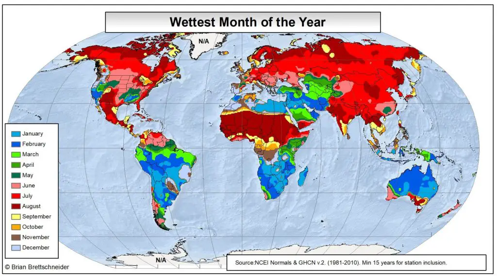
Below are maps of wettest and driest months of the year based on climate averages.
Wettest month of the year
The equatorial region near the monsoon trough is the Earth’s continents’ wettest part. Yearly, the rain belt within the tropics moves northward by August and then goes southward into the Southern Hemisphere by February and March.


?")


