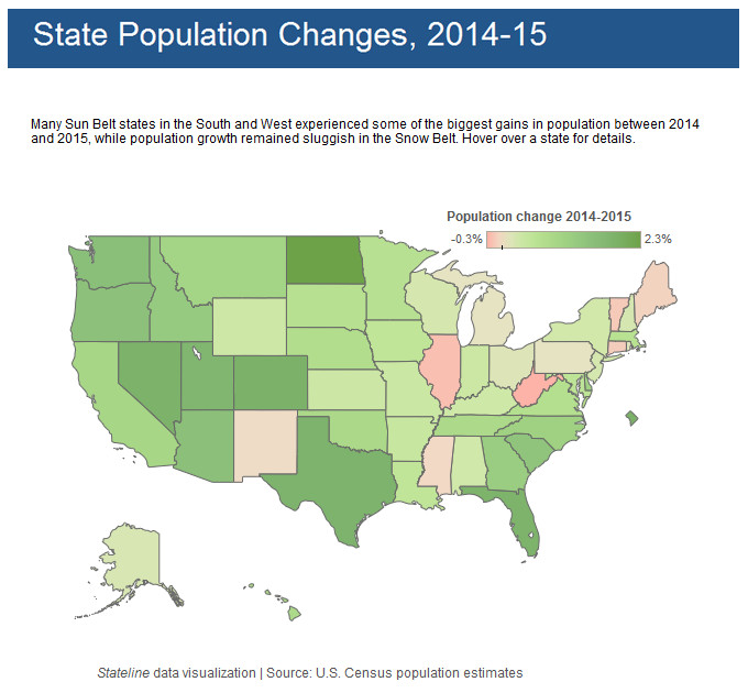
Interactive mapsMapping StereotypesNaturePopulationScience State population changes (2014 – 2015) January 8, 2016 Alex Many Sun Belt states in the South and West experienced some of the biggest gains in population between 2014 and 2015, while population growth remained sluggish in the Snow Belt. Hover over a state for details. Related Posts:Snowiest places in the United States mappedIndia explained in 25 mapsPercentage who have not Consumed Alcohol in the last…The Oldest Cities in the U.S. MappedSolar Eclipses Paths MappedUnveiling America's Shifting Landscape: A United…Exotic Animal Laws by U.S. State MappedNeighborhood Racial and Ethnic Change Trajectories…