In 1474, the prevailing understanding of the Earth’s continents was quite different from our modern knowledge. During that time, many people in Europe and other parts of the world held a geocentric view of the universe, which placed Earth at the center of everything. This geocentric perspective influenced how people perceived the distribution of landmasses on Earth, although their understanding was limited by the lack of advanced navigation and exploration tools.
The full extent of continents like North America, South America, and Australia was not yet known to European mapmakers.
During the 15th century, cartography (map-making) was still in its early stages of development. Maps from that era were often inaccurate and lacked the precision of modern maps. The maps of the time were typically based on a combination of ancient knowledge, religious beliefs, and partial exploratory information. This resulted in a variety of misconceptions about the size, shape, and location of continents.
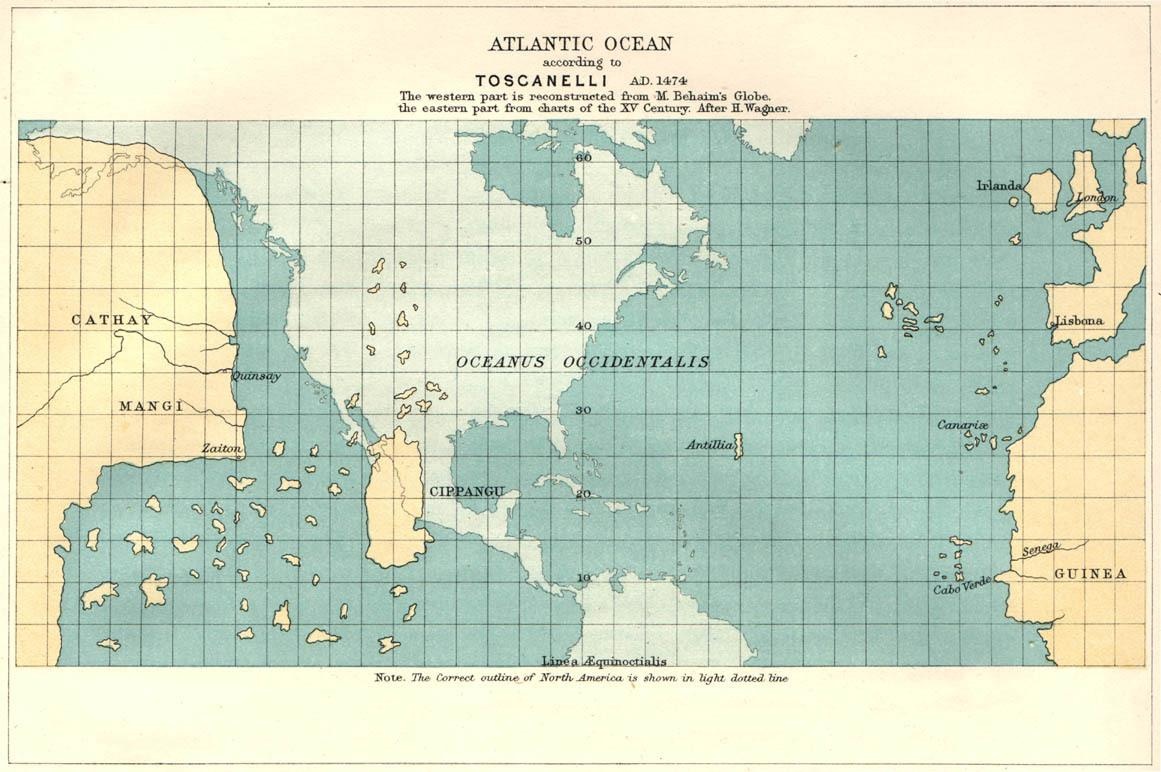
Below is the map of the Atlantic Ocean, according to Paolo dal Pozzo Toscanelli (1474). This is most probably what Columbus was expecting to find (American real outline in the background).
The correct outline of North America is shown in light blue tint
The European explorations of Christopher Columbus, Vasco da Gama, and others in the late 15th and early 16th centuries gradually led to a more accurate understanding of the Earth’s continents and their locations.
You can learn more about explorers from the following books:


Atlantic Ocean According to Toscanelli (A.D. 1474)
1474 in the title