“Alaska: Far North Frontier” (1959)
When Alaska officially became the 49th state of the United States in January 1959, it was the culmination of decades of debate, strategic maneuvering, and public persuasion. Not everyone was thrilled about it. In fact, many Americans — including influential voices in Congress — were firmly opposed. Some saw it as too remote, too costly, or too sparsely populated to join the Union. Others suspected there was a political motivation behind the timing, especially during the Cold War. The idea of admitting a massive territory bordering the Soviet Union raised both concerns and hopes.
This context is part of what makes a pictorial map published that same year so interesting. Created by Klengston Rude, the map is more than just a visual guide to Alaska’s rivers, mountains, cities, and wildlife. It also reads — subtly but clearly — like a visual endorsement of Alaska’s place in the American story. A kind of soft propaganda, perhaps. A way of showing the public: “Look how beautiful, rich, and full of potential this new state is.”
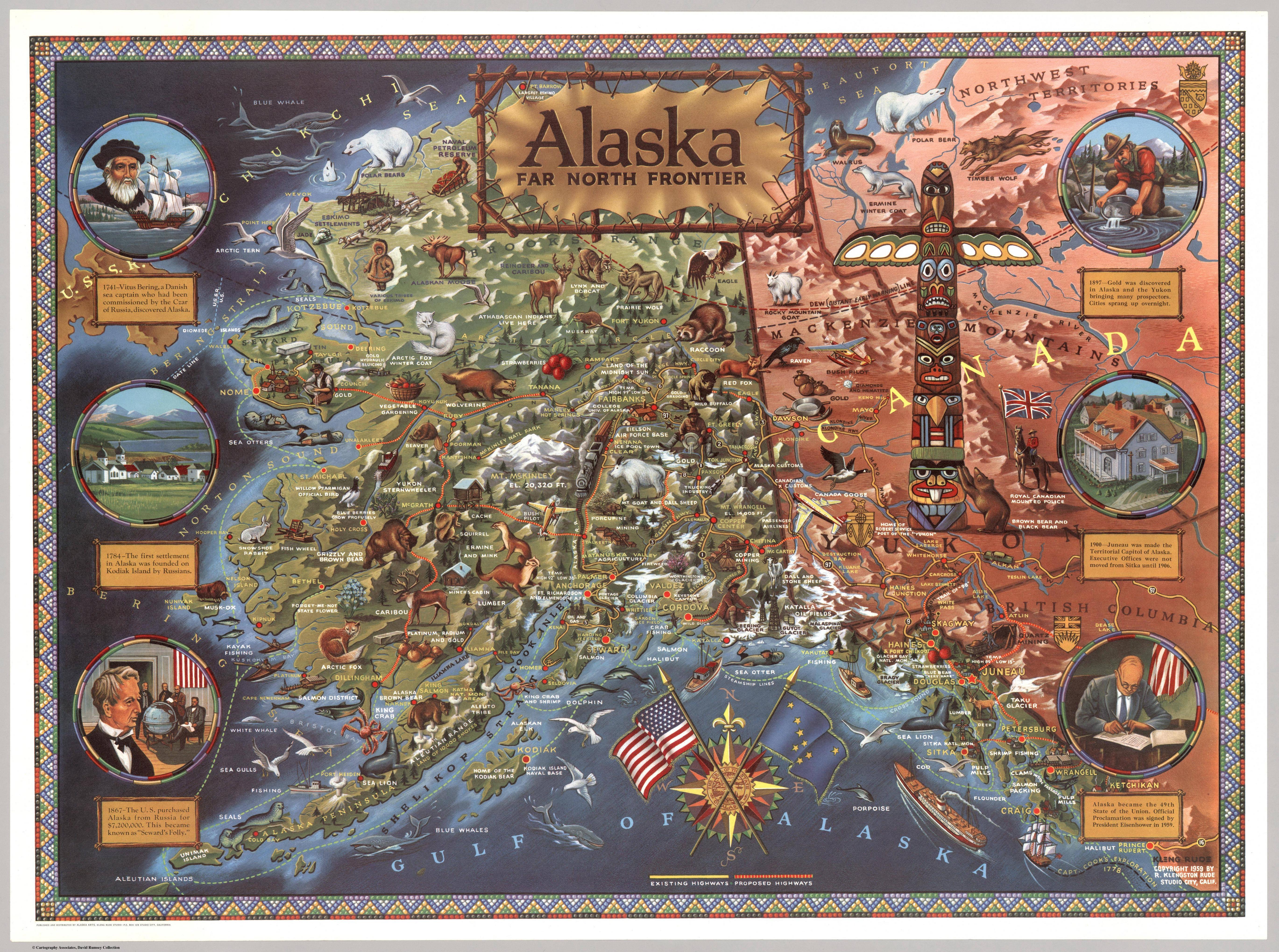
The map is packed with details. Moose, seals, bears, lynx, mountain goats, and bald eagles are illustrated throughout the state’s vast terrain. Major glaciers are labeled, mountain ranges sketched, cities and settlements placed alongside winding rivers and coastal inlets. Roads and highways — some real, some still only proposed — stretch out across the landscape, reflecting ambitions to connect communities in this rugged land. The cartographer likely used government sources such as U.S. Geological Survey maps and Alaska Territory infrastructure records to construct it, but like many pictorial maps of the era, it mixes cartography with illustration and storytelling.
What also stands out are the six historical scenes flanking the map on the left and right. These short illustrated vignettes mark what the mapmakers considered turning points in Alaska’s history: Bering’s expedition in 1741; the first Russian settlement in 1784; the U.S. purchase from Russia in 1867; the Klondike gold rush in 1897; the capital’s move to Juneau in 1900; and finally, statehood in 1959. Taken together, they present a neat historical arc — from discovery to settlement to inclusion in the Union.
But of course, the real story wasn’t that tidy. While Alaska’s statehood passed in Congress with strong support in the final vote, the road there had been long and often contentious. Many southern states worried about new liberal votes in the Senate. Others feared increased federal spending on infrastructure or defense in a state that had only around 225,000 residents at the time. Opposition voices, like that of Senator Strom Thurmond of South Carolina, argued Alaska was economically dependent on the federal government and culturally too different to be granted equal status. Supporters, including President Eisenhower, saw it as a way to strengthen national unity and increase strategic reach, especially with tensions high during the Cold War.
So in that environment — with public opinion not yet firmly in favor — this kind of colorful, appealing, patriotic map likely served more than just educational purposes. It was a way of helping Americans feel more familiar with and connected to a place many had never seen or thought much about. It put wildlife, infrastructure, and historical legitimacy front and center. It helped shape an image of Alaska as not just remote wilderness, but as a place full of life, history, and American identity.


