Europe was the location of powerful states that frequently competed with each other. They took part in bloody wars and weaved diplomatic intrigues behind the scenes. In this confrontation, satire was not only an art form but also a dangerous weapon, the purpose of which was to convey to its population and the population of other countries who’s who in the political arena.
Below is an atlas of satirical maps that is an artistic representation of European countries’ historical events.
British satirical map of Europe (1830)
Satirical map “The French Invasion; or John Bull, bombarding the Bum-boats” (1791)
In this 1793 map, George III assumes the shape of the British land. Looking defiant, he releases his bowels on a navy of French ‘bumboats’ (supply ships) which ply the Channel above the anthropomorphized face of France. His excrement showers out of Portsmouth, the heart of the British Royal Navy.
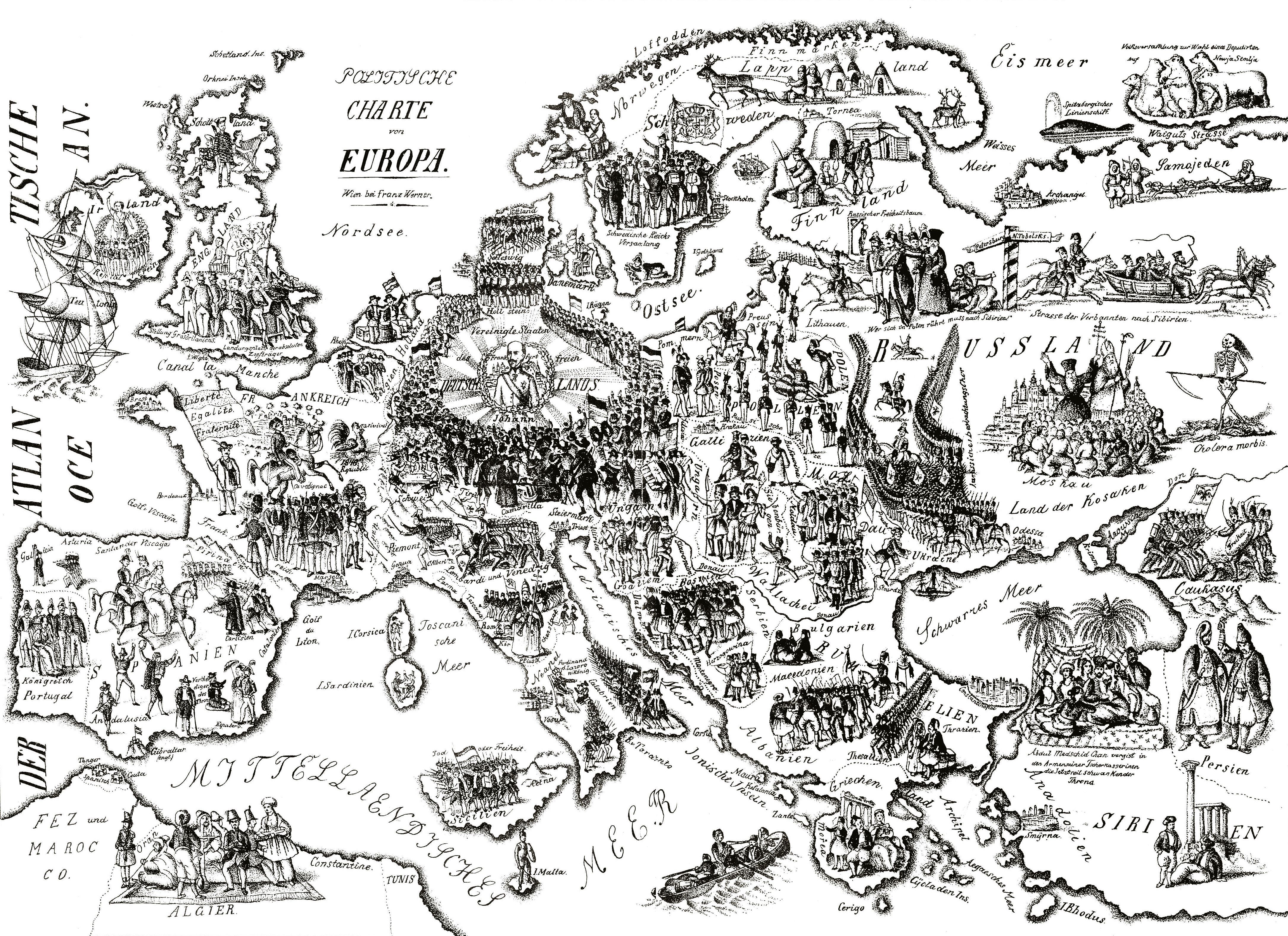
Map of Europe published in Vienna during 1848 Revolutions
Comic map of the seat of war (1854)
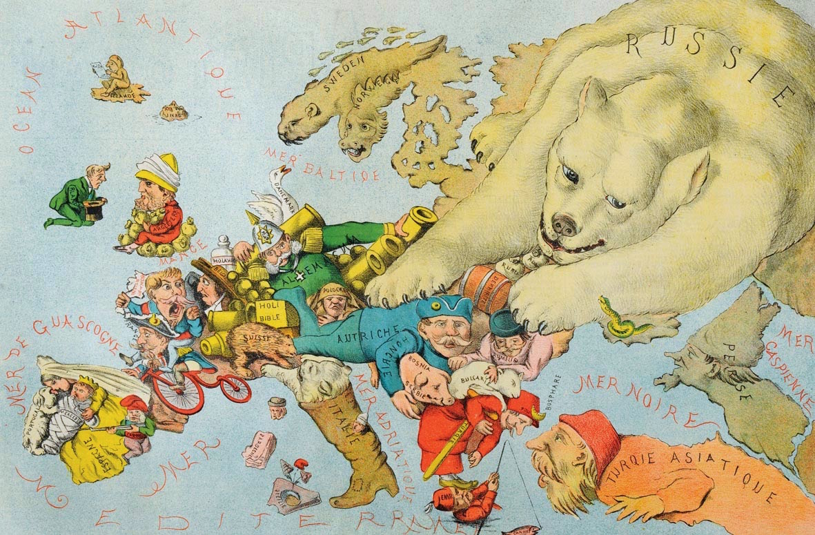
British satirical propaganda map of Europe at the end of the Crimean war (1856 )
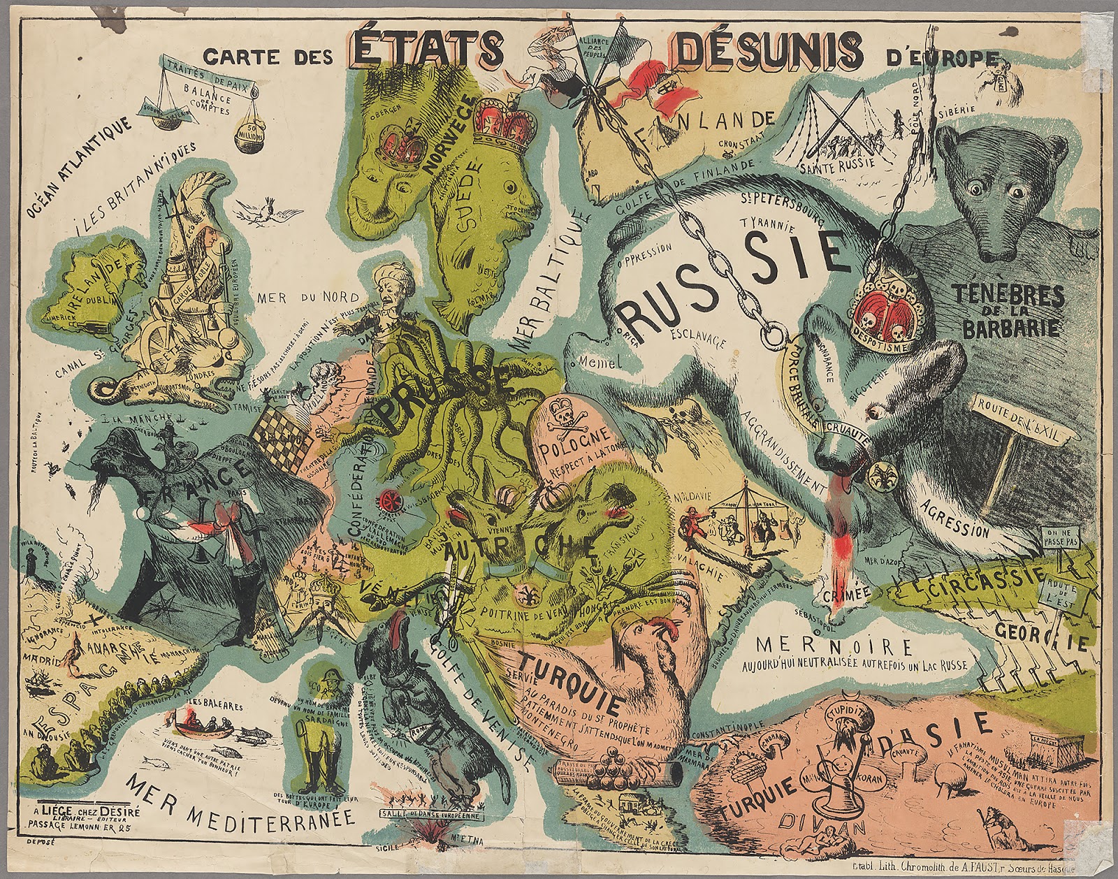
Disunited States of Europe (1864) (French)
Comic Map of Europe (1870) (French)
Caricature map of Europe by Paul Hadol (1870)
Satirical map of Europe (1870) (French)
Neumann Satirical Map of Europe (1870)
“England, setting off on their island, is waving a white flag in neutrality, although their neutrality is questionable since they are sending arms to France. Ireland is being held on a string by England and hopes to one day sever those ties. France has lost Alsace and Lorraine, which are being held by Germany. Corsica homes one day to again give birth to a ‘Great Corsican’.Italy plays cards with Rome and loses Switzerland heals the wounded. Belgium and Holland invite the warring parties for a visit while holding bayonets. Denmark says, ‘My dear, he is still there’. Russia is sitting back and waiting, with a sharpened knife, until they have the opportunity to slice off a piece of the Crescent (Ottoman Empire) for themselves. For the time being, Sweden and Norway just sit and watch.”
A satirical geopolitical map of Europe (1871) (Italy)
Map was based on the numerous events portrayed on the map such as the defeat of the Papal States in Italy
The European Animal, a satirical map made by A. Belloquet (1882)
Today’s Europe / Das heutige Europa, Zürich (1887)
Status mundi / Európa béke-mappája (1887) (Hungarian)
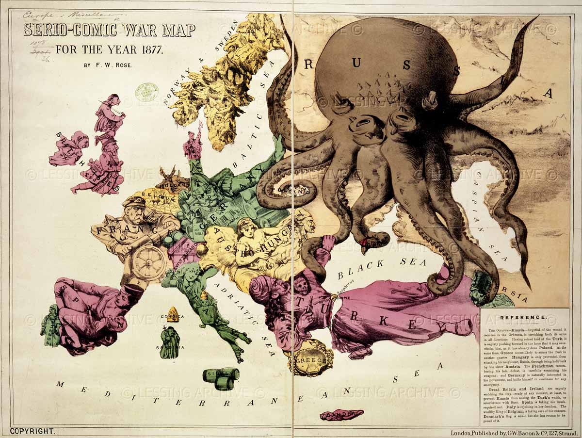
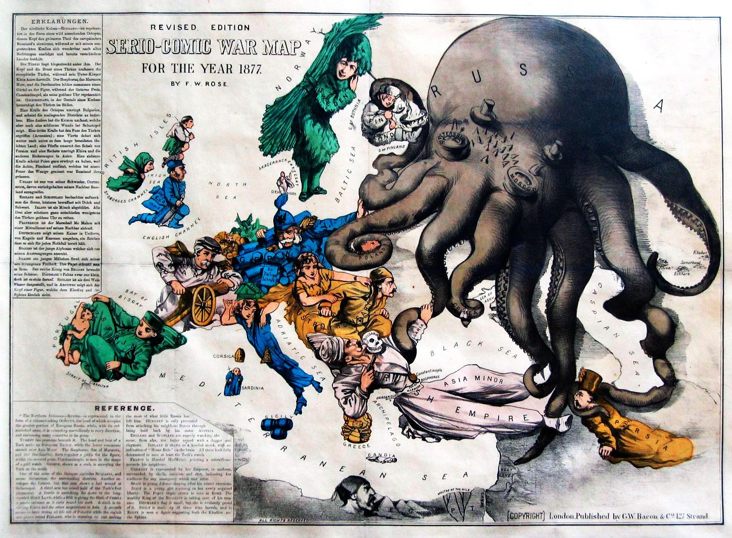
Angling in Troubled Waters, a Serio-Comic Map of Europe, by Fred W. Rose (1899)
John Bull and His Friends, a Serio-Comic Map of Europe, by Fred W. Rose (1900)
Fraternal Europe (1900)
Cartoon map of Europe (1914)
Europe at war (1914) (French)
German Comic war map (1914)
Kill That Eagle (1914)
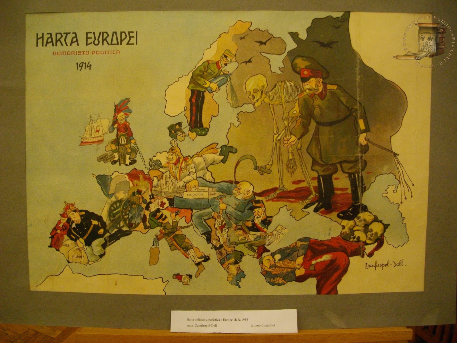
Humoristic map of Europe (1914) (Romanian)
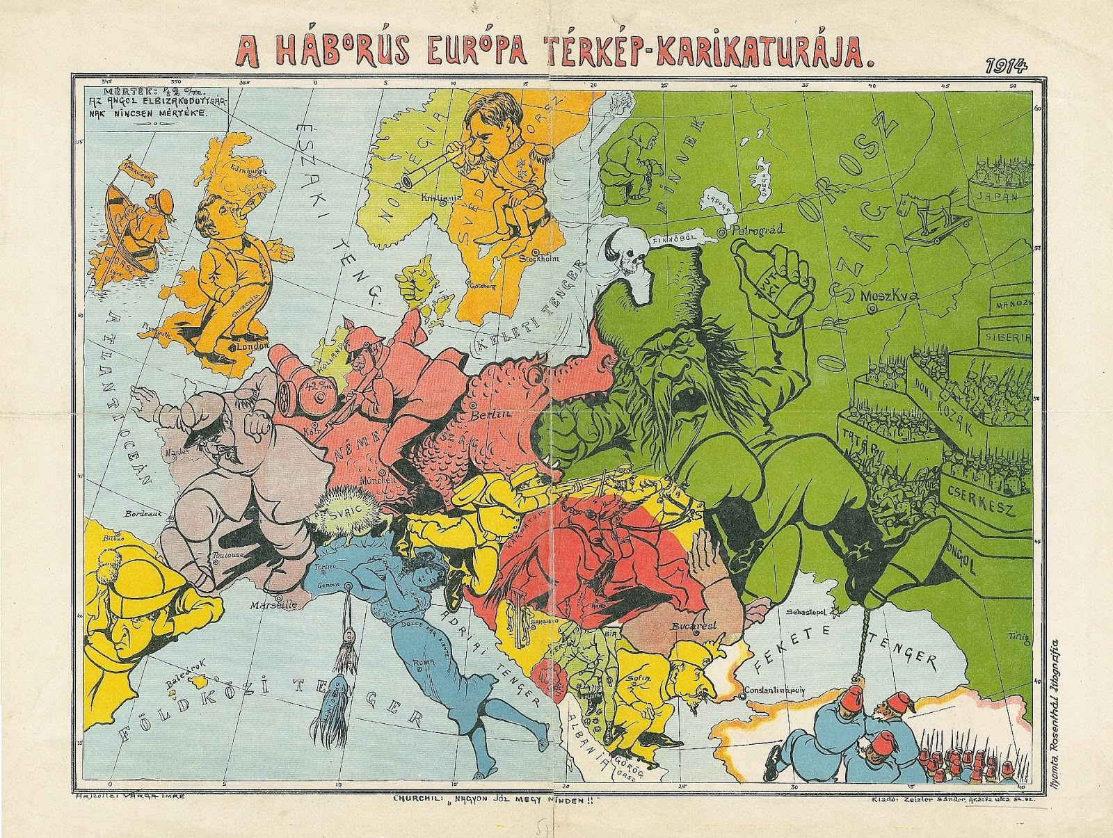
Caricature War map of Europe (1914) (Hungarian)
Map of Europe at the outbreak of World War I (1914) (German)
Caricature Map of Europe “The Great War 1914”
European War (1914)
Map of Europe from Das Plakat (1914)
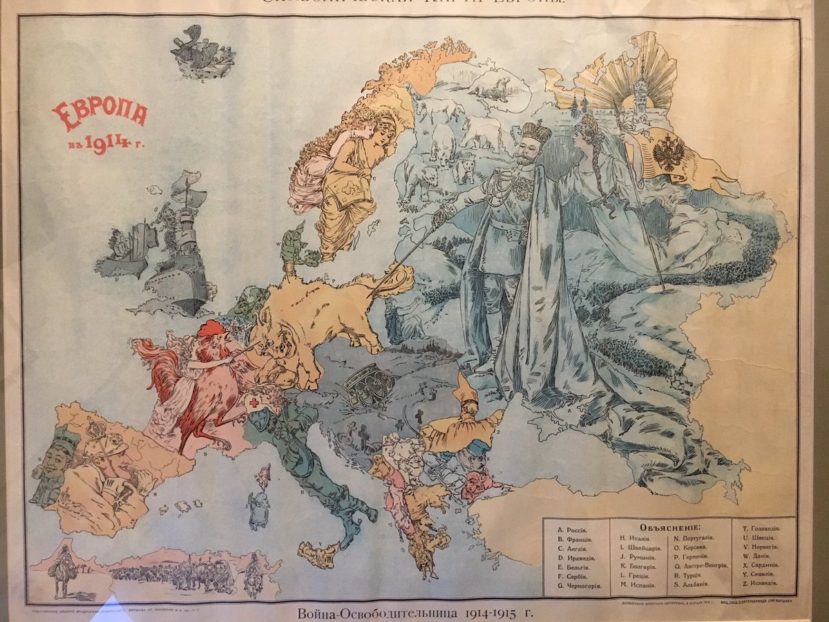
Europe (1914) (Russian) “Liberation War”
Satirical Maps of the WWI (1915) (German)
Europe (1915) (Italian)
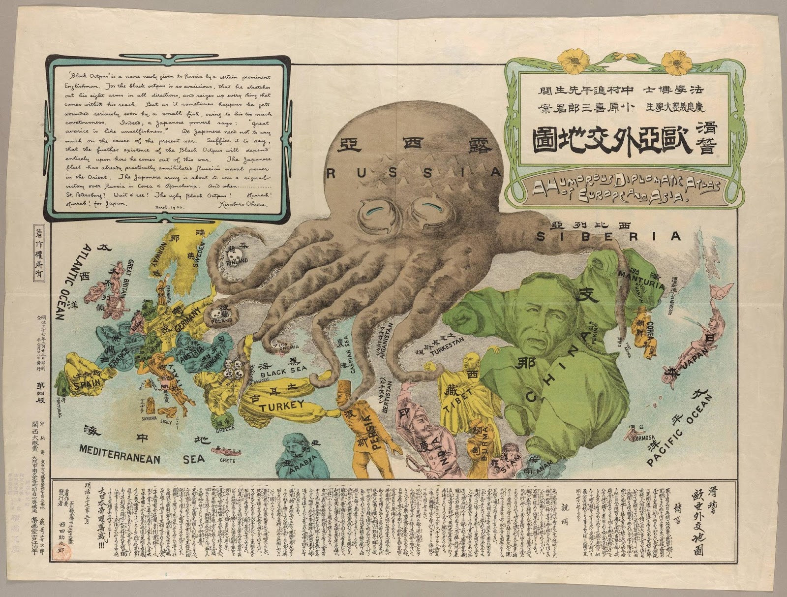
A Japanese satirical map of European stereotypes (1932)
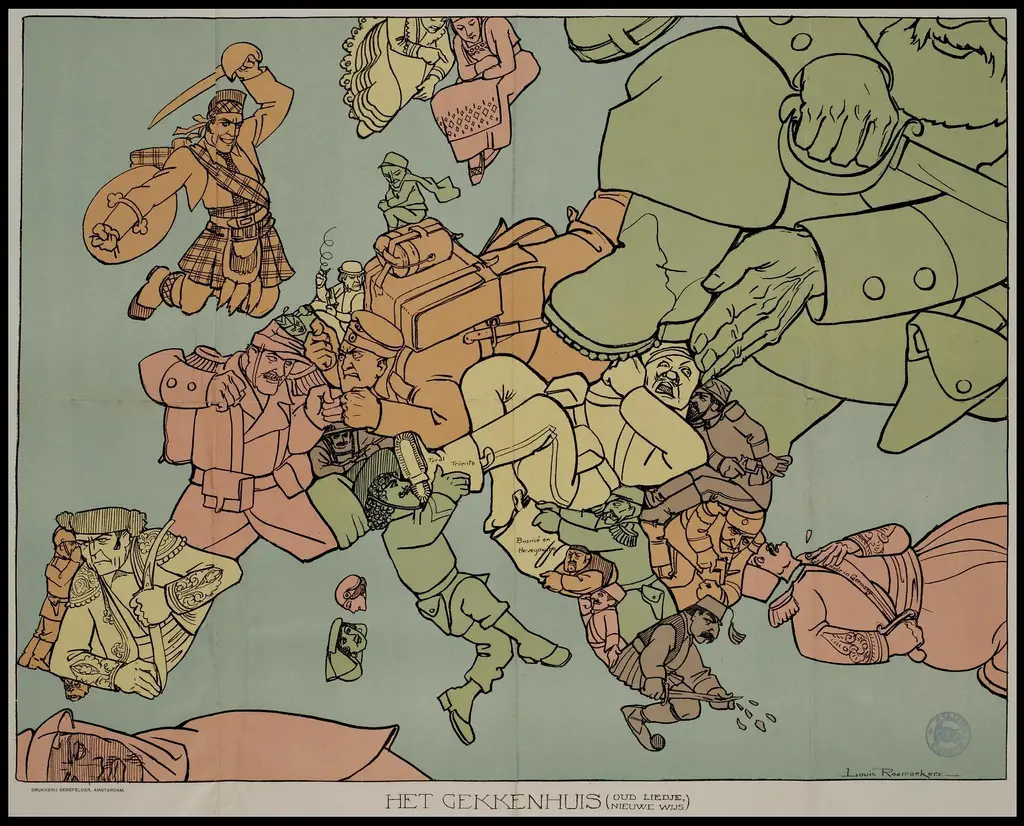
Factionalized pre World War I Europe
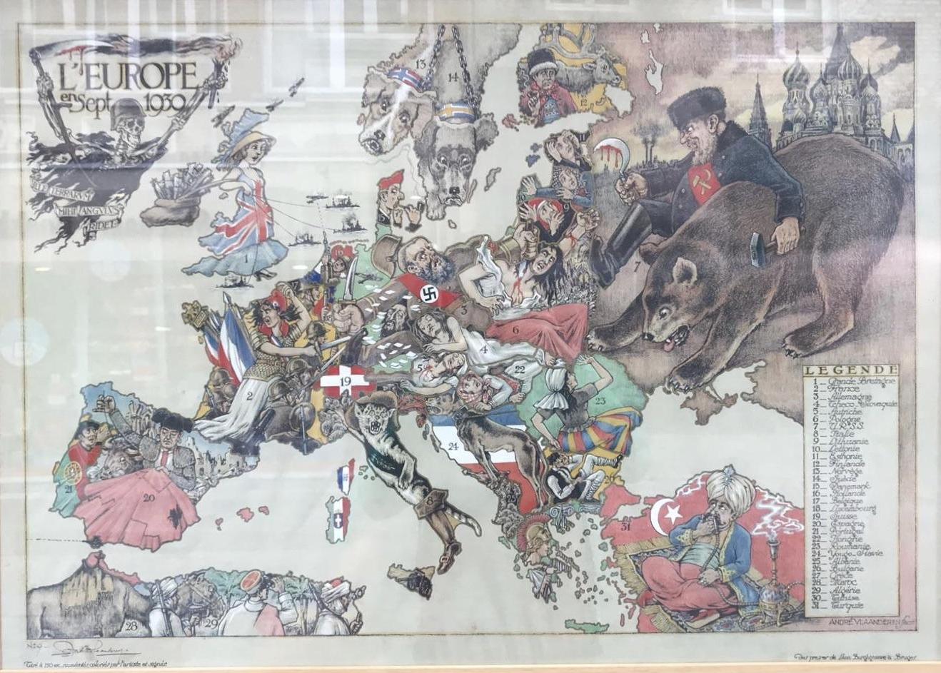
Europe during the World War 2
Europe (1917) (Italian)
“Hark! Hark! The Dogs Do Bark!”
Europe (1939)
The World War II seriocomic map created by Cornelis André Vlaanderen, the Dutch artist, and published by Leon Burghgraeve in Bruges vividly portrays nations as human or animal figures during the turbulent period of 1939. Germany, depicted as a menacing Nazi soldier, wields knives threateningly after annexing Austria and Czechoslovakia. Russia, the other aggressor, is represented with a bloody sickle and hammer, accompanied by a ferocious bear. The map uses visual metaphors to illustrate geopolitical events, including Germany’s invasion of Poland.
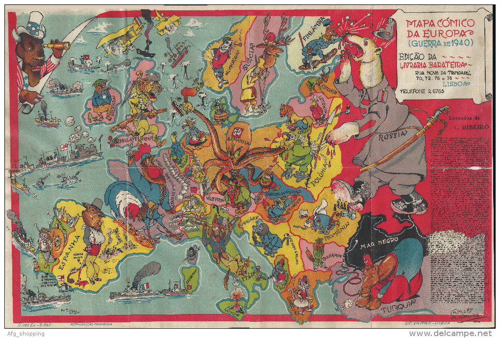
Comic map Europe (1940) (Portuguese)
Humoristic Cold War map of Europe (1953) (Portuguese)


Pretty good meme.
OUTSTANDING
Thanks
oh yeah daddy shove it in harder