Bangladesh population mapped
Bangladesh’s population reached an estimated number of almost 165 million inhabitants in 2020. The country’s land area amounts to 130.2 thousand square kilometers or 50.3 thousand square miles.
The population density of Bangladesh is 1,265 people per square kilometers or 3,276 people per square mile. This is highly dense to a nation and comparative to some towns in the United States.
This South Asian country is the 10th most densely populated country globally. Bangladesh’s population density was exceeded only by tiny countries Monaco, Macao, Singapore, Hong Kong, Gibraltar, Bahrain, Vatican City, the Maldives, and Malta. General, Asia had the highest population density in the world in 2018.
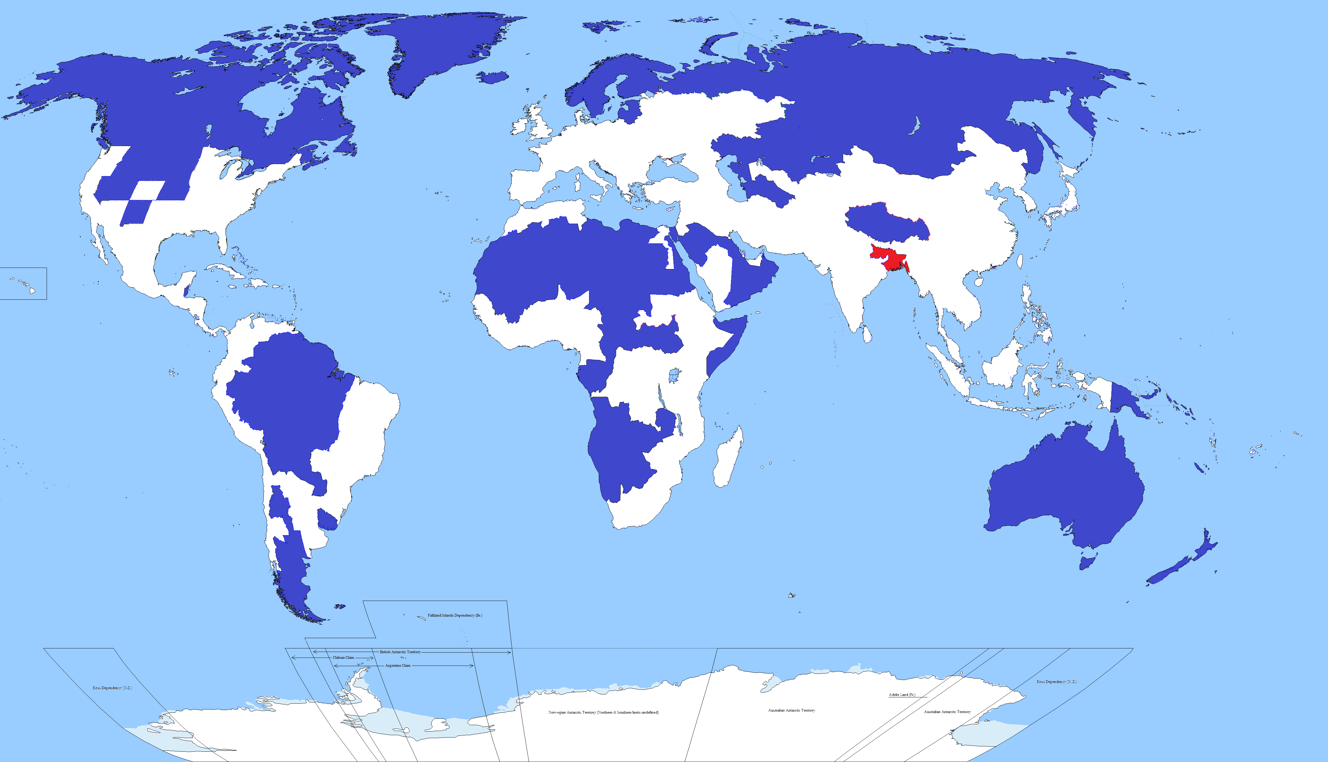
The red polygon mainly covering Bangladesh territory on the map below contains more people than the blue polygons put together.
The Bangladeshis are living mainly in the countryside in farms and villages. Compared to more developed nations like the United States, that world region isn’t nearly as urbanized. Bangladesh’s urbanization rate is about 37%, whereas 82% in the United States.
The map below shows how Bangladesh’s population fits into the United States.

But during the last time, Bangladesh’s birth rate and mortality rate had significantly decreased in the past years, with a life expectancy of 72.59 years in 2019. Nowadays, the population in Bangladesh has been increasing at a slow speed, barely fluctuating around an annual rate of 1%. This growth was predicted to persist, although it was forecasted to halve by 2040.


