The World’s Forests Mapped
A forest is an area of land covered by trees. According to the Food and Agriculture Organization, forests cover some 3.9 billion hectares (or 9.6 billion acres), which is about 30% of the Earth’s land surface.
Read MoreMaps depicting environmental degradation across planet.
A forest is an area of land covered by trees. According to the Food and Agriculture Organization, forests cover some 3.9 billion hectares (or 9.6 billion acres), which is about 30% of the Earth’s land surface.
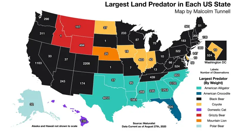
Read MoreThe largest predators usually have a broad range rare because of their places at the top of food chains. Many predators are living in the United States, but their number varies depending on the state.
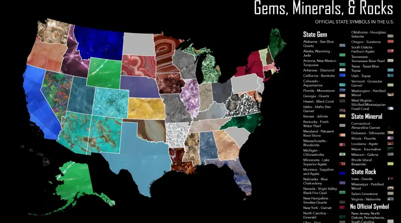
Read MoreGovernors of U.S. states in the U.S., which have notable mineral deposits, frequently create a state mineral, gems, and rocks to encourage engagement in their natural resources, tourism or history.
Read MoreThe term “big cat” is are commonly used to relate to any of the five species of the genus Panthera: lion, tiger, jaguar, leopard, and snow leopard. Except for the snow leopard, these big cat species can roar. A more broad interpretation of the term covers species outside of Panthera including the cougar, clouded leopard, Sunda clouded leopard, cheetah and even the several lynxes species. However, these added species also do not roar.
Read MoreAccording to the U.S. Forest Service report, more than 640 various species of trees in the United States, 186 of which are endemic. Maps of tree diversity in the U.S. include the total species richness and endemic species of trees.
Read MoreNorth America contains the most significant number of oak species, with around 90 growing in the U.S., while Mexico has 160 species, of which 109 are endemic. In the United States, the highest diversity of oak species occurs in the eastern states.
Read MoreThe face of our planet is shifting continuously by geological processes. Splitting supercontinent Pangaea, these tectonic plates have arranged the planet’s surface into 7 continent landmasses and 5 oceans. Here is a visualization of the significant events on planet Earth through its four billion year history.
Read MoreAccording to the map, forest heights decrease at a higher elevation and are highest at low latitudes, decreasing in height the farther they are from the tropics (except 40° south latitude in southern temperate rainforests in Australia and New Zealand). Moreover, the highest forests are concentrated in mountain areas.
Read MoreThe maps are based on distance from cities, roads, railways, and airports. The green areas represent places where travel to the city, road and other transportation facilities can be measured in hundreds of kilometers.
Read MoreThe road system of the U.S. surpasses four million miles in combined length, plus numerous public line roads (8.3 million miles), other service roads, and off-road driving trails.
Read More