Land use Germany
Source: dlr.de
Read MoreMaps depicting environmental degradation across planet.
Source: dlr.de
Read MoreReddit user: FSMPBUH
Read More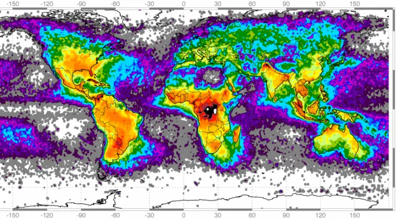
Global frequency of Lighting strikes U.S. frequency of Lighting strikes Lightning density map showing total lightning from 2015-2019. The National
Read MoreJapanese map published early in the 19th century depicting an enormous archipelago representing Japan at the center of the world.
Read MoreSummer highs in New York City could be more like Juarez (Mexico) by 2100 without emissions cuts. Los Angeles ->
Read MoreMinerals on the ocean floor and the genetic and chemical wealth of marine life provide a number of opportunities for
Read MoreMore than 24 million Americans suffer from asthma. Nearly 127 million Americans is threatened by both smog pollution and ragweed pollen.
Read More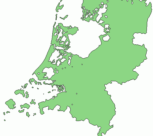
About 17% of the total land area of the Netherlands has been reclaimed from the sea. As a result, approximately 65% of the nation would be underwater at high tide without dams and pumps. Land reclamation in the 20th century added 1,650 sq km or 640 sq mi to the nation’s land area. Today 21% of the Netherlands ‘ population dwells in 26% of the land below mean sea level.
Read MoreThe researchers estimate that the nation could face damages worth 0.7 percent of gross domestic product per year by the
Read More