French Presidential Election (2017)
French election results by departments including overseas Reddit user: DoctorWinstonOBoogie French election result by city Reddit user: matdmr The French
Read MorePolitical Maps show governmental and administrative borders of countries, provinces, states, and counties, the location of major cities, and other political units.
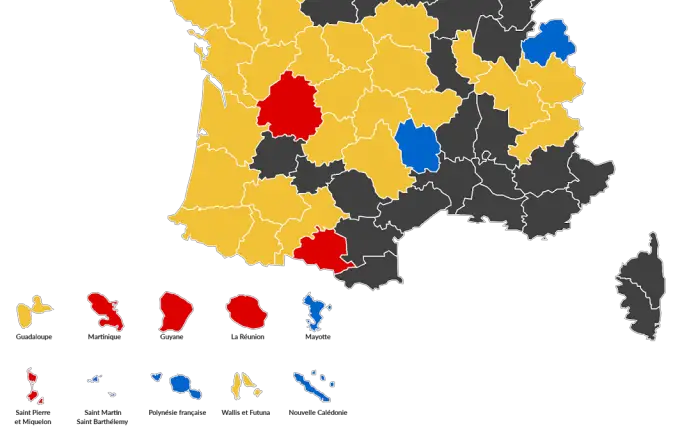
French election results by departments including overseas Reddit user: DoctorWinstonOBoogie French election result by city Reddit user: matdmr The French
Read MoreTurkish constitutional referendum results (2017): 51.4% for, 48.6% against. Source: yenisafak.com Erdogan said: “Turks living abroad have played a major part in
Read MoreReddit user: micas84
Read More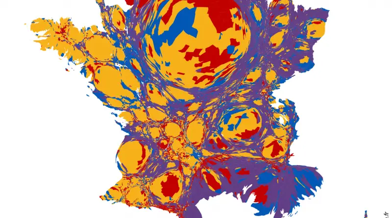
Source: slate.fr Related post: – French Presidential Election (2017)
Read MoreSource: Martin Prosperity Institute, based on date from U.S. Census. New Urban Crisis Index – a combined measure of the
Read More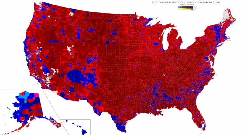
Unites States presidential election by precinct (2016) Source: Ryne Rohla Change in percentage margin between 2012 and 2016 United States
Read More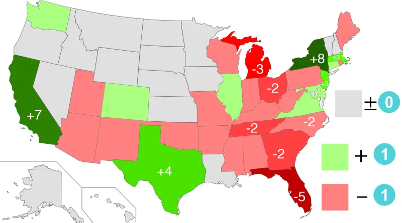
Reddit user: Asparagus64
Read More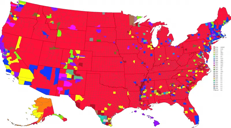
The map below shows the number of military personnel. Top 10 European countries by the number of military personnel
Read More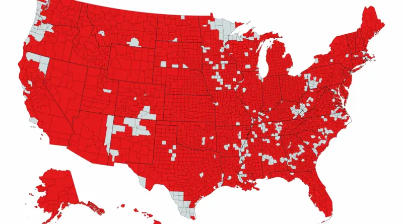
Related posts: – 2016 U.S. presidential election results in three maps – TrumpLand and Clinton Archipelago
Read More