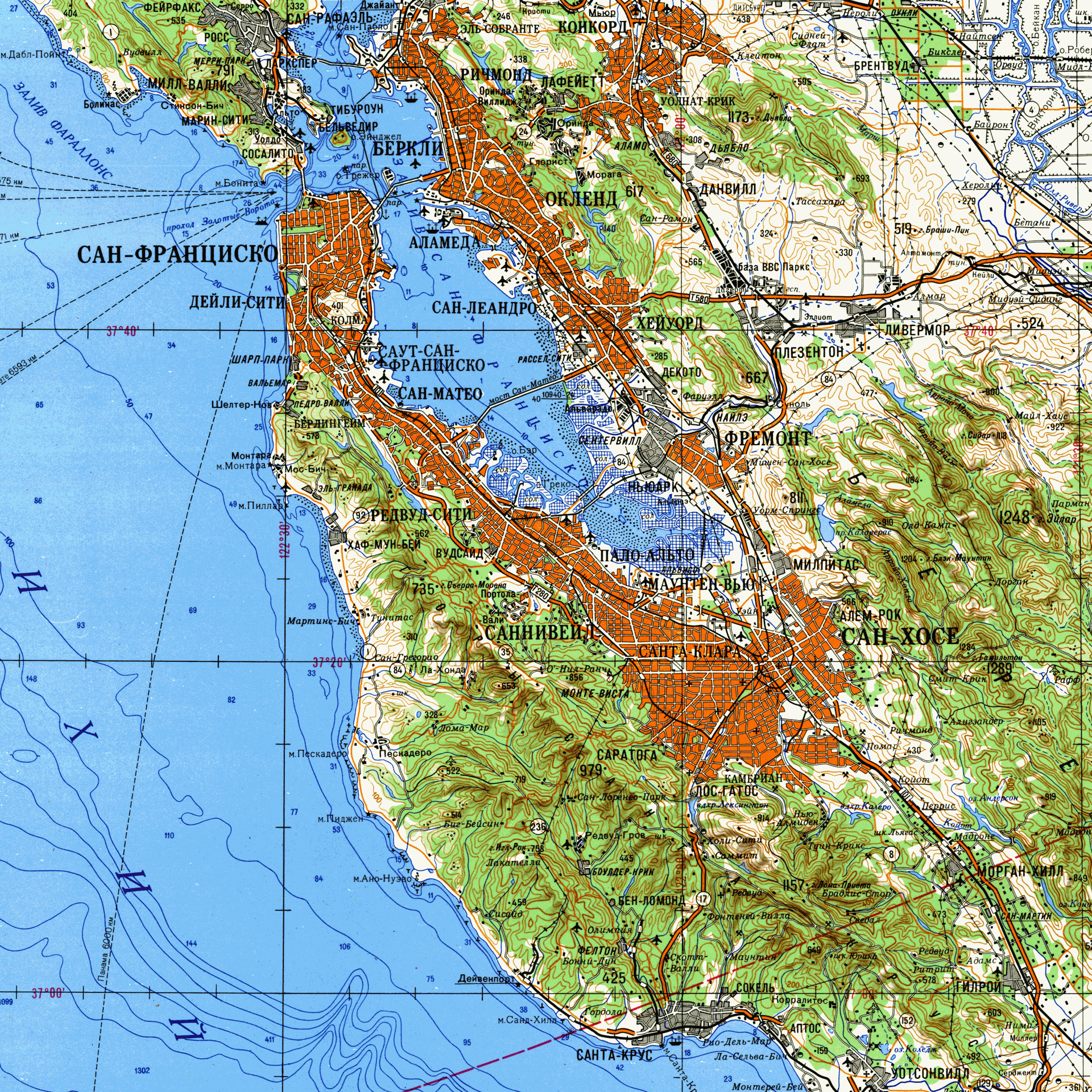
Imagine a map of your own city, drawn in Cyrillic, that shows water depths in the bay and elevation lines on every hill. Now add the date. 1980, in the middle of the Cold War. The sheet below shows the San Francisco Bay area as the Soviet military saw it.
How did the USSR get such precise data on the Bay Area?
From several places at once. Historians John Davies and Alexander Kent, authors of The Red Atlas, found that the Soviet sheets copied heavily from public maps. A review in Cartographic Perspectivesnotes that much of the information clearly came from U.S. Geological Survey maps. A legend says the Soviet embassy in Washington sent someone to check for new releases, according to National Geographic.
Satellites were an option too. The same article points out that the Soviets launched their first spy satellite in 1962.
Did spies measure the water depths?
Possibly, though not with fishing rods. That rumor is popular, yet none of the sources consulted confirms it. What the researchers did find is a comparison of Chicago’s harbor, where Soviet depths and channels differ from the USGS figures and were probably gathered by people on the ground. Details like lane counts and bridge load limits also pointed to diplomats, attachés and agents on site. Which sources fed this specific Bay sheet is not documented.
Why map a country Soviet citizens could never visit?
The maps were never meant for citizens. They were classified “secret” and made for the General Staff. Even the maps on sale in Soviet bookstores contained deliberate distortions, while the military kept accurate ones of San Francisco.
The authors judge that the maps would have supported a full range of military planning. Another reading is that they were meant for civil administration after a hoped-for political change. Davies and Kent estimate the whole program produced more than one million maps!
They proved useful later. American pilots reportedly used Soviet maps of Afghanistan in 2001 because nothing else was as comprehensive.