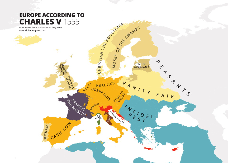
Historical MapsMapping Stereotypes Europe according to Charles V (1555) August 7, 2015 Alex Related Posts:How the Spanish Empire could have survivedAtlas of satirical maps of EuropeDifferences between the United States and Europe mappedAtlas of European historyThe Holy Roman EmpireHow Each State got its NameEurope according to the DutchRegions of Europe