European Countries Without Mountains
Mountains cover about 35% of Europe’s total land area. Within the European Union, roughly 29% of the territory is classified as mountainous (source). But not every European country fits this alpine image. Some nations are notably flat, their terrain shaped by ice rather than tectonic collisions.
| Country | Highest Point (Name) | Height (km) | Height (mi) |
|---|---|---|---|
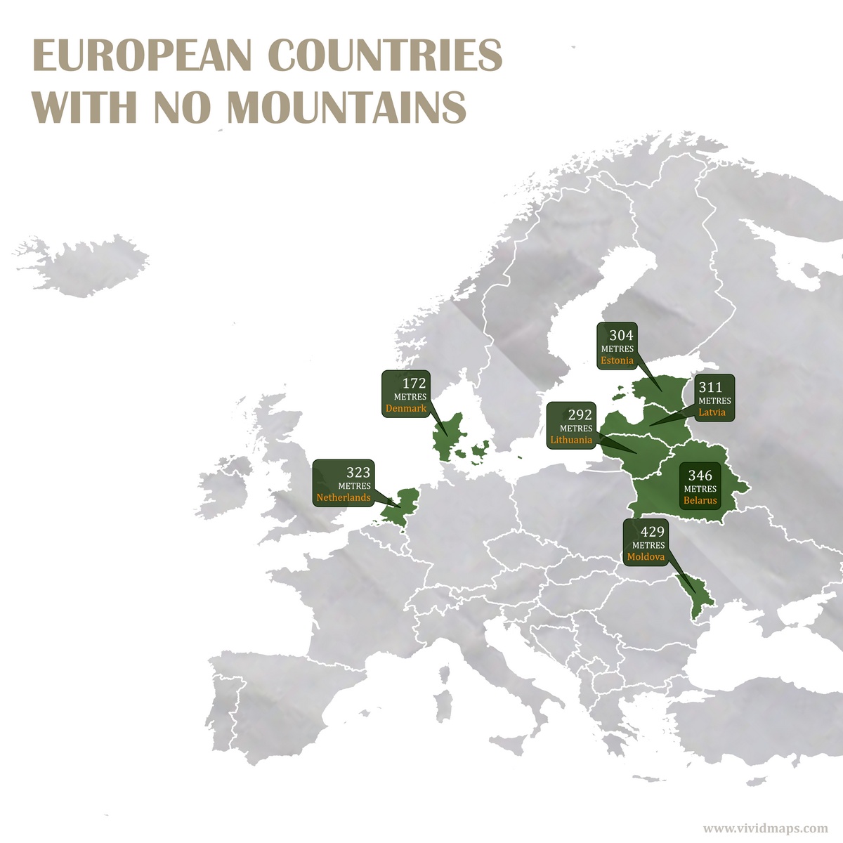
| Moldova | Bălănești Hill | 0.429 km | ~0.267 mi |
| Belarus | Dzyarzhynskaya Hara | 0.346 km | ~0.215 mi |
| Netherlands | Vaalserberg (mainland) | 0.323 km | ~0.201 mi |
| Latvia | Gaiziņkalns | 0.311 km | ~0.193 mi |
| Estonia | Suur Munamägi | 0.304 km | ~0.189 mi |
| Lithuania | Aukštojas Hill | 0.292 km | ~0.181 mi |
| Denmark | Møllehøj | 0.172 km | ~0.107 mi |
It should be noted that there is no universally accepted definition of a “mountain.” According to the Internationally Shared Aquifer Resources Management (ISARM), elevation, volume, relief, steepness, spacing, and continuity have all been used as criteria for defining one. By most standards, what these countries call their highest points are actually hills. Modest bumps in otherwise level terrain.
Why such flat landscapes? The answer lies hundreds of thousands of years in the past. The Alps and Carpathians formed where tectonic plates slammed together and thrust rock skyward. These northern and eastern countries experienced nothing like that. Their geology is much quieter.
Glaciers reshaped everything. Massive ice sheets from Scandinavia pushed south during the Pleistocene (Ice Age), then retreated, then advanced again. Each glacial cycle ground down hills and filled valleys with sediment. With no mountain-building forces active in millions of years, the land stayed low and level.


")

