Half the Population of Each U.S. State
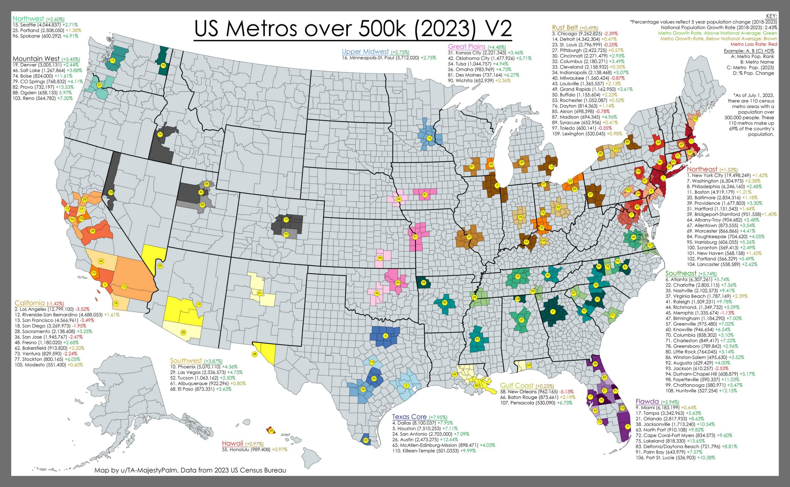
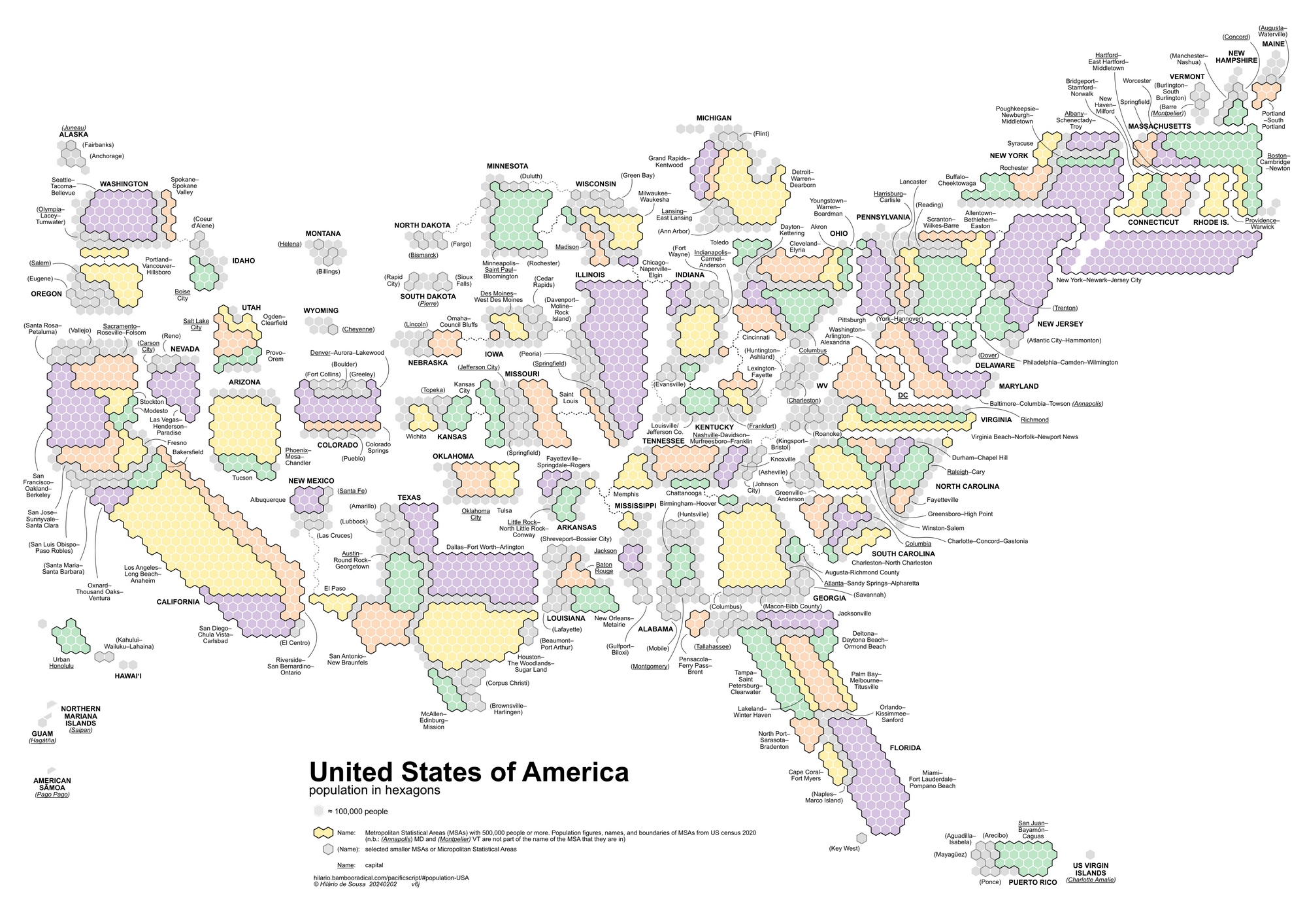
The spatial distribution of the U.S. population is a dynamic and complex phenomenon shaped by a multitude of factors, resulting in a diverse and varied landscape of human settlement across the vast expanse of the country. Broadly speaking, the population distribution is not uniform, with distinctive patterns and concentrations that reflect historical, geographical, economic, and cultural influences.
In the eastern part of the United States, particularly along the Atlantic seaboard, major metropolitan areas such as New York City, Boston, and Washington D.C. form densely populated urban clusters. These regions are characterized by high population density, reflecting a long history of industrialization, economic development, and cultural diversity.
Moving westward, the population distribution becomes more dispersed, marked by vast expanses of rural areas and smaller towns. The Midwest, known as the “Corn Belt,” is characterized by a mix of agricultural communities, while the Great Plains exhibit lower population densities due to factors like agricultural practices and climate.
The western part of the United States showcases a diverse range of spatial patterns. Coastal areas, such as California, house large metropolitan centers like Los Angeles and San Francisco, drawing populations due to economic opportunities and a desirable climate. Conversely, the Rocky Mountain region and the southwestern deserts exhibit a more scattered population distribution, influenced by geographic features and climatic conditions.
In the southern United States, cities like Atlanta, Dallas, and Houston serve as hubs for both economic activity and population concentration. The Southeast, with its warmer climate and historical factors, has experienced significant population growth and urbanization over the years.
The spatial distribution is also influenced by topographical features, with mountainous and arid regions often having lower population densities compared to fertile plains and coastal areas. Transportation networks, historical settlement patterns, and economic opportunities further contribute to the intricate mosaic of the U.S. population distribution.
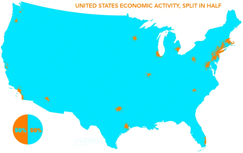
The map of the United States below created by wywing shows every U.S. state divided into half by population (the densest half and least dense half).


Here is a list of some of the most populous U.S. counties and their estimated populations in 2022.
| Rank | U.S. county | Population, millions |
|---|---|---|
| 1 | Los Angeles County, California | 10.1 |
| 2 | Cook County, Illinois (Chicago) | 5.2 |
| 3 | Harris County, Texas (Houston) | 4.9 |
| 4 | Maricopa County, Arizona (Phoenix) | 4.7 |
| 5 | San Diego County, California | 3.4 |
| 6 | Orange County, California | 3.2 |
| 7 | Miami-Dade County, Florida | 2.7 |
| 8 | Dallas County, Texas | 2.6 |
| 9 | Riverside County, California | 2.5 |
| 10 | Queens County, New York | 2.4 |
| 11 | Clark County, Nevada (Las Vegas) | 2.3 |
| 12 | San Bernardino County, California | 2.2 |
| 13 | King County, Washington (Seattle) | 2.2 |
| 14 | Tarrant County, Texas (Fort Worth) | 2.1 |
| 15 | Santa Clara County, California (San Jose) | 1.9 |
| 16 | Broward County, Florida (Fort Lauderdale) | 1.9 |
| 17 | New York County, New York (Manhattan) | 1.7 |
| 18 | Alameda County, California (Oakland) | 1.7 |
| 19 | Philadelphia County, Pennsylvania | 1.6 |
| 20 | Suffolk County, New York | 1.5 |
Alone, these 20 U.S. counties are home to more than 60 million people.
Curious to discover more fascinating facts about the United States? Consider exploring the following atlases and maps to gain valuable insights into the country.


Easy to see how elections are stolen.
Easy to see how it should be popular vote only and republicans would never win again.
When total thermonuclear warfare commences we know where a large portion of the warheads will be targeted.