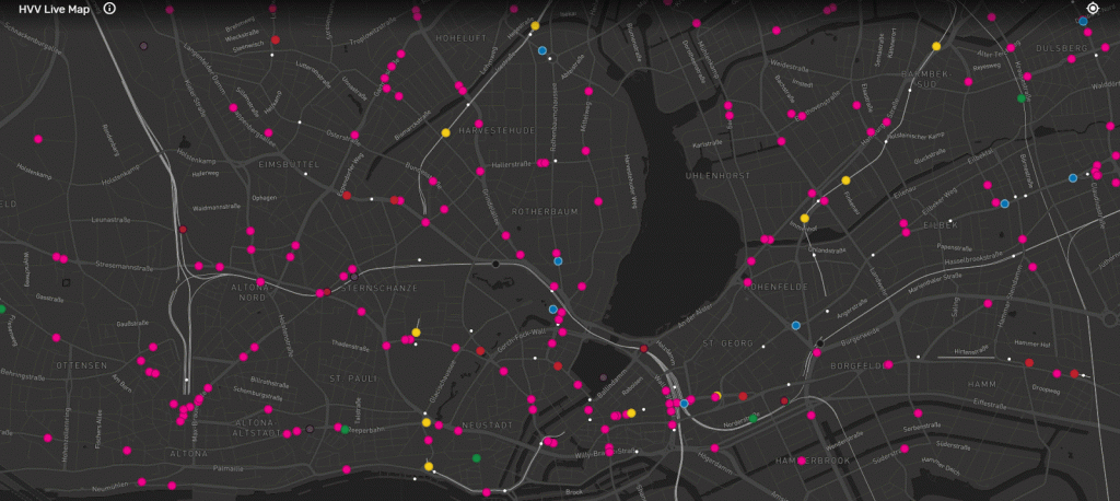
CitiesGermanyInteractive mapsTransport Hamburg’s public transport live map June 15, 2017 Alex hvv.live Related Posts:The World's Forests MappedHow the World was Imagined: First Maps and Atlases3D Mapping of The Global ClimateWhich countries get the most paid vacation days?Percentage of Public School Students from Immigrant…Atlas of satirical maps of EuropeThe UK public transport system mappedGermany Population DensityHow Paid Vacation Varies Around the WorldNew York City Transportation Accessibility:…
Why are we going around and dividing countries in Europe?