How Big Is Alaska?
Alaska is the biggest U.S. state by area and the 7th-biggest subnational division among all countries. It is the 3rd-least populated and the most sparseness populated U.S. state but by far the continent’s most populous territory, mostly north of the 60th parallel, with an estimated population of approximately 800 thousand. About 50% of Alaska’s inhabitants live in the Anchorage urban area. Juneau’s state capital is the 2nd-biggest city in the U.S. by size, covering more territory than the states of Delaware and Rhode Island.

Below are maps comparing Alaska to other US states.

Below is the map of Alaska vs. Europe, without Mercator projection distortion.

Quick facts
- Alaska is 586,400 square miles, over twice the size of Texas.
- The size of Alaska is equivalent to the entire Eastern Seaboard spanning north to south from Maine to Florida and west to Tennessee.
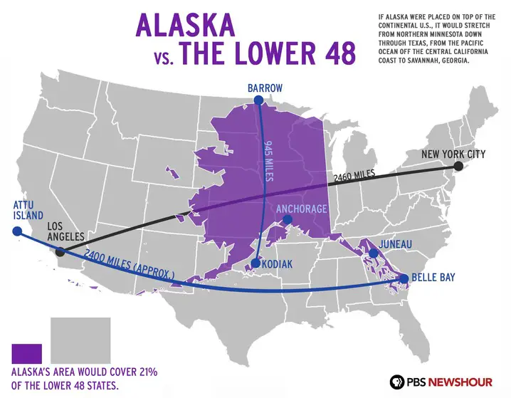
- If Alaska were placed on top of the continental United States, it would stretch from Northern Minnesota down through Texas, from the Pacific Ocean off the central California coast to Savannah, Georgia.
- Alaska’s area would cover 21 percent of the lower 48 U.S. states.


nice map showing
Map good
Map super good