Ice flows of Antarctica
These serial radar images were taken by the Copernicus Sentinel-1A satellite from December 2014 to March 2016 and used to produce this great map revealing how fast the ice flows on the Antarctic sheet.

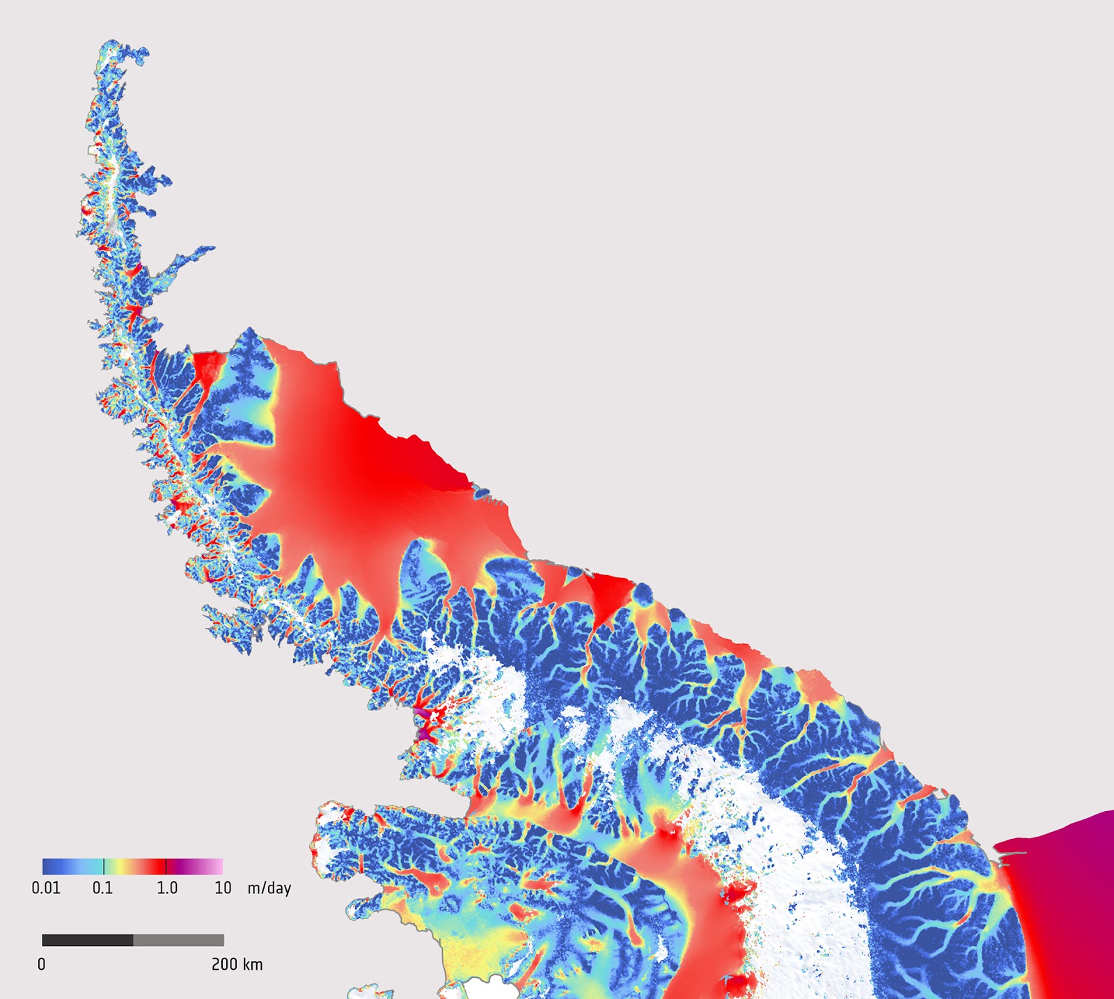
The detailed map below displays how fast the ice flows on the Antarctic Peninsula.
This map was constructed by tracing ice features’ movement in pairs of radar images taken twelve days apart.
The Antarctic Peninsula is a thin mountain spine of land stretching northwards away from the Central Antarctic ice sheet. It contains the northernmost arm of the Antarctic ice sheet.
The color scale shows the ice movement’s speed in meters per day, varying from one centimeter per day or less in dark blue to up to one meter per day in the red.
The vivid colors trace a combined network of channels along which streams of ice run from the high peaks down towards the shoreline where the ice flow speeds up and spreads out into drifting ice ridges.
The white area on the peninsula’s western side is where snowfall is possible to have covered features and so limited tracking between the image pairs.
As one of the most active glacial conditions on Earth, this region has been undergoing fast climate warming.
Since 1991, sputniks of European space agency have witnessed many ice shelves’ disintegration, including the northern piece of the Larsen ice shelf and the Wilkins ice shelf.


