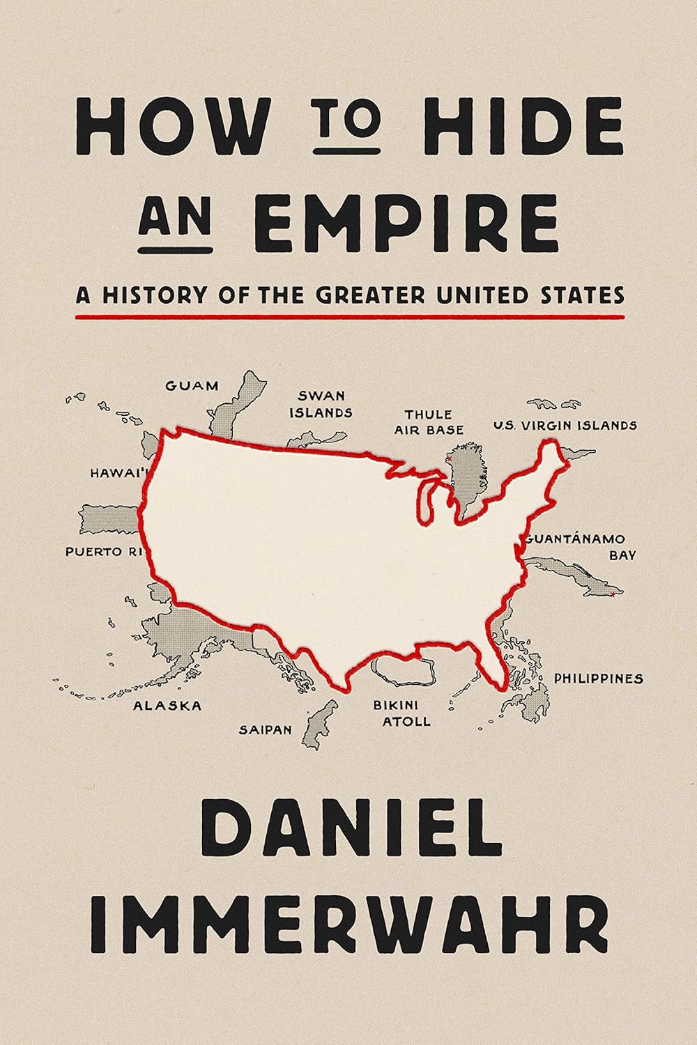
The United States is more than just its 50 states. While most maps showcase the familiar continental outline, the nation also includes territories scattered across the globe. Daniel Immerwahr’s book, How to Hide an Empire: A History of the Greater United States, explores this hidden geography, shedding light on the lands that have shaped the country’s history, economy, and influence.
These territories continue to be part of the United States, each holding a unique position in the country’s political and cultural landscape. The history of these territories, from important military sites to lively islands, is both complicated and captivating.
1898 (Ceded by Spain after the Spanish-American War)
*Note: The Swan Islands are a special case; although claimed by the U.S., they have been administered by Honduras since 1972.
Living in these U.S. territories isn’t quite the same as living in a state. For example, while Puerto Ricans are U.S. citizens, they cannot vote in presidential elections unless they relocate to a state. Guam and the U.S. Virgin Islands also enjoy limited representation in Congress, reflecting the unique status of these regions.
Territories That Became Independent
Not all U.S. territories stayed under American control. Some, like the Philippines and Palau, sought independence through decolonization and shifting political tides. Even though they eventually broke away, many of these former territories maintained strong ties with the U.S.
Country/Territory
Size (sq miles)
Size (km²)
Population
Became U.S. Territory
Gained Independence
Philippines
115,831
300,000
114,163,719
1898 (Ceded by Spain after Spanish-American War)
1946 (Independence granted by U.S.)
Palau
177
459
18,024
1947 (UN Trust Territory)
1994
Micronesia
271
702
113,131
1947 (UN Trust Territory)
1986
Marshall Islands
181
470
42,050
1947 (UN Trust Territory)
1986
Samoa (Western Samoa)
1,097
2,842
227,000
1899 (Partitioned from German Samoa)
1962
Political Status & Entry Rules
For the territories that remain part of the U.S., travel rules are fairly straightforward for citizens—they can move freely between states and territories. However, for foreign nationals, entry rules vary. For instance, traveling to Puerto Rico or Guam requires adherence to U.S. visa policies. In contrast, former U.S. territories like the Philippines now follow their own visa regulations, although historical ties sometimes result in special arrangements.
Debates Over Independence
The question of political status remains a hot topic in some areas. Puerto Rico, for instance, has seen multiple referendums where residents expressed mixed feelings about statehood versus maintaining territorial status or even pursuing independence. Similarly, in Guam, there are voices advocating for greater self-determination or closer ties with the U.S., while American Samoa continues to stir debates about citizenship and political rights.
What Remains of Former U.S. Territories?
Even after achieving independence, many former U.S. territories continue to share deep political, economic, and cultural connections with the United States. The Philippines, for example, still has long-standing military and economic agreements with the U.S., and its citizens often benefit from special immigration pathways compared to those from other nations.
Daniel Immerwahr’s How to Hide an Empire takes a deep look into these issues, challenging our traditional view of the U.S. map and revealing a broader, more complex history.