The Ocean Nations of Oceania
The Pacific Ocean covers roughly one-third of Earth’s surface.
Among all oceans, it dwarfs continents. Its many islands are scattered across enormous distances, like stars in a galaxy.
The map below, created by Abel Gil Lobo for El Orden Mundial, shows a political map of Oceania that looks like a map of a water world on another planet. In this aquatic vision, the sea is sovereign ground. Each island state or dependency claims waters rather than soil.
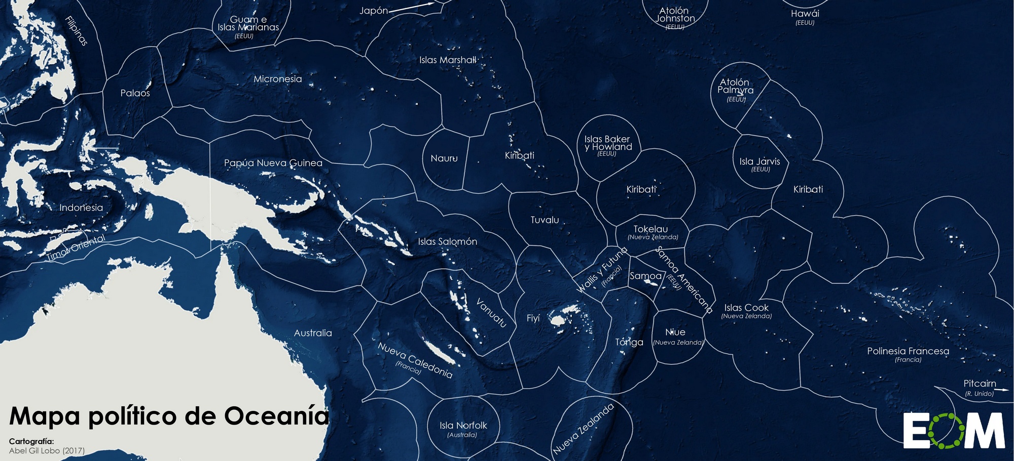
On that map, if you set Australia and New Zealand aside, the biggest “countries” of this ocean realm — in terms of Exclusive Economic Zones — are French Polynesia (4.8 million km² / 1.85 million mi²), Micronesia (3 million km² / 1.16 million mi²), and the Marshall Islands (2.1 million km² / 0.81 million mi²).


