German territorial losses since First World War
From the Treaty of Versailles to the Potsdam Conference, trace the territorial shifts in Germany’s borders from 1919 to 1945. Learn with maps and key historical facts.
Read MoreFrom the Treaty of Versailles to the Potsdam Conference, trace the territorial shifts in Germany’s borders from 1919 to 1945. Learn with maps and key historical facts.
Read MoreHistorical map of the maximum intensity of earthquakes registered in Italy. Related posts: – Interactive Map of the Earthquake in
Read More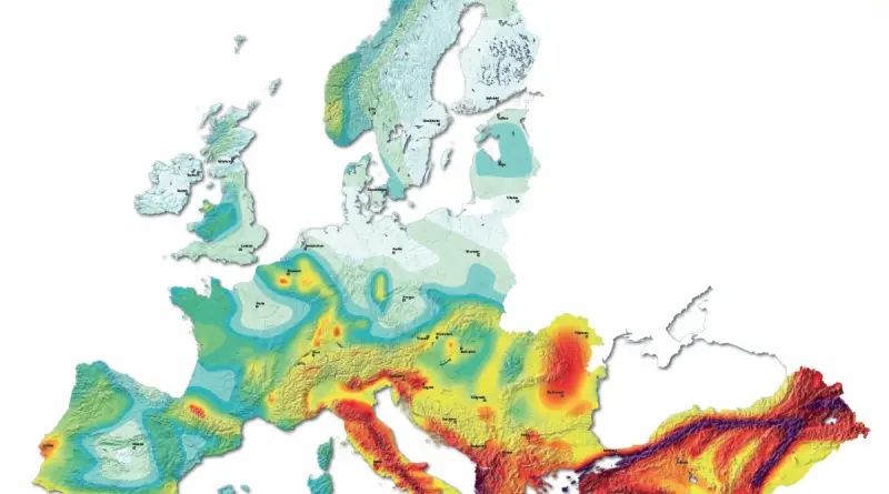
Earthquake history in Europe Distribution of over 30 thousand earthquakes with magnitudes large or equal to 3.5 for the period
Read More
Via usgs.gov
Read More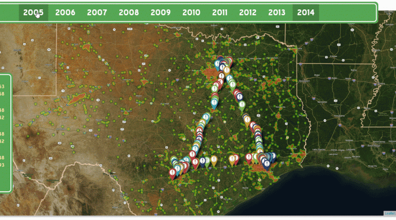
In a densely populated area formed roughly by Dallas, San Antonio, Houston, and Austin lies the Texas Triangle. Outlined by
Read More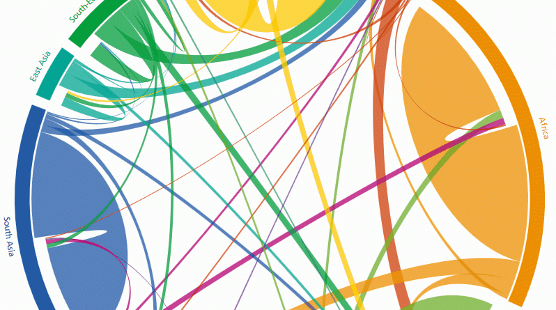
The circular plot shows the estimates of directional flows between 123 countries that recorded a migration volume (immigration + emigration)
Read MoreAs Singapore’s property market cools, more private homes are waiting to be snapped up. A total of 31,362 new units
Read More