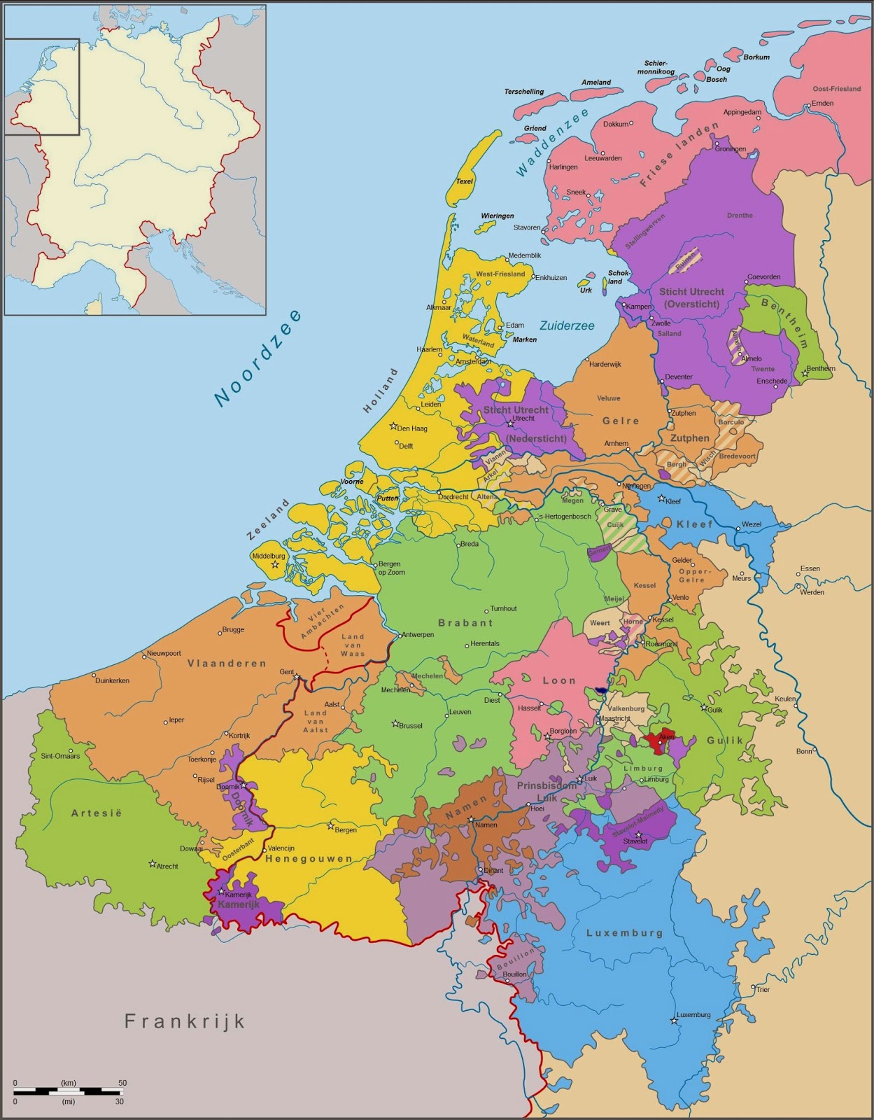
The Low Countries is a coastal region in northwestern Europe, consisting especially of the Netherlands and Belgium, and the low-lying delta of the Rhine, Meuse, Scheldt, and Ems rivers where much of the land is at or below sea level. This wide area of Western Europe roughly stretches from the French département du Nord at its southwestern point, to German East Frisia at its northeastern point.