The country’s earliest railways were constructed in the 1820s and 1830s, mainly in New England and the Mid-Atlantic region. The Baltimore and Ohio Railroad, chartered in 1827, was the nation’s first typical carrier railway.
By 1850, an expansive railroad network had started forming in the rapidly industrializing Northeastern U.S. and Midwest region, while somewhat fewer railways were built in the predominantly agricultural Southern States. The map of the United States below created by Reddit user manpace shows United States rail networks, right before the Civil War.
During and after the American Civil War, the first transcontinental railroad was constructed to link California with the rest of the national rail network in Iowa.
In only 30 years after its introduction, the U.S. rail network totaled nearly 28,900 miles (46,500 km) on the eve of the Civil War (1861-1865).
Railways continued expanding throughout the 1800s, almost achieving about every corner of the country. The nation’s railways were temporarily nationalized between 1917 and 1920 by the U.S. Railroad Administration due to U.S. entry into WWI. Railway mileage in the country peaked at this time. Railroads were significantly impacted by the Great Depression in the U.S., with some rail lines being abandoned during this time. A significant increase in traffic during WWII got a temporary respite, but after the war, railways faced severe contest from cars and aircraft and began a long decline. Passenger service was particularly painfully hit, with the federal government making Amtrak 1971 take over duty for intercity passenger travels. Numerous railroad corporations went bankrupt beginning in the 1960s, most notably Penn Central Transportation Company in 1971, in the largest bankruptcy in the nation’s history.
Nowadays, the U.S. has the most extensive rail transport network size of any country globally, at about 160,000 miles or 260,000 kilometers.
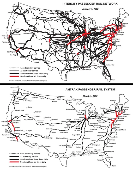
The map below shows the passenger rail network in the United States in 1962 vs. 2005.
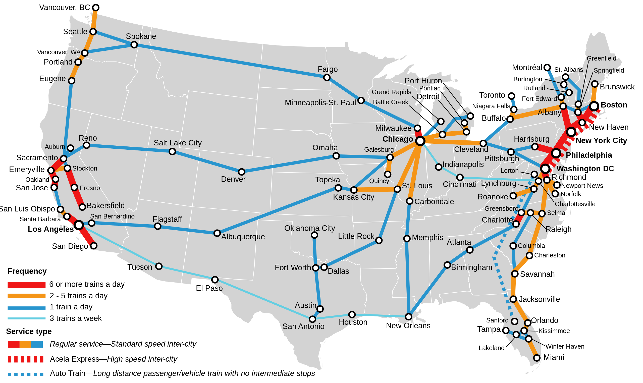
Some Amtrak routes, often referred to as “corridors,” have higher frequency due to their popularity and shorter distances between major cities. These corridors may offer several departures per day, providing passengers with more flexibility in choosing their travel times. On the contrary, passengers on long-distance routes may have fewer departure options each week, often ranging from a few times per week to once a day. Below is the map of the Amtrak frequency as of 2023.
Are you interested in U.S. railroads? Check out this excellent railroad legacy map designed by National Geographic on Amazon.