Russia Is Only 2.4 Miles from the United States
Most people picture Russia somewhere far away from the United States. Different sides of the globe. An entire ocean separating them.
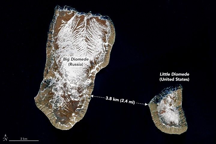
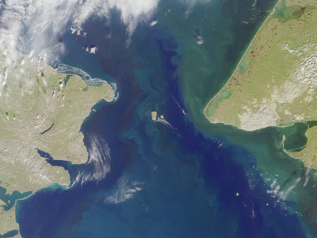
Turn your attention to the Bering Strait though. Two islands there change this whole perception. Big Diomede is Russian territory. Little Diomede belongs to Alaska. The distance separating them? Just 2.4 miles (3.8 km). When fog clears and visibility improves, residents on one island look across and see the other country clearly.
The International Date Line runs right between Big Diomede and Little Diomede. This creates something truly odd. Say you’re standing on Little Diomede at 3 PM on Monday. Look west toward Big Diomede and you’re seeing Tuesday at noon over there. Same stretch of water, same gray sky, but technically tomorrow.
People started calling them Yesterday Island and Tomorrow Island because of this, because when you look at Big Diomede from Little Diomede, you’re looking into the future.
Big Diomede covers roughly 11 square miles (29 sq km). It’s been empty of permanent residents since 1948. That year, the Soviet government relocated the entire indigenous population and set up a military observation post. Today you’ll only find rotating military personnel and weather station staff.
Little Diomede is smaller at 2.8 square miles (7.3 sq km), but people actually live there. The population sits at around 77 now. In 1990, census takers counted 178 residents of the Iñupiat people, but the number has been declining.
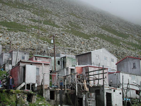
Their ancestors have occupied this island for thousands of years, maybe longer. The village occupies a narrow beach running along the western coast. That’s literally the only level ground on the entire island. Step behind someone’s house and you’re facing slopes that climb nearly vertical to cliffs exceeding 1,600 feet (490 m).
Most of the food comes from hunting and fishing. Men hunt seals, walruses, and whales depending on the season and weather. They also fish for bullheads, tomcods, and blue cods.
In January, temperatures range from 6°F to -14°F (or -14°C to -25°C). July is the warmest month, sometimes reaching 50°F (10°C) on a good day. Each island gets about 11 inches (289 mm) of precipitation a year. Fog is constant. Wind never stops blowing.
| Feature | Big Diomede (Russia) | Little Diomede (USA) |
|---|---|---|
| Area | 11 sq mi (29 sq km) | 2.8 sq mi (7.3 sq km) |
| Population | 0 (military/weather personnel) | ~77 (2023) |
| Distance to Mainland | 28 miles / 45 km (Cape Dezhnev, Chukotka) | 16 miles / 25 km (mainland Alaska) |
| Highest Point | 1,657 ft (505 m) | 1,621 ft (494 m) |
Climate change brings practical problems to Little Diomede. Winter ice used to form thick and solid, creating a natural runway for small cargo planes. That’s becoming less reliable each year. Ice doesn’t reach proper thickness anymore, or it melts before supply deliveries finish, or some winters it barely forms at all. Helicopters handle all cargo now, which means reduced capacity and increased shipping costs.
Hunters traditionally traveled across ice to reach productive hunting grounds. When ice conditions become unpredictable, hunting becomes unpredictable too.
Buildings throughout the village face foundation issues as permafrost underneath melts. Ground that stayed frozen for thousands of years is turning soft. Structures tilt noticeably. Some sink. Others shift downslope a few inches annually. Robert Soolook, the tribal president, describes how the community responds. People adapt because they’ve always had to. Conditions change, methods change with them.
When the United States purchased Alaska from Russia in 1867, cartographers drew a new international boundary through the Bering Strait. For many decades after, indigenous families on both islands largely ignored this political line. People maintained family visits across the water. They coordinated hunting activities. Their community connections predated any European government’s territorial claims by thousands of years.
The Cold War ended that freedom. Russia reinforced its military presence on Big Diomede. American authorities began monitoring Little Diomede more closely. The narrow passage got a new name: the Ice Curtain, a frozen parallel to Europe’s Iron Curtain. Families who had crossed freely for countless generations found themselves separated by armed enforcement of the border.


