English noise mapping
The noise pollution map shows the noise levels along major English roads and railway lines.
Read MoreThe noise pollution map shows the noise levels along major English roads and railway lines.
Read More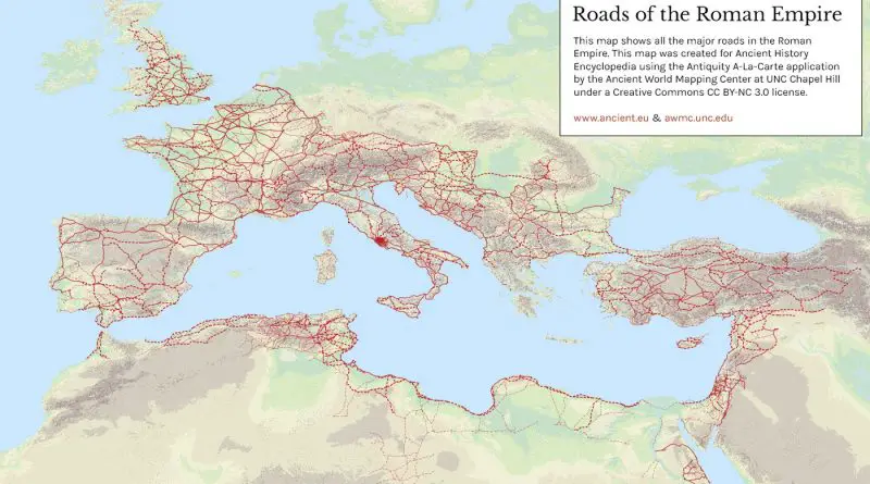
Roman roads used to move of officials, civilians, armies, and trade. Ways of the Empire were of different kinds, varying from small provincial roads to broad, long-distance roadways built to unite large cities, chief towns and military posts. These significant roads were surfaced with stone and metaled, cambered for drainage, and were flanked by walkways, bridle path and drainage trenches. They were set along ideally studied courses, and some were made through hills, canyons and rivers.
Read MoreThe CORINE land cover map 2012 for the UK. Reds indicate artificial surfaces, yellows are agricultural land, greens are forests,
Read More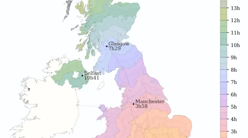
The 1st roads on the British Isles appeared during the Iron Age. Then the network of engineered roads was extended during the Roman colonization. The most intensive road construction has taken place from the 1950s to the 1990s. Today the UK has a road system totaling approximately 262.3 thousand mi (422.1 thousand km) of paved
Read MoreLondon, the South East and the East of England have greater surname heterogeneity than the rest of the United Kingdom. Big urban areas attract foreign and domestic migration and produce a large and ethnically diverse society, with high population mixing, and consequently form a higher diversity of surnames.
Read MoreThis map shows how long one would expect to travel to any point in Europe starting in London, using only
Read MoreThe current population of the United States of America is 325 million. The United Kingdom’s population is 66 million. Related
Read MoreForeign travel advice by the British government including travel warnings and health, safety and security, entry requirements.
Read More