Tearing Argentina Apart
Argentina may stretch just 3,700 km (2,300 miles) from north to south, but within that long silhouette lies a country that feels like several nations in one. From noisy Buenos Aires to the windswept plains of Patagonia, Argentina contains a mix of cultures, landscapes, dialects, and attitudes that rarely agree on anything—except fútbol and Fernet.
And nothing captures this internal contrast better than a pair of brilliantly over-the-top maps from Reddit users patagoniac and epatrono. Using humor and stereotypes, they’ve divided Argentina not by provinces or economic zones, but by who rules what, what animals are most common, how people vote, and even where you should buy your next iPhone.
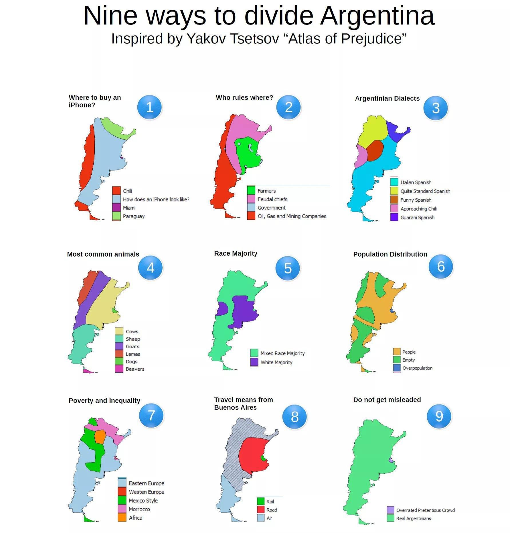
There are ten other ways to split Argentina apart.

What makes both maps so effective is how they use humor to mirror real cultural and geographic divides, without pretending to be accurate. They don’t rely on strict datasets, but rather on local perceptions, running jokes, and regional clichés familiar to many Argentinians themselves.
This style of playful cartography is part of a broader trend that was popularized by Yanko Tsvetkov in his bestselling Atlas of Prejudice series. If you enjoy maps like these, you’ll probably love his work too. It’s available on Amazon (please note this is an external link to Amazon’s site), and worth checking out if you like seeing the world filtered through national stereotypes, political sarcasm, and brutally honest humor.

