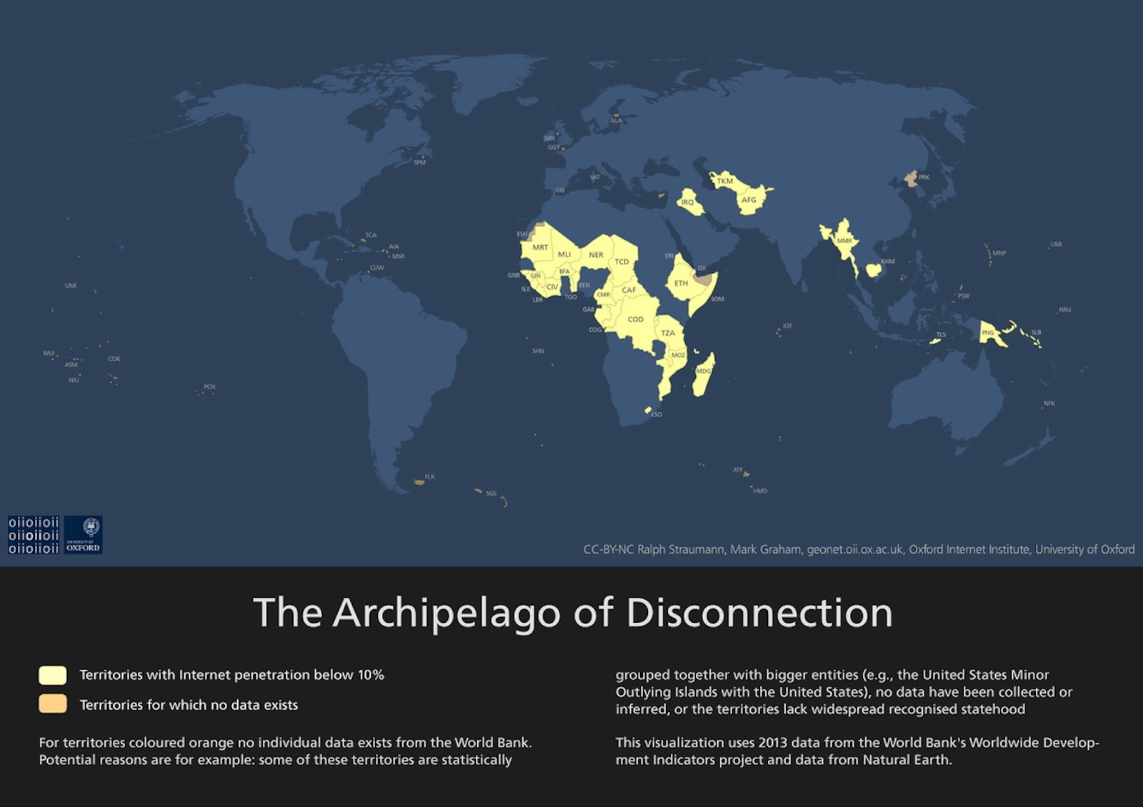
The ‘Archipelago of Disconnection’
For territories coloured orange no individual data exists from the World Bank. Potential reasons are for example: some of these territories are statistically
grouped together with bigger entities (e.g., the United States Minor Outlying Islands with the United States), no data have been collected or inferred, or the territories lack widespread recognised statehood
This visualization uses 2013 data from the World Bank’s Worldwide Development Indicators project and data from Natural Earth.

