In today’s world, pinpointing the exact location of, say, a specific Apple Store in New York City, the POLIN Museum of the History of Polish Jews in Warsaw, or the Pyramid of Khufu in Giza takes mere seconds. This ability to access precise geographical information is a recent development in historical terms. Many of us can recall a time when the most detailed cartographical information available about distant lands (or even our own) merely highlighted cities and major roads, assuming we even had a world atlas on hand. Today, younger generations take for granted the knowledge of not just where every place in the world is located, but also what it looks like, its prices, and even what its visitors have expressed about it.
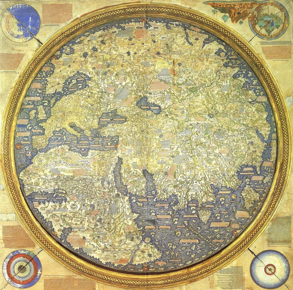
In a sense, we are living in the dream of Fra Mauro, the Venetian cartographer-monk from the late Middle Ages who crafted the most objective and detailed world map of his time. Fra Mauro’s early life as a soldier and merchant in the renowned Venice Merchant Fleet sparked his interest in mapping. He eventually settled in the monastery of San Michele on the island of Murano in the Venice Lagoon, where he became a lay brother. In the early 1450s, he was authorized by King Afonso V of Portugal to create a map of the world.
Fra Mauro’s map was a testament to Portugal’s ambition to dominate world trade, which necessitated the most detailed maps possible. His map also reflected his own determination to gather information about every corner of the Earth, no matter how remote. Remarkably, he accomplished this without ever leaving Venice. Arab traders and world explorers passing through the port provided him with a wealth of information about the world. The fall of Constantinople a few years before the map was completed further enriched his knowledge, as well-traveled refugees likely shared their stories with him. The creation of Fra Mauro’s map was a collaborative effort, and its contents were gathered through a process akin to fifteenth-century crowdsourcing.
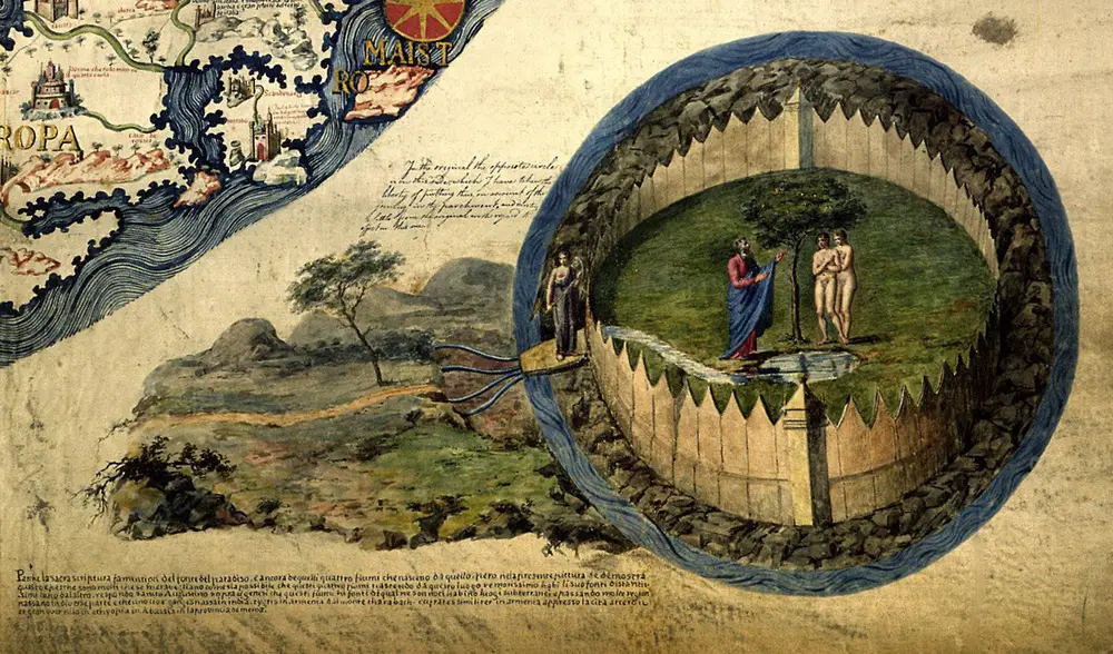
This chapter in cartographical history invites parallels with modern technology. Despite his affiliation with the monastery of San Michele, Fra Mauro’s map was a radical departure from traditional religious cartography. He did not place Jerusalem at the center, and he relegated the Garden of Eden to a side box, unattached to any specific geographical location.
His meticulousness led him to be the first cartographer to depict Japan as an island and to show that one could sail all the way around Africa. While his map was the most accurate of its time, its over 3,000 annotations included many tall tales, often involving literal giants. Yet, are these tales really less reliable than the average twenty-first-century user review?
If you’re looking to adorn your room’s wall with a Fra Mauro map of the world, we recommend checking out Amazon.

 Expensive To Be an Apple Superfan?")


