The Urban Fabric Map
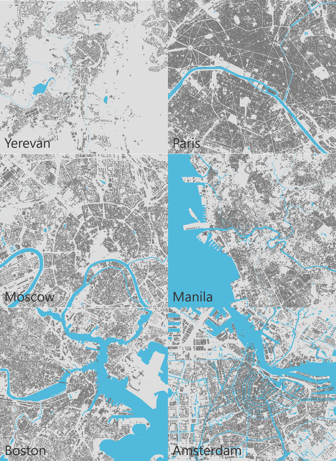
Compare the building footprints of cities shown at the same scale. Buildings are an indicator of transportation activity as most trips involve going from one building to another (example: home to work). By viewing what cities look like from a given distance above, we can get an idea of the transportation activity in the city. We can also get an idea of the size of the city, its density, and economic activity.
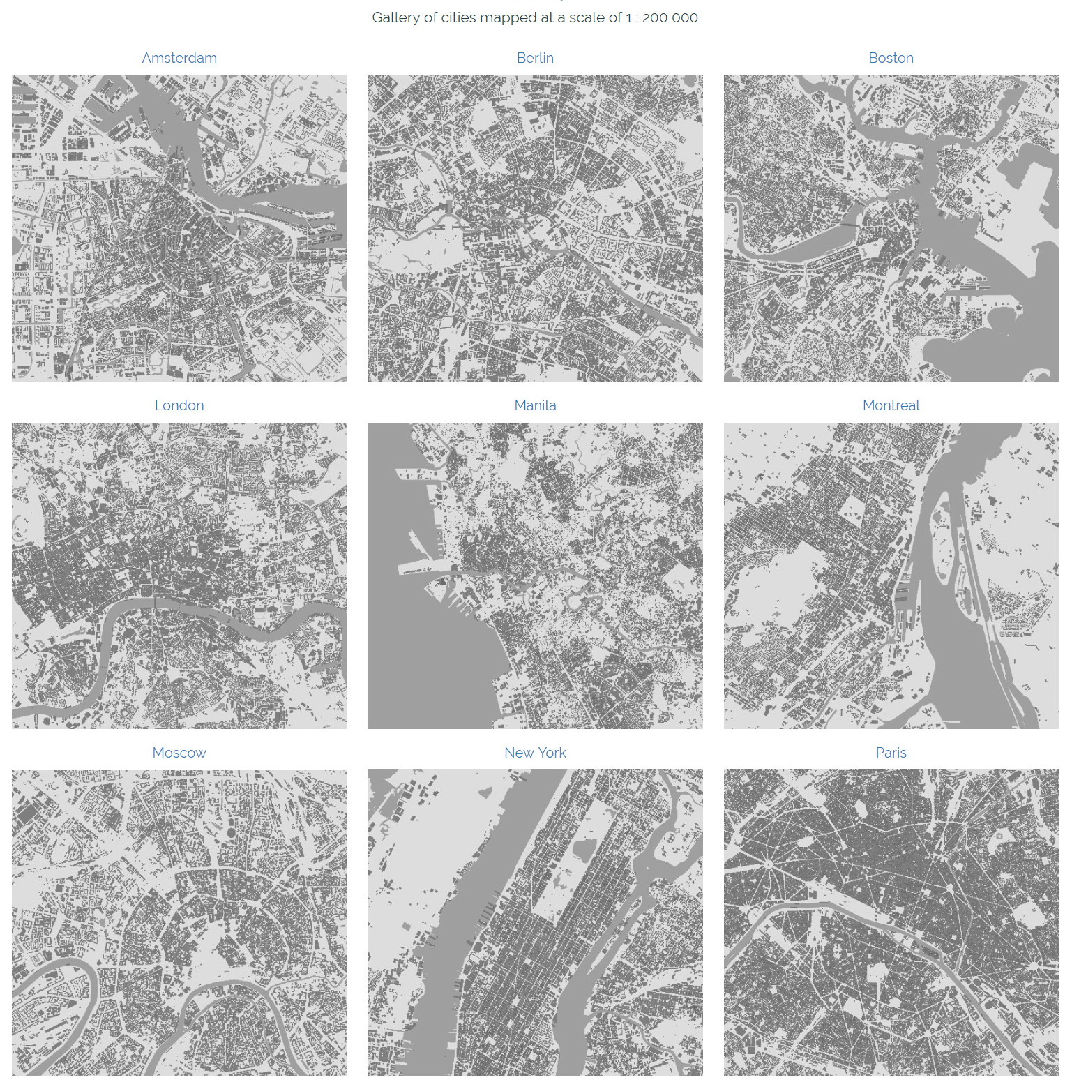
The Urban Fabric Map grabs the building data from Openstreet Map and displays it on the maps below using a custom Mapbox style. This means that the results are a 100% dependant on what is already mapped in OSM. If you want to find out how your city compares to others, then start mapping.
The data is grabbed in real time when you search for a city. For this reason, it might take a few seconds for the buildings to show up on the map. Also, considering the insane amount of data that needs to be downloaded in a few seconds, attempting to view large cities at a low zoom level, might cause your browser to freeze for a few seconds and in some cases to crash completely. If it does crash, you can retry to view at a higher zoom level by adjusting the bar and trying again.
Via www.spatialcarto.com/home/urban-fabric-map

