U.S.- Mexico border from west to east
The U.S.-Mexico boundary stretched from the Gulf of Mexico in the east to the Pacific Ocean in the west. It is the most frequently passed boundary in the world, with around 350 million documented crossings yearly.
The length of the U.S. – Mexico border
The U.S.-Mexico border is the 10th-longest boundary separating two nations globally (3,145 km / 1,954 mi).

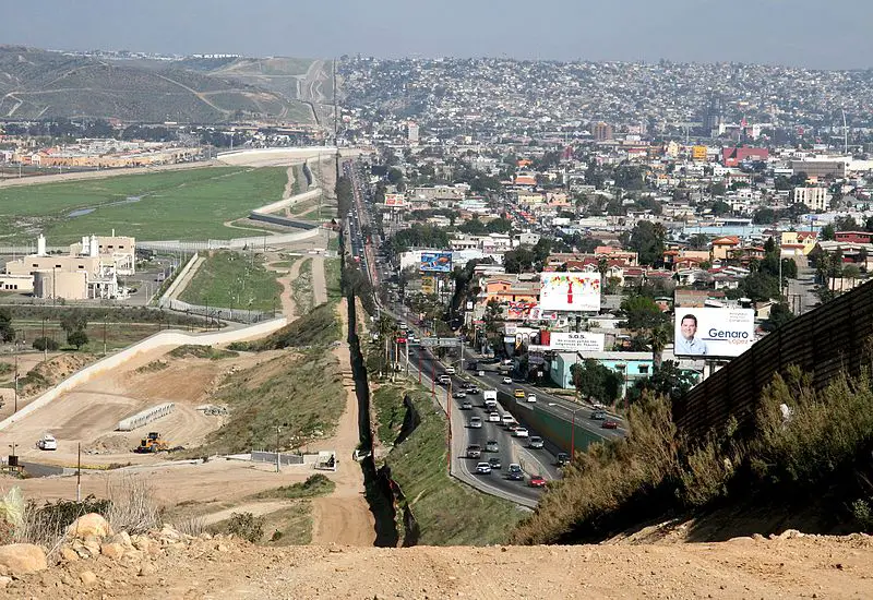
U.S. – Mexico border cities, from west to east
The U.S. and Mexico are neighbors who depend on each other economically and culturally.
The population of the U.S.-Mexico border region (44 U.S. counties. and 80 municipalities in Mexico) is rated to be about fifteen million residents. It includes 15 pairs of sister cities.
The map below shows U.S. – Mexico border cities, from San Diego-Tijuana in the west to Brownsville-Matamoros in the east (14 major cross-border cities).

Cities with fewer than 15 thousand inhabitants were omitted:
– Andrade, CA / Los Algodones, B.C.
– Lukeville, AZ / Sonoyta, Son.
– Sasabe, AZ / Altar, Son.
– Naco, AZ / Naco, Son.
– Columbus, NM / Palomas, Chih.
Crime on the U.S.-Mexico Border
There are 50 places where people can legitimately cross the U.S.-Mexico–United States border. But that doesn’t stop illegal immigrants.
There are an estimated 500 thousand illegal entries into the U.S. every year. Therefore, it is not surprising that there are approximately 11.5 million undocumented workers in the United States nowadays, and 87 percent of undocumented immigrants have lived in the U.S. for more than seven years.
The state border is a magnet that attracts criminals from both countries. But due to the high level of corruption in Mexico, the crime rate
in the Mexican border region is much higher than in the U.S.
The map below shows U.S.-Mexico border homicide rates per 100 thousand people per year.


