20 Best Maps of 2020
Despite the coronavirus pandemic, this year has been a good year for map fans. We thought it would be enjoyable to look back at the most attractive maps of the last year.
From the largest predator in each U.S. state to tipping etiquette around the world, these marvelous maps show cartography at its best. The popular maps of the year 2020 are ranked by total views.
Table of Contents
- 20. The Atlantropa project
- 19. The Richest Person in Every US State
- 18. The World’s Forests Mapped
- 17. Tipping etiquette around the world
- 16. The happiest countries in the world (2013 – 2020)
- 15. US Asian Population by County (1990 – 2018)
- 14. Native Oak Tree Ranges in the United States
- 13. US Hispanic Population by County (1990 – 2018)
- 12. Largest Predator in Each U.S. State
- 11. Disintegration of Yugoslavia
- 10. Roads of the Roman Empire
- 9. Germany is still divided by east and west
- 8. The topologist’s map of the world
- 7. 2020 U.S. Election Mapped: What happened to TrumpLand?
- 6. 3D Mapping The Global Population Density
- 5. The diversity of trees in the US mapped
- 4. Olive Tree in the Mediterranean Bassin
- 3. Tearing Spain apart
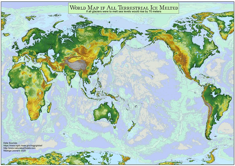
- 2. The world with a 70 meters sea-level rise
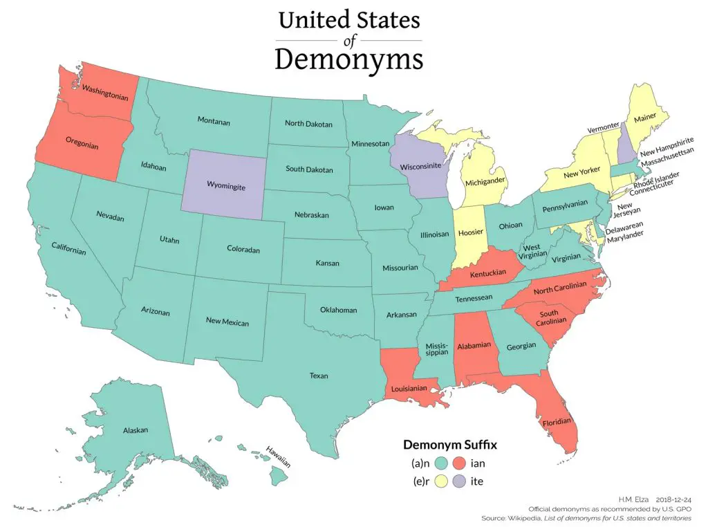
- 1. Demonyms of the U.S. and Canada
20. The Atlantropa project

19. The Richest Person in Every US State

18. The World’s Forests Mapped

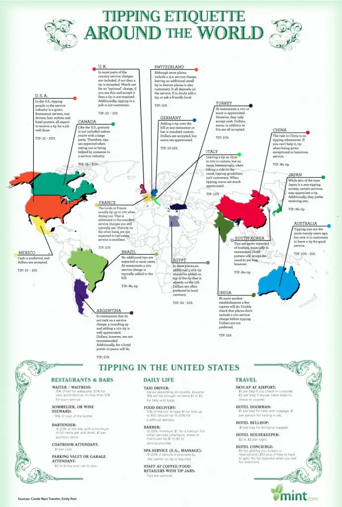
17. Tipping etiquette around the world
16. The happiest countries in the world (2013 – 2020)

15. US Asian Population by County (1990 – 2018)

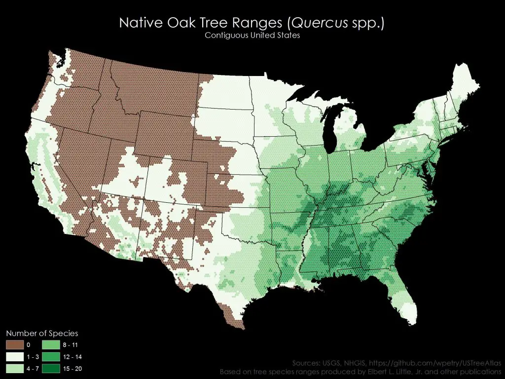
14. Native Oak Tree Ranges in the United States
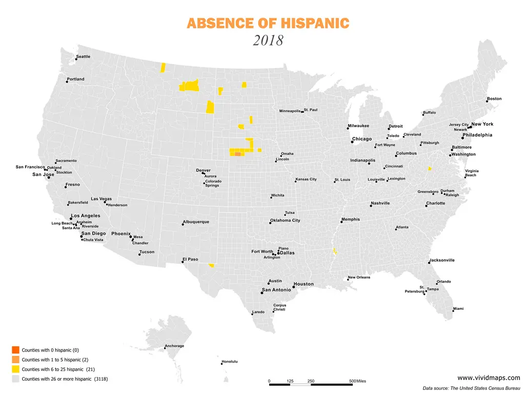
13. US Hispanic Population by County (1990 – 2018)
12. Largest Predator in Each U.S. State

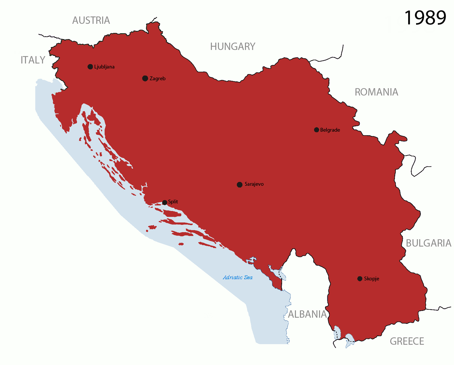
11. Disintegration of Yugoslavia
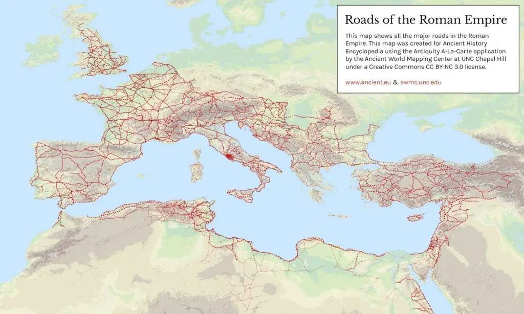
10. Roads of the Roman Empire
9. Germany is still divided by east and west

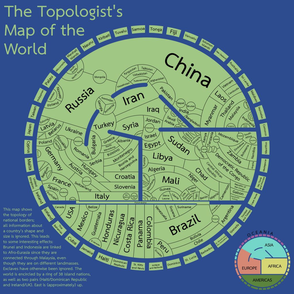
8. The topologist’s map of the world
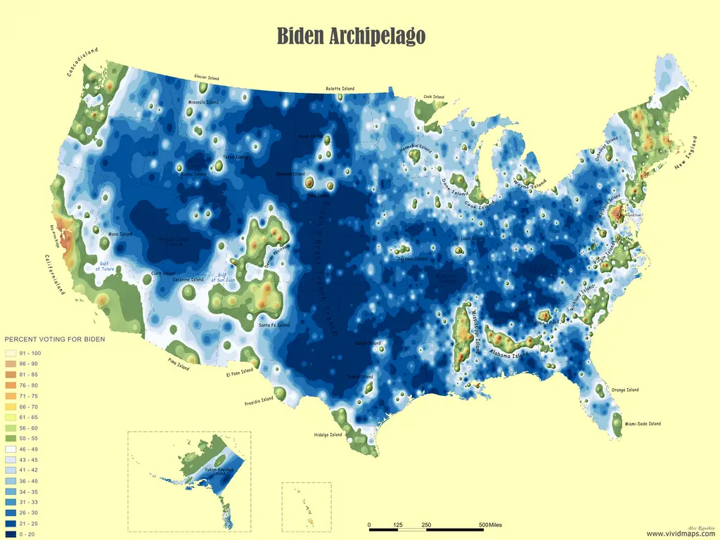
7. 2020 U.S. Election Mapped: What happened to TrumpLand?
6. 3D Mapping The Global Population Density

5. The diversity of trees in the US mapped

4. Olive Tree in the Mediterranean Bassin

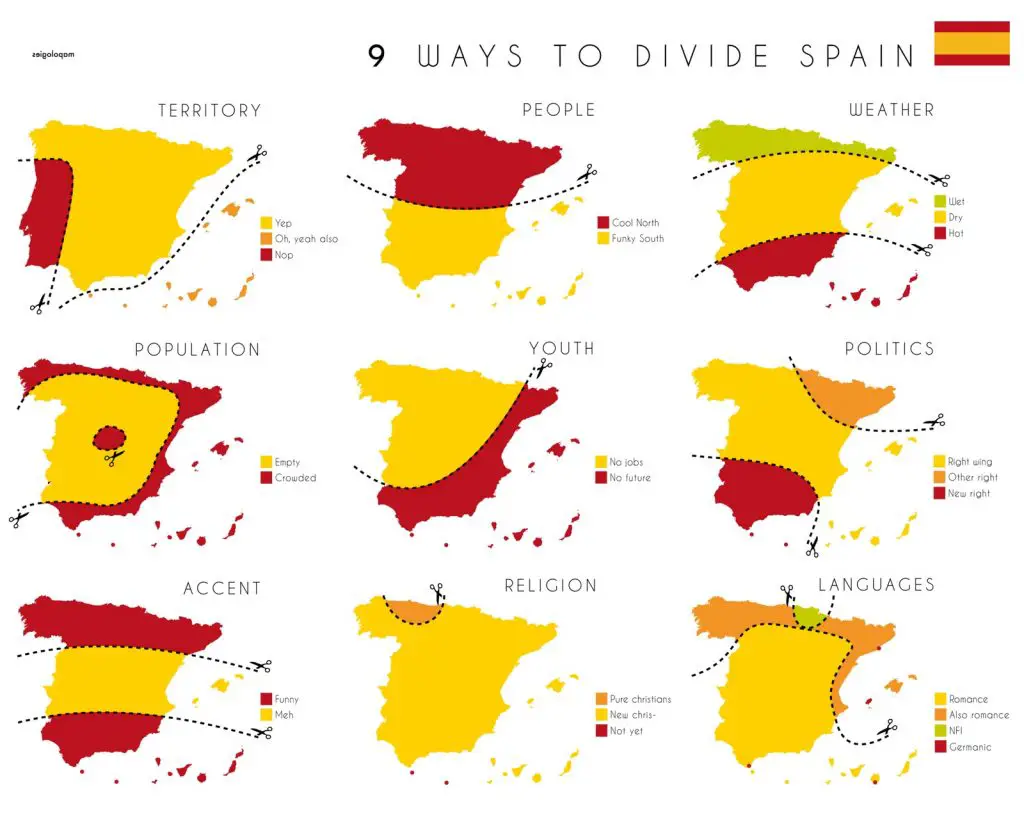
3. Tearing Spain apart
2. The world with a 70 meters sea-level rise
1. Demonyms of the U.S. and Canada
See previous amazing popular maps here: 2019, 2018
Related Posts:


Great maps 🙂
Ill add one more: https://bigthink.com/strange-maps/critical-tourist-map