Animated marine traffic in the San Francisco Bay
How do big ships navigate the San Francisco Bay? The tracks on this map show telemetry data from 24 hours of activity archived by the U.S. Coast Guard on September 1st, 2014, along with underwater bathymetry (depth) data provided by NOAA. Ship telemetry data has been anonymized by the USCG, so relative ship sizes are approximated based on their general behavior.

As ship approach the entrance to the Bay, they line up within designated traffic lanes to avoid collisions in this congested zone. The official navigation charts note these traffic lanes and separation lines so that the captain can safely set a course for the approach.

Any ship over a certain size cannot enter most harbors, including the San Francisco Bay, without being guided by a professional harbor pilot who has intimate knowledge of the navigational hazards specific to the area. The challenge begins just outside the Golden Gate with treacherous shallow sand bars that give the San Francisco Bar Pilots their name. The harbor pilot meets a waiting ship just beyond the sand bars at the pilot rendezvous point. Getting a harbor pilot aboard is a dangerous job as it requires the pilot to climb up a rope ladder strung on the side of a massive cargo ship as it pitches and rolls in open ocean swells.

Inside the Golden Gate, vessel traffic of all sizes zips from shore to shore. High speed ferries make regular crossings from San Francisco to destinations in Marin County and the East Bay. Tourist ferries shuttle sightseers to Alcatraz Island or underneath the Golden Gate Bridge. Big ships generally move along predictable routes travelling counter-clockwise around Alcatraz. No matter what happens, smaller boats must yield right of way to the big ships as they have limited maneuverability in close quarters.

Once arriving in the Bay, a ship may have to wait before its destination port is ready to unload its cargo. This is especially true for oil and gas tankers, who must wait in a specially designated “anchorage for explosives” in the South Bay. The circular patterns shown here are formed as the ships spin around with the daily tides. From the city’s eastern shore, you can see these ships fully lit up at night as they wait under anchor.

There are many ports within the San Francisco Bay. Each one handles a different type of cargo. As a ship approaches its designated berth, its harbor pilot must skillfully bring it to rest, adjusting its course for the tides, currents, wind, and other factors. Also visible towards the bottom of this view is a turning basin, a section of the Oakland estuary that has been widened and dredged so big ships can turn around 180 degrees in the otherwise narrow channel.

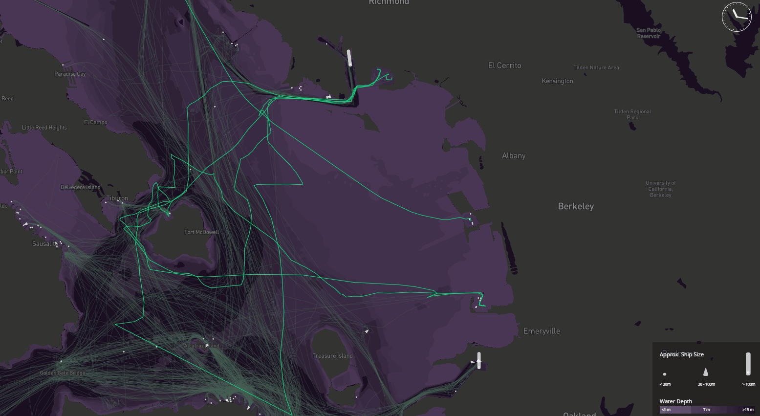
Not all of the bay is navigable to large ships. Some regions, such as the area between Richmond and Emeryville, are much too shallow for deep draft ships to pass— as little as one meter in some places. The only traffic you will see here is from smaller pleasure craft, such as a powerboat returning from China Camp State Park to the Berkeley Marina, or a sailing vessel (tracing a telltale zig-zag pattern as it tacks upwind) touring a popular route around Angel Island. Only boats over 60ft in length are required by law to transmit AIS telemetry data, so many smaller boats do not appear on this map.
Via mapbox.com


