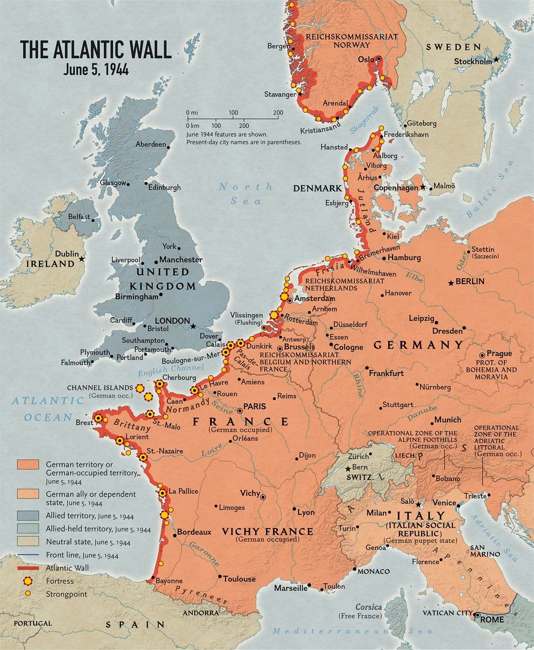
The German defensive barrier known as the Atlantic Wall included two areas that met the requirements for a massive Allied invasion – beaches that were accessible to landing craft, tanks, and other vehicles and were not too far from British ports or Germany, the ultimate objective. Suitable beaches around Calais were only 30 miles (4.8 kilometers) from the port of Dover and 200 miles (322 kilometers) from the German border, but their proximity to the Reich meant that they were well-defended. The other promising landing site – between the fortified ports of Le Havre and Cherbourg in Normandy – was distant from Germany, but was chosen because the beaches there were less heavily defended. German field marshal Rommel made sure that obstacles laid there to snag landing craft and amphibious tanks were also installed on the Normandy coast. But his request to defend that coast with several armored divisions that could meet invaders head-on was rejected.
Below is the map from the Atlas of World War II that illustrates the length of this barrier.
The construction of the Atlantic Wall began in 1942 and was completed in 1944. The wall was over 2,400 kilometers (1,500 miles) long, stretching from the border of Spain and France to the northern tip of Norway. It was one of the largest construction projects in human history, involving the labor of millions of workers and the use of hundreds of millions of tons of concrete and steel.
Despite its massive size and the resources devoted to its construction, the Atlantic Wall proved to be largely ineffective. Allied forces were able to break through the wall at several points, including the Normandy landings in June 1944.