Map of threatened mammals and amphibians
Fine-scale patterns of terrestrial diversity. (A) The numbers of threatened mammal species and (B) those with ranges smaller than the
Read MoreMaps depicting environmental degradation across planet.
Fine-scale patterns of terrestrial diversity. (A) The numbers of threatened mammal species and (B) those with ranges smaller than the
Read MoreThe average rainfall for the continent is about 670 mm per year but the spatial and temporal distribution is very
Read MoreThe Rainforest Alliance’s work is driven by the principle that the health of the land is inextricably linked to the
Read More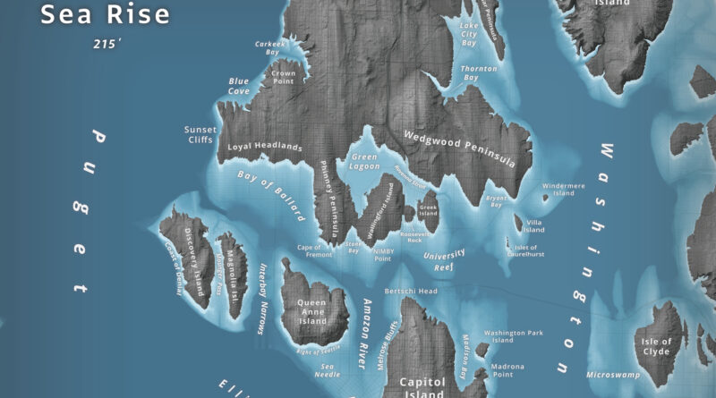
What happens to Seattle when 66 meters of water flood Puget Sound? Jeffrey Linn used LiDAR elevation data to map the city as an archipelago, where Capitol Hill becomes “Capitol Island” and the Space Needle turns into the “Sea Needle.” He created two versions with different cartographic styles.
Read More– Nearly one in every five deaths of children under the age of five worldwide is due to a water-related
Read More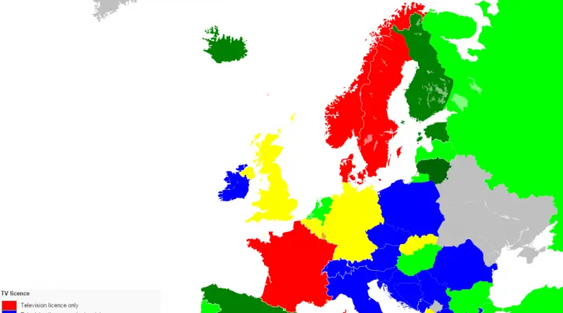
Norway had the highest per capita funding of public television in 2015: €136. Denmark was at €91, while Finland, which
Read More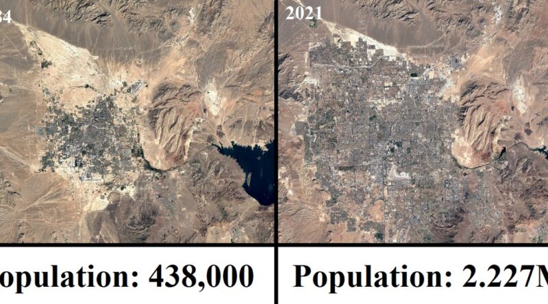
Las Vegas is the 28-most populated city in the U.S. and the most populated city in the state of Nevada, and a world leader in the entertainment industry. Las Vegas evolved from a tiny, desert-bound railway service center at the origin of the 20th century to the nation’s fastest-developing metropolis at the century’s end.
Read More
Light pollution is human-made light (streetlights, advertising, building lighting) that disrupts ecosystems and has harmful health consequences. The eastern part of the U.S. has the highest level of light pollution. D.C. is the most light-polluted area of the nation, with higher than 200,000 times the artificial brightness of the U.S. darkest spot, the city of Yakutat in Alaska.
Read More
The sea level has increased 15 to 20 cm (6 to 8 inches) in the latest 100 years. The process of raising the water level of the world’s oceans continues. If all the ice on our planet were to melt, the sea level would rise about 70 m (230 ft).
Read MoreHistorically, grasslands occupied about one billion acres in the United States, roughly fifty per cent of the landmass of the 48 contiguous states. The considerable preponderance of the meadows was found west of the Mississippi River. But, some indigenous grasslands were spread throughout the Midwestern and Southeastern U.S. States.
Read More