Historical Maps
Historical maps showing territorial changes of countries and historical events of the past.
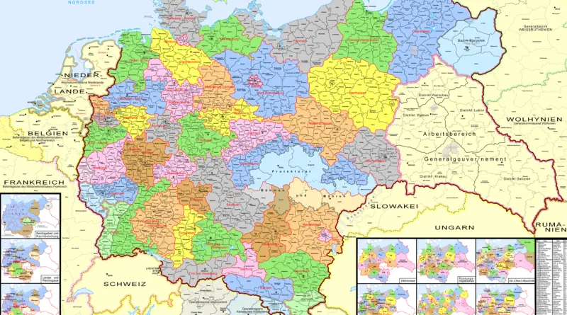
From Empire to Modern State: The Evolution of Germany’s Administrative Divisions (1900-Present)
Discover how Germany’s internal borders and administrative structures evolved dramatically from the German Empire’s complex federal system in 1900, through the centralized Nazi regime’s gau system, to today’s democratic federal states, featuring historical maps and detailed analysis.
Read MoreEmpire of the Great Qing
25th yaer of the Jiaqing Emperor (A.D. 1820).
Read More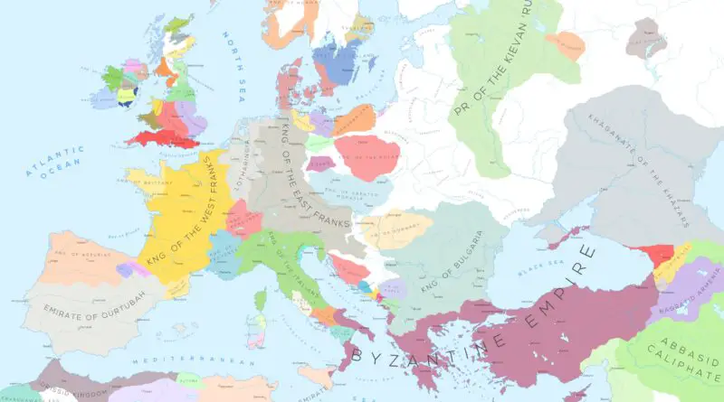
Atlas of European history
uropean history is a vast and complex tapestry of events, cultures, and civilizations that have shaped the continent over millennia. It encompasses ancient civilizations such as the Greeks and Romans, the medieval period with its feudal systems and the rise of Christianity, the Renaissance, which saw a revival of art, science, and learning, and the Age of Exploration, which brought about global exploration and colonization.
Read More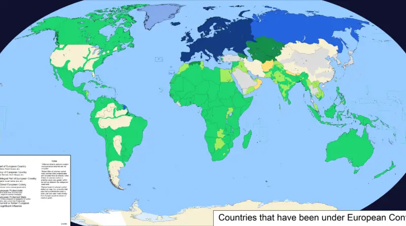
Countries that have been under European control
European colonialism was a widespread and often destructive project that set almost the whole planet under the control of European powers over many hundreds of years.
Read MoreTrade Routes of the Roman Empire
The roads and routes constructed and developed by the Roman bound all manner of peoples together, made possible the intermingling
Read More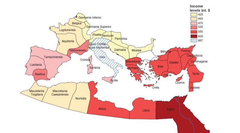
Per capita income in the provinces of the Roman Empire
Economic historians differ in their estimates of the gross domestic product of the Roman economy. Per capita income in the provinces of the Roman Empire range from $425 to $867 (2000 US dollar). The GDP per capita of Italy is valued at approximately 50 percent higher than in the rest of the Roman Empire.
Read MoreWorld War II casualties as a percentage of the population
World War II was the deadliest military conflict in the history of humankind (85 million people were killed). The USSR
Read More