History of the World: Every Year
The History of the World. Since 200,000 BCE, humanity has spread around globe and enacted huge change upon the planet.
Read MoreHistorical maps showing territorial changes of countries and historical events of the past.
The History of the World. Since 200,000 BCE, humanity has spread around globe and enacted huge change upon the planet.
Read MoreVia newyorker.com .. NYC maps
Read More

In the early 600s a new regional state was formed in the Lhasa region and ousted the old Yarlung Dynasty
Read MoreIt is estimated the first Proto-Slavs arrived in the European area around the late 5th to early 6th Century from
Read MoreRelated post: – Countries scaled to the econmic aid they receive from the United States
Read More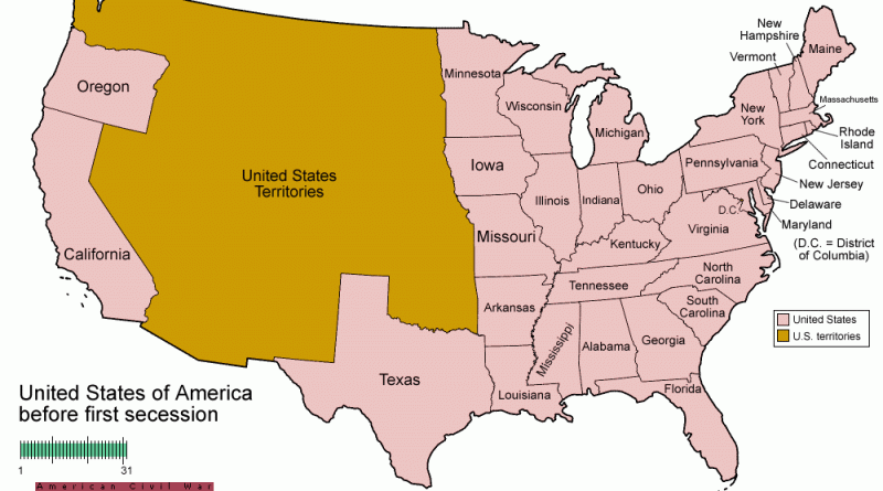
Related posts: – USA boundary evolution – Territorial evolution of North America of non-native nation states from 1750 to 2008
Read More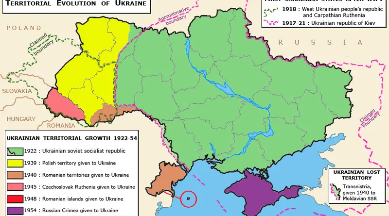
History of Ukraine (since 600 BC)
Read MoreDid you know from 1890 to 1958 the British Columbia Electric Railway Co. Ltd. installed and operated interurban and streetcar
Read More